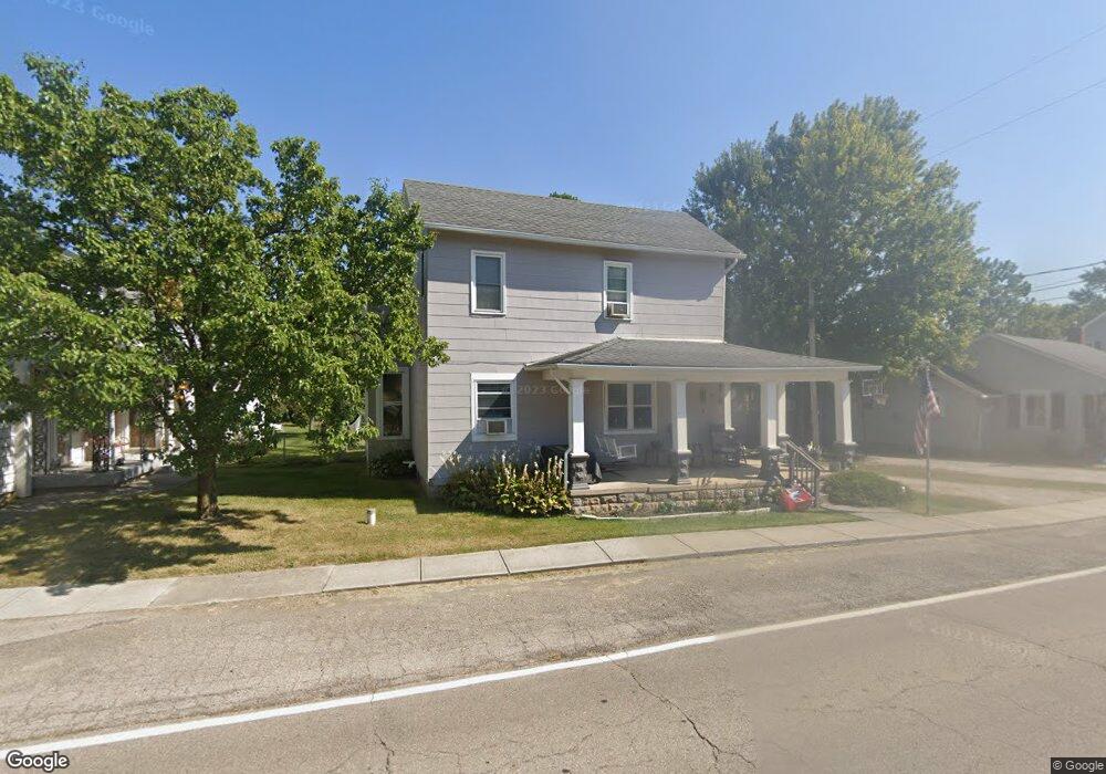
226 N Mulberry St Tremont City, OH 45372
Estimated Value: $73,000 - $163,000
3
Beds
1
Bath
1,376
Sq Ft
$81/Sq Ft
Est. Value
About This Home
This home is located at 226 N Mulberry St, Tremont City, OH 45372 and is currently estimated at $111,979, approximately $81 per square foot. 226 N Mulberry St is a home with nearby schools including Northwestern Elementary School and Northwestern Junior/Senior High School.
Ownership History
Date
Name
Owned For
Owner Type
Purchase Details
Closed on
Sep 3, 2002
Sold by
Martindale Jeffery A
Bought by
Porteus Barbara A
Current Estimated Value
Home Financials for this Owner
Home Financials are based on the most recent Mortgage that was taken out on this home.
Original Mortgage
$55,084
Outstanding Balance
$23,296
Interest Rate
6.41%
Mortgage Type
FHA
Estimated Equity
$88,683
Purchase Details
Closed on
Jan 1, 2000
Sold by
Herring Virginia B
Bought by
Martindale Jeffery A
Create a Home Valuation Report for This Property
The Home Valuation Report is an in-depth analysis detailing your home's value as well as a comparison with similar homes in the area
Home Values in the Area
Average Home Value in this Area
Purchase History
| Date | Buyer | Sale Price | Title Company |
|---|---|---|---|
| Porteus Barbara A | $55,500 | -- | |
| Martindale Jeffery A | $50,000 | -- |
Source: Public Records
Mortgage History
| Date | Status | Borrower | Loan Amount |
|---|---|---|---|
| Open | Porteus Barbara A | $55,084 |
Source: Public Records
Tax History Compared to Growth
Tax History
| Year | Tax Paid | Tax Assessment Tax Assessment Total Assessment is a certain percentage of the fair market value that is determined by local assessors to be the total taxable value of land and additions on the property. | Land | Improvement |
|---|---|---|---|---|
| 2024 | $574 | $22,510 | $4,190 | $18,320 |
| 2023 | $574 | $22,510 | $4,190 | $18,320 |
| 2022 | $609 | $22,510 | $4,190 | $18,320 |
| 2021 | $488 | $18,680 | $3,470 | $15,210 |
| 2020 | $483 | $18,680 | $3,470 | $15,210 |
| 2019 | $488 | $18,680 | $3,470 | $15,210 |
| 2018 | $425 | $17,310 | $3,470 | $13,840 |
| 2017 | $425 | $17,308 | $3,465 | $13,843 |
| 2016 | $416 | $17,308 | $3,465 | $13,843 |
| 2015 | $396 | $16,692 | $3,465 | $13,227 |
| 2014 | $396 | $16,692 | $3,465 | $13,227 |
| 2013 | $413 | $16,692 | $3,465 | $13,227 |
Source: Public Records
Map
Nearby Homes
- 30 Center St
- 6250 Willowdale Rd
- 4211 Grey Stone Crossing
- 4328 Pine Tree Place
- 3802 Lawrenceville Dr
- 593 Hiser Ave
- 5646 Springfield-Urbana Pike Unit Lot 88
- 5646 Springfield-Urbana Pike Unit Lot 122
- 5646 Springfield-Urbana Pike Unit Lot 61
- 5646 Springfield-Urbana Pike Unit Lot 127
- 5646 Springfield-Urbana Pike Unit Lot 72
- 4100 Troy Rd Unit 96
- 4100 Troy Rd Unit 12
- 794 Donnelly Ave
- 4514 Dowden St
- 880 Brendle Trace Unit 28
- 916 Sawmill Ct
- 26 Thomaston Trail
- 5770 Storms Creek Rd
- 970 Forest Edge Ave
- 230 N Mulberry St
- 220 N Mulberry St
- 214 N Mulberry St
- 221 N Mulberry St
- 246 N Mulberry St
- 18 North St
- 207 N Mulberry St
- 204 N Mulberry St
- 215 2nd St
- 303 W 2nd St
- 219 221 Second St
- 304 N Mulberry St
- 24 Blose St
- 225 W 2nd St
- 24 North St
- 28 W North St
- 18 Blose St
- 14 Church Hill Rd
- 233 W 2nd St
- 123 N Mulberry St