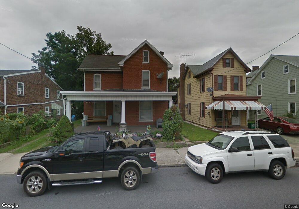
226 N State St Unit 2 Ephrata, PA 17522
Estimated Value: $268,000 - $287,116
1
Bed
1
Bath
1,590
Sq Ft
$175/Sq Ft
Est. Value
About This Home
This home is located at 226 N State St Unit 2, Ephrata, PA 17522 and is currently estimated at $278,029, approximately $174 per square foot. 226 N State St Unit 2 is a home located in Lancaster County with nearby schools including Highland Elementary School, Ephrata Intermediate School, and Ephrata Senior High School.
Ownership History
Date
Name
Owned For
Owner Type
Purchase Details
Closed on
Feb 14, 2025
Sold by
Lantz Daniel S and Lantz Hannah E
Bought by
State Street Rental Llc
Current Estimated Value
Purchase Details
Closed on
Feb 13, 2023
Sold by
Sarek Properties Llc
Bought by
Lantz Daniel S and Lantz Hannah E
Home Financials for this Owner
Home Financials are based on the most recent Mortgage that was taken out on this home.
Original Mortgage
$194,000
Interest Rate
6.88%
Mortgage Type
New Conventional
Purchase Details
Closed on
Sep 17, 2022
Sold by
Douglas Brubaker
Bought by
Sarek Properties Llc
Purchase Details
Closed on
Jan 11, 2008
Sold by
Krafft Gary G and Krafft Rosalind S
Bought by
Brubaker Douglas
Home Financials for this Owner
Home Financials are based on the most recent Mortgage that was taken out on this home.
Original Mortgage
$55,000
Interest Rate
6.21%
Mortgage Type
Seller Take Back
Create a Home Valuation Report for This Property
The Home Valuation Report is an in-depth analysis detailing your home's value as well as a comparison with similar homes in the area
Home Values in the Area
Average Home Value in this Area
Purchase History
| Date | Buyer | Sale Price | Title Company |
|---|---|---|---|
| State Street Rental Llc | $273,000 | None Listed On Document | |
| Lantz Daniel S | $250,000 | -- | |
| Sarek Properties Llc | $153,500 | -- | |
| Brubaker Douglas | $75,000 | None Available |
Source: Public Records
Mortgage History
| Date | Status | Borrower | Loan Amount |
|---|---|---|---|
| Previous Owner | Lantz Daniel S | $194,000 | |
| Previous Owner | Brubaker Douglas | $55,000 |
Source: Public Records
Tax History Compared to Growth
Tax History
| Year | Tax Paid | Tax Assessment Tax Assessment Total Assessment is a certain percentage of the fair market value that is determined by local assessors to be the total taxable value of land and additions on the property. | Land | Improvement |
|---|---|---|---|---|
| 2025 | $3,448 | $143,800 | $36,700 | $107,100 |
| 2024 | $3,448 | $143,800 | $36,700 | $107,100 |
| 2023 | $3,364 | $143,800 | $36,700 | $107,100 |
| 2022 | $3,220 | $143,800 | $36,700 | $107,100 |
| 2021 | $3,153 | $143,800 | $36,700 | $107,100 |
| 2020 | $3,153 | $143,800 | $36,700 | $107,100 |
| 2019 | $3,109 | $143,800 | $36,700 | $107,100 |
| 2018 | $2,437 | $143,800 | $36,700 | $107,100 |
| 2017 | $2,800 | $105,800 | $27,100 | $78,700 |
| 2016 | $2,778 | $105,800 | $27,100 | $78,700 |
| 2015 | $614 | $105,800 | $27,100 | $78,700 |
| 2014 | $2,074 | $105,800 | $27,100 | $78,700 |
Source: Public Records
Map
Nearby Homes
- 221 Duke St
- 308 Washington Ave
- 234 Church Ave
- 124 Washington Ave
- 346 Duke St
- 49 N Church St
- 335 Lincoln Ave
- 623 N State St
- 126 Marion Terrace
- 704 Lincoln Ave
- 210 Marion Terrace
- 221 Marion Terrace
- 538 E Main St
- 2 Westpointe Dr
- 214 Linda Terrace
- 18 Akron Rd
- 10 E Queen St
- 811 Pleasantview Dr
- 837 Martin Ave
- 114 Brickyard Cir