Estimated Value: $338,000 - $373,000
2
Beds
2
Baths
864
Sq Ft
$410/Sq Ft
Est. Value
About This Home
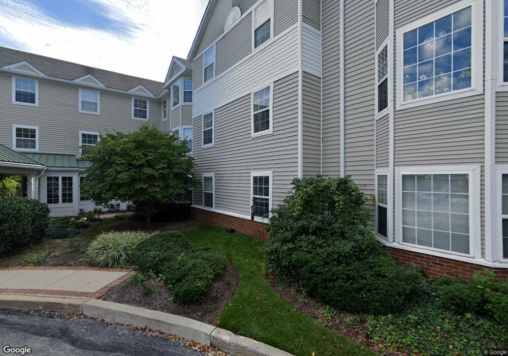
This home is located at 226 Paoli Pointe Dr Unit 226U, Paoli, PA 19301 and is currently estimated at $354,091, approximately $409 per square foot. 226 Paoli Pointe Dr Unit 226U is a home located in Chester County with nearby schools including Hillside Elementary School, Valley Forge Middle School, and Conestoga Senior High School.
Ownership History
Date
Name
Owned For
Owner Type
Purchase Details
Closed on
Oct 28, 2020
Sold by
Metcalf Eleanor Fee
Bought by
Petruzzi Barbara
Current Estimated Value
Home Financials for this Owner
Home Financials are based on the most recent Mortgage that was taken out on this home.
Original Mortgage
$140,000
Outstanding Balance
$124,804
Interest Rate
2.9%
Mortgage Type
New Conventional
Estimated Equity
$229,287
Purchase Details
Closed on
Feb 23, 1996
Sold by
South Mountain Forestry Corp
Bought by
Metcalf Eleanor Fee
Create a Home Valuation Report for This Property
The Home Valuation Report is an in-depth analysis detailing your home's value as well as a comparison with similar homes in the area
Home Values in the Area
Average Home Value in this Area
Purchase History
| Date | Buyer | Sale Price | Title Company |
|---|---|---|---|
| Petruzzi Barbara | $200,000 | Land Services Usa Inc | |
| Metcalf Eleanor Fee | $139,380 | -- |
Source: Public Records
Mortgage History
| Date | Status | Borrower | Loan Amount |
|---|---|---|---|
| Open | Petruzzi Barbara | $140,000 |
Source: Public Records
Tax History Compared to Growth
Tax History
| Year | Tax Paid | Tax Assessment Tax Assessment Total Assessment is a certain percentage of the fair market value that is determined by local assessors to be the total taxable value of land and additions on the property. | Land | Improvement |
|---|---|---|---|---|
| 2025 | $3,253 | $92,340 | $31,930 | $60,410 |
| 2024 | $3,253 | $92,340 | $31,930 | $60,410 |
| 2023 | $3,055 | $92,340 | $31,930 | $60,410 |
| 2022 | $2,976 | $92,340 | $31,930 | $60,410 |
| 2021 | $2,920 | $92,340 | $31,930 | $60,410 |
| 2020 | $2,839 | $92,340 | $31,930 | $60,410 |
| 2019 | $4,821 | $92,340 | $31,930 | $60,410 |
| 2018 | $3,593 | $123,100 | $31,930 | $91,170 |
| 2017 | $3,507 | $123,100 | $31,930 | $91,170 |
| 2016 | -- | $123,100 | $31,930 | $91,170 |
| 2015 | -- | $123,100 | $31,930 | $91,170 |
| 2014 | -- | $123,100 | $31,930 | $91,170 |
Source: Public Records
Map
Nearby Homes
- 109 Vincent Rd
- 106 N Valley Rd
- 521 Foxwood Ln
- 1 Whitworth Ave
- 5 Kent Ln
- 2102 Quail Ridge Dr
- 1304 Weatherstone Dr Unit 1304
- 1201 Weatherstone Dr Unit 1201
- 2104 Weatherstone Dr Unit 2104
- 1602 Weatherstone Dr Unit 1602
- 1441 Berwyn Paoli Rd
- 1242 Old Lancaster Rd
- 29 Manor Rd
- 21 Manor Rd
- 104 Lynbrook Rd
- 114 Manor Rd
- 202 Shoreline Dr
- 340 Beechwood Rd
- 12 Moreland Rd
- 3 Bryan Ave
- 502 Paoli Pointe Dr Unit 502G
- 317 Paoli Pointe Dr Unit 317G
- 221 Paoli Pointe Dr Unit 221U
- 306 Paoli Pointe Dr Unit 306L
- 309 Paoli Pointe Dr Unit 309G
- 117 Paoli Pointe Dr Unit 317-U
- 231 Paoli Pointe Dr Unit 231U
- 506 Paoli Pointe Dr
- 524 Paoli Pointe Dr
- 523 Paoli Pointe Dr Unit 523
- 522 Paoli Pointe Dr Unit 522
- 521 Paoli Pointe Dr Unit 521
- 520 Paoli Pointe Dr Unit 520
- 519 Paoli Pointe Dr Unit 519
- 518 Paoli Pointe Dr
- 517 Paoli Pointe Dr Unit 517
- 516 Paoli Pointe Dr Unit 516
- 515 Paoli Pointe Dr Unit 515
- 514 Paoli Pointe Dr Unit 514
- 513 Paoli Pointe Dr Unit 513