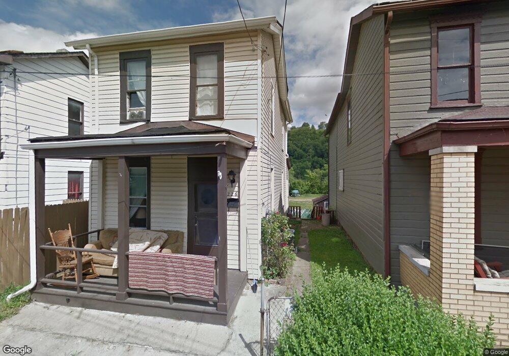
226 Pine St McKeesport, PA 15132
Estimated Value: $53,000 - $73,000
2
Beds
1
Bath
1,104
Sq Ft
$58/Sq Ft
Est. Value
About This Home
This home is located at 226 Pine St, McKeesport, PA 15132 and is currently estimated at $64,209, approximately $58 per square foot. 226 Pine St is a home located in Allegheny County with nearby schools including Mckeesport Area Senior High School, Propel Schools - McKeesport, and Walnut Grove Christian School.
Ownership History
Date
Name
Owned For
Owner Type
Purchase Details
Closed on
Feb 14, 2024
Sold by
Westmoreland Inc
Bought by
Met Properties Llc
Current Estimated Value
Purchase Details
Closed on
Jan 28, 2015
Sold by
Bills Edward E
Bought by
Westmoreland Inc
Purchase Details
Closed on
Apr 9, 2002
Sold by
Feeney John J and Feeney Patricia J
Bought by
Federal Home Loan Mortgage Corporation
Purchase Details
Closed on
Oct 27, 1997
Sold by
Broccolo Anthony C
Bought by
Feeney John J and Feeney Patricia J
Purchase Details
Closed on
Jan 24, 1997
Sold by
Eversole Donald Lee and Eversole Marianne
Bought by
Feeney John J and Feeney Patricia J
Create a Home Valuation Report for This Property
The Home Valuation Report is an in-depth analysis detailing your home's value as well as a comparison with similar homes in the area
Home Values in the Area
Average Home Value in this Area
Purchase History
| Date | Buyer | Sale Price | Title Company |
|---|---|---|---|
| Met Properties Llc | $15,500 | -- | |
| Westmoreland Inc | $7,000 | -- | |
| Federal Home Loan Mortgage Corporation | $1,735 | -- | |
| Feeney John J | $6,832 | -- | |
| Feeney John J | $6,600 | -- |
Source: Public Records
Tax History Compared to Growth
Tax History
| Year | Tax Paid | Tax Assessment Tax Assessment Total Assessment is a certain percentage of the fair market value that is determined by local assessors to be the total taxable value of land and additions on the property. | Land | Improvement |
|---|---|---|---|---|
| 2025 | $499 | $10,800 | $3,300 | $7,500 |
| 2024 | $499 | $10,800 | $3,300 | $7,500 |
| 2023 | $499 | $10,800 | $3,300 | $7,500 |
| 2022 | $499 | $10,800 | $3,300 | $7,500 |
| 2021 | $407 | $10,800 | $3,300 | $7,500 |
| 2020 | $490 | $10,800 | $3,300 | $7,500 |
| 2019 | $329 | $10,800 | $3,300 | $7,500 |
| 2018 | $51 | $10,800 | $3,300 | $7,500 |
| 2017 | $299 | $10,800 | $3,300 | $7,500 |
| 2016 | $51 | $10,800 | $3,300 | $7,500 |
| 2015 | $51 | $10,800 | $3,300 | $7,500 |
| 2014 | -- | $10,800 | $3,300 | $7,500 |
Source: Public Records
Map
Nearby Homes
- 418 Arctic St
- 601 Romine Ave
- 800 Romine Ave
- 2832 Skyline Dr
- 502 Archer St
- - Skyline Dr
- 505 Manning Ave
- 2678 Glenny Ln
- 911 Elmwood St
- 2301 Vermont Ave
- 2247 Vermont Ave
- lot Sunset Dr
- 2725 Glenny Ln
- 1000 Washington Blvd
- 706 Upston St
- 706 Upston St Unit 2
- 2813 Glenny Lane Extension
- 2154 Vermont Ave
- 732 Upston St
- 19 Charles St