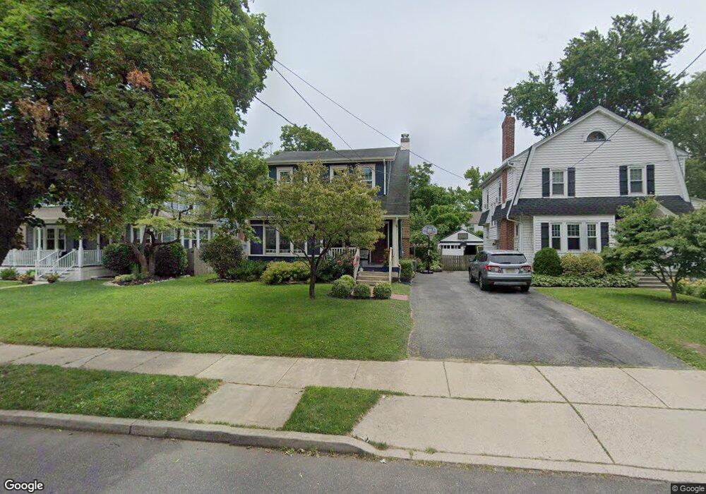
226 Rhoads Ave Haddonfield, NJ 08033
Estimated Value: $835,000 - $1,049,000
4
Beds
3
Baths
2,325
Sq Ft
$411/Sq Ft
Est. Value
About This Home
This home is located at 226 Rhoads Ave, Haddonfield, NJ 08033 and is currently estimated at $956,318, approximately $411 per square foot. 226 Rhoads Ave is a home located in Camden County with nearby schools including Haddonfield Memorial High School, Christ the King Regional School, and Haddonfield Friends School.
Ownership History
Date
Name
Owned For
Owner Type
Purchase Details
Closed on
Jul 30, 2009
Sold by
Maas Peter L and Lee Carter R
Bought by
Miller Michael G and Miller Jessica L
Current Estimated Value
Home Financials for this Owner
Home Financials are based on the most recent Mortgage that was taken out on this home.
Original Mortgage
$395,000
Outstanding Balance
$257,279
Interest Rate
5.19%
Mortgage Type
Purchase Money Mortgage
Estimated Equity
$699,039
Create a Home Valuation Report for This Property
The Home Valuation Report is an in-depth analysis detailing your home's value as well as a comparison with similar homes in the area
Home Values in the Area
Average Home Value in this Area
Purchase History
| Date | Buyer | Sale Price | Title Company |
|---|---|---|---|
| Miller Michael G | $455,000 | -- |
Source: Public Records
Mortgage History
| Date | Status | Borrower | Loan Amount |
|---|---|---|---|
| Open | Miller Michael G | $395,000 |
Source: Public Records
Tax History Compared to Growth
Tax History
| Year | Tax Paid | Tax Assessment Tax Assessment Total Assessment is a certain percentage of the fair market value that is determined by local assessors to be the total taxable value of land and additions on the property. | Land | Improvement |
|---|---|---|---|---|
| 2025 | $13,703 | $424,100 | $196,000 | $228,100 |
| 2024 | $13,520 | $424,100 | $196,000 | $228,100 |
| 2023 | $13,520 | $424,100 | $196,000 | $228,100 |
| 2022 | $13,414 | $424,100 | $196,000 | $228,100 |
| 2021 | $13,346 | $424,100 | $196,000 | $228,100 |
| 2020 | $13,253 | $424,100 | $196,000 | $228,100 |
| 2019 | $131 | $424,100 | $196,000 | $228,100 |
| 2018 | $12,990 | $424,100 | $196,000 | $228,100 |
| 2017 | $12,681 | $424,100 | $196,000 | $228,100 |
| 2016 | $12,396 | $424,100 | $196,000 | $228,100 |
| 2015 | $12,053 | $424,100 | $196,000 | $228,100 |
| 2014 | $11,786 | $424,100 | $196,000 | $228,100 |
Source: Public Records
Map
Nearby Homes
- 252 Rhoads Ave
- 155 Rhoads Ave
- 144 Marne Ave
- 215 Haddonfield Commons
- 209 Haddonfield Commons
- 240 Hopkins Ave
- 107 Colonial Ave
- 801 Cedar Ave
- 501 Somerset Dr
- 63 Truman Ave
- 870 Cedar Ave
- 360 Carriage House Ln
- 209 Westmont Ave
- 33 Estaugh Ave
- 110 B Cherry Parke
- 315 Peyton Ave
- 113 A Cherry Parke
- 23 Center St
- 110 Westmont Ave
- 120 Kings Hwy W
- 230 Rhoads Ave
- 222 Rhoads Ave
- 232 Rhoads Ave
- 218 Rhoads Ave
- 225 Hawthorne Ave
- 231 Hawthorne Ave
- 219 Hawthorne Ave
- 236 Rhoads Ave
- 212 Rhoads Ave
- 235 Hawthorne Ave
- 217 Hawthorne Ave
- 225 Rhoads Ave
- 221 Rhoads Ave
- 240 Rhoads Ave
- 208 Rhoads Ave
- 239 Hawthorne Ave
- 217 Rhoads Ave
- 229 Rhoads Ave
- 211 Hawthorne Ave
- 233 Rhoads Ave