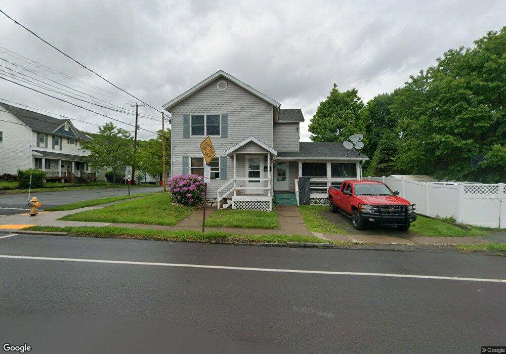
226 Rushbrook St Jermyn, PA 18433
Estimated Value: $117,668 - $188,000
--
Bed
--
Bath
1,600
Sq Ft
$96/Sq Ft
Est. Value
About This Home
This home is located at 226 Rushbrook St, Jermyn, PA 18433 and is currently estimated at $152,917, approximately $95 per square foot. 226 Rushbrook St is a home located in Lackawanna County with nearby schools including Lakeland Junior/Senior High School.
Ownership History
Date
Name
Owned For
Owner Type
Purchase Details
Closed on
Feb 15, 2007
Sold by
Tyrie Michael and Tyrie Ann E
Bought by
Smith Kevin H and Smith Jaycee C
Current Estimated Value
Home Financials for this Owner
Home Financials are based on the most recent Mortgage that was taken out on this home.
Original Mortgage
$67,050
Outstanding Balance
$40,405
Interest Rate
6.27%
Mortgage Type
New Conventional
Estimated Equity
$112,512
Purchase Details
Closed on
Jan 10, 2005
Sold by
Black Vaughn L and Black Beverly
Bought by
Tyrie Michael and Tyrie Ann E
Create a Home Valuation Report for This Property
The Home Valuation Report is an in-depth analysis detailing your home's value as well as a comparison with similar homes in the area
Home Values in the Area
Average Home Value in this Area
Purchase History
| Date | Buyer | Sale Price | Title Company |
|---|---|---|---|
| Smith Kevin H | $74,500 | None Available | |
| Tyrie Michael | $69,000 | None Available |
Source: Public Records
Mortgage History
| Date | Status | Borrower | Loan Amount |
|---|---|---|---|
| Open | Smith Kevin H | $67,050 |
Source: Public Records
Tax History Compared to Growth
Tax History
| Year | Tax Paid | Tax Assessment Tax Assessment Total Assessment is a certain percentage of the fair market value that is determined by local assessors to be the total taxable value of land and additions on the property. | Land | Improvement |
|---|---|---|---|---|
| 2025 | $1,984 | $5,400 | $0 | $5,400 |
| 2024 | $1,173 | $5,400 | $0 | $5,400 |
| 2023 | $1,173 | $5,400 | $0 | $5,400 |
| 2022 | $1,145 | $5,400 | $0 | $5,400 |
| 2021 | $1,145 | $5,400 | $0 | $5,400 |
| 2020 | $1,139 | $5,400 | $0 | $5,400 |
| 2019 | $1,086 | $5,400 | $0 | $5,400 |
| 2018 | $1,075 | $5,400 | $0 | $5,400 |
| 2017 | $1,075 | $5,400 | $0 | $5,400 |
| 2016 | $608 | $5,400 | $0 | $0 |
| 2015 | -- | $5,400 | $0 | $0 |
| 2014 | -- | $5,400 | $0 | $0 |
Source: Public Records
Map
Nearby Homes
- 603 Lincoln Ave
- 0 Bacon St
- 441 Madison Ave
- 440 Washington Ave
- 0 Scranton Carbondale Hwy
- 0 Chestnut St
- 118-120 Madison Ave
- 322 Shadow Wood Cir Unit U13
- 192 Shadow Wood Cir
- 333 Shadow Wood Cir
- 369 Upper Powderly St
- 15 Lower Powderly St
- 233 Shadow Wood Cir
- 880 Scranton - Carbondale
- 815 Oak St
- 590 N Main St
- 820 Oak St
- 115 Gordon Ave
- 426 Wildcat (Rt 247) Rd
- 723 Chestnut St
- 704 Jefferson Ave
- 214 Rushbrook St Unit 216
- 225 Rushbrook St
- 216 Rushbrook St
- 701 Jefferson Ave
- 0 Jefferson Ave Unit GSB008067
- 0 Jefferson Ave Unit GSB01447
- 0 Jefferson Ave Unit GSB014555
- 708 Jefferson Ave Unit 710
- 705 Jefferson Ave
- 219 Rushbrook St
- 711 Jefferson Ave
- 303 Rushbrook St
- 712 Jefferson Ave Unit 714
- 656 Jefferson Ave
- 709-711 Jefferson Ave
- 709 Jefferson Ave Unit 711
- 210 Rushbrook St
- 314 Rushbrook St
- 716 Jefferson Ave Unit 718