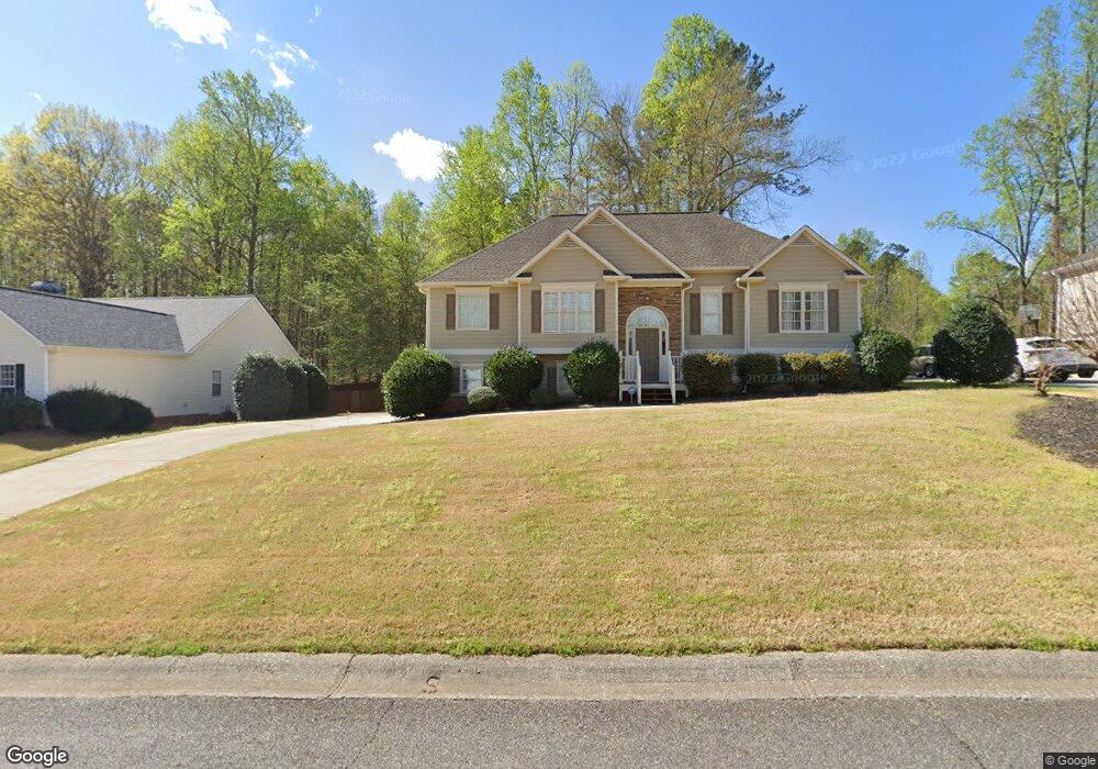
226 Sable Trace Dr Acworth, GA 30102
Oak Grove NeighborhoodEstimated Value: $426,024 - $446,000
3
Beds
2
Baths
2,423
Sq Ft
$180/Sq Ft
Est. Value
About This Home
This home is located at 226 Sable Trace Dr, Acworth, GA 30102 and is currently estimated at $436,012, approximately $179 per square foot. 226 Sable Trace Dr is a home located in Cherokee County with nearby schools including Oak Grove Elementary School, E. T. Booth Middle School, and Etowah High School.
Ownership History
Date
Name
Owned For
Owner Type
Purchase Details
Closed on
Jun 28, 2006
Sold by
Gore Jeffrey and Gore Jill S
Bought by
Wooten George W and Wooten Dianne S
Current Estimated Value
Home Financials for this Owner
Home Financials are based on the most recent Mortgage that was taken out on this home.
Original Mortgage
$160,000
Outstanding Balance
$93,721
Interest Rate
6.6%
Mortgage Type
New Conventional
Estimated Equity
$342,291
Purchase Details
Closed on
Apr 27, 2001
Sold by
Gore Jeffrey
Bought by
Gore Jeffrey and Gore Jill S
Home Financials for this Owner
Home Financials are based on the most recent Mortgage that was taken out on this home.
Original Mortgage
$166,549
Interest Rate
6.9%
Mortgage Type
New Conventional
Create a Home Valuation Report for This Property
The Home Valuation Report is an in-depth analysis detailing your home's value as well as a comparison with similar homes in the area
Home Values in the Area
Average Home Value in this Area
Purchase History
| Date | Buyer | Sale Price | Title Company |
|---|---|---|---|
| Wooten George W | $200,000 | -- | |
| Gore Jeffrey | -- | -- | |
| Gore Jeffrey | $171,700 | -- |
Source: Public Records
Mortgage History
| Date | Status | Borrower | Loan Amount |
|---|---|---|---|
| Open | Wooten George W | $160,000 | |
| Previous Owner | Gore Jeffrey | $166,549 |
Source: Public Records
Tax History Compared to Growth
Tax History
| Year | Tax Paid | Tax Assessment Tax Assessment Total Assessment is a certain percentage of the fair market value that is determined by local assessors to be the total taxable value of land and additions on the property. | Land | Improvement |
|---|---|---|---|---|
| 2025 | $860 | $161,216 | $34,000 | $127,216 |
| 2024 | $837 | $162,136 | $34,000 | $128,136 |
| 2023 | $706 | $164,640 | $34,000 | $130,640 |
| 2022 | $783 | $132,760 | $32,000 | $100,760 |
| 2021 | $755 | $107,600 | $24,000 | $83,600 |
| 2020 | $732 | $100,560 | $22,000 | $78,560 |
| 2019 | $706 | $93,840 | $22,000 | $71,840 |
| 2018 | $683 | $84,280 | $19,200 | $65,080 |
| 2017 | $696 | $208,000 | $19,200 | $64,000 |
| 2016 | $669 | $180,400 | $19,200 | $52,960 |
| 2015 | $610 | $160,400 | $15,200 | $48,960 |
| 2014 | $597 | $156,300 | $13,000 | $49,520 |
Source: Public Records
Map
Nearby Homes
- 6390 Woodstock Rd
- 6312 Woodstock Rd
- 400 Sable Trace Cove
- 148 Sable Trace Trail
- 307 Queensbury Walk
- 626 Spanish Oak Dr
- 302 Seth Way
- 271 Oak Grove Way
- 423 Royal Oak Dr
- 402 Royal Oak Dr
- 313 Maltibie Dr
- 5574 Oak Grove Dr
- 4645 Highway 92
- 154 Bryon Ln
- 6375 Caladium Dr
- 145 Winner St
- 1768 Balsa Ln
- 222 Gallant Fox Way
- 228 Sable Trace Dr
- 224 Sable Trace Dr
- 230 Sable Trace Dr
- 222 Sable Trace Dr
- 0 Sable Trace Dr Unit 7498581
- 0 Sable Trace Dr Unit 8699945
- 0 Sable Trace Dr Unit 8395557
- 0 Sable Trace Dr Unit 8363382
- 0 Sable Trace Dr Unit 7554680
- 0 Sable Trace Dr Unit 3152426
- 0 Sable Trace Dr Unit 7050660
- 0 Sable Trace Dr Unit 8627752
- 0 Sable Trace Dr Unit 8133502
- 0 Sable Trace Dr Unit 8908707
- 0 Sable Trace Dr Unit 7131200
- 0 Sable Trace Dr Unit 7074190
- 0 Sable Trace Dr Unit 9033651
- 0 Sable Trace Dr Unit 9051519
- 0 Sable Trace Dr Unit 8842819
- 0 Sable Trace Dr Unit 8852562