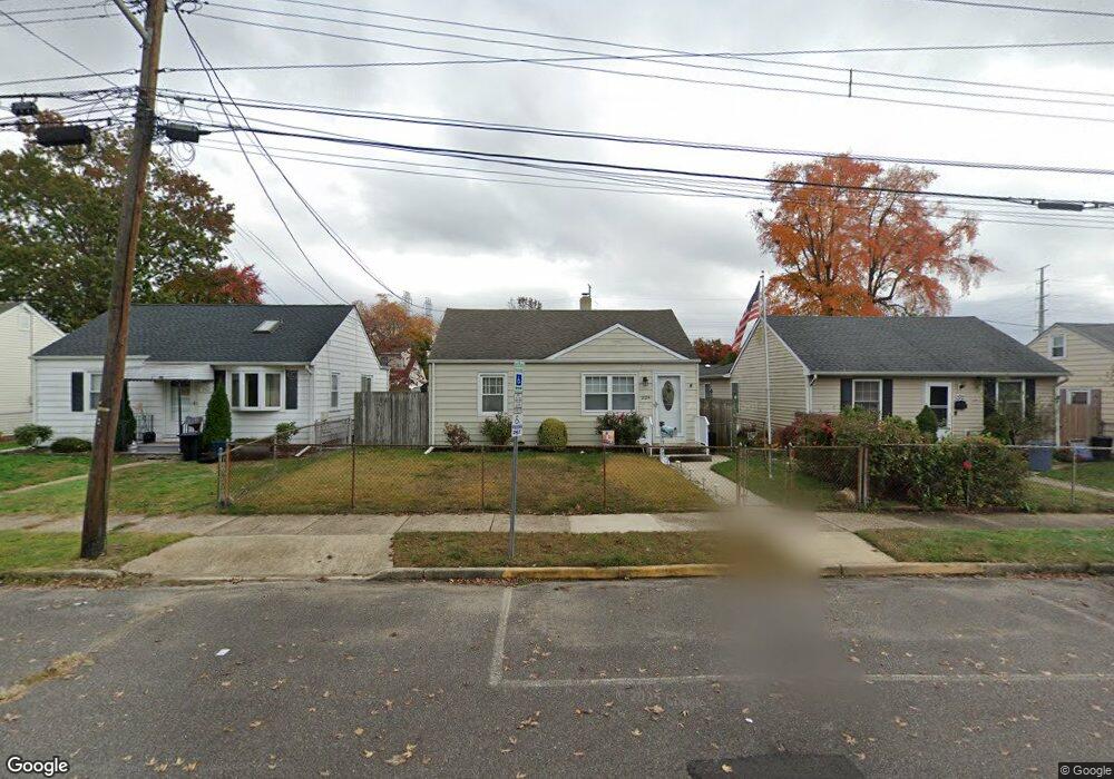
226 Samdin Blvd Trenton, NJ 08610
Estimated Value: $258,490 - $317,000
2
Beds
1
Bath
720
Sq Ft
$405/Sq Ft
Est. Value
About This Home
This home is located at 226 Samdin Blvd, Trenton, NJ 08610 and is currently estimated at $291,373, approximately $404 per square foot. 226 Samdin Blvd is a home located in Mercer County with nearby schools including George E. Wilson Elementary School, Albert E. Grice Middle School, and Hamilton West-Watson High School.
Ownership History
Date
Name
Owned For
Owner Type
Purchase Details
Closed on
Mar 12, 2009
Sold by
Stevens Ronald C and Stevens Rose M
Bought by
Struck Steven and Struck Karen
Current Estimated Value
Home Financials for this Owner
Home Financials are based on the most recent Mortgage that was taken out on this home.
Original Mortgage
$160,047
Outstanding Balance
$101,822
Interest Rate
5.14%
Mortgage Type
FHA
Estimated Equity
$189,551
Purchase Details
Closed on
Jun 4, 2001
Sold by
Longeran Veronica
Bought by
Stevens Ronald and Stevens Rose
Home Financials for this Owner
Home Financials are based on the most recent Mortgage that was taken out on this home.
Original Mortgage
$65,000
Interest Rate
7.15%
Mortgage Type
Purchase Money Mortgage
Create a Home Valuation Report for This Property
The Home Valuation Report is an in-depth analysis detailing your home's value as well as a comparison with similar homes in the area
Home Values in the Area
Average Home Value in this Area
Purchase History
| Date | Buyer | Sale Price | Title Company |
|---|---|---|---|
| Struck Steven | $163,000 | Emerald Title Agency | |
| Stevens Ronald | $75,000 | -- |
Source: Public Records
Mortgage History
| Date | Status | Borrower | Loan Amount |
|---|---|---|---|
| Open | Struck Steven | $160,047 | |
| Previous Owner | Stevens Ronald | $65,000 |
Source: Public Records
Tax History Compared to Growth
Tax History
| Year | Tax Paid | Tax Assessment Tax Assessment Total Assessment is a certain percentage of the fair market value that is determined by local assessors to be the total taxable value of land and additions on the property. | Land | Improvement |
|---|---|---|---|---|
| 2025 | $4,398 | $124,800 | $53,300 | $71,500 |
| 2024 | $4,122 | $124,800 | $53,300 | $71,500 |
| 2023 | $4,122 | $124,800 | $53,300 | $71,500 |
| 2022 | $4,057 | $124,800 | $53,300 | $71,500 |
| 2021 | $5,033 | $124,800 | $53,300 | $71,500 |
| 2020 | $4,584 | $124,800 | $53,300 | $71,500 |
| 2019 | $4,449 | $124,800 | $53,300 | $71,500 |
| 2018 | $4,415 | $124,800 | $53,300 | $71,500 |
| 2017 | $4,183 | $124,800 | $53,300 | $71,500 |
| 2016 | $3,375 | $124,800 | $53,300 | $71,500 |
| 2015 | $4,215 | $80,600 | $38,800 | $41,800 |
| 2014 | $4,128 | $80,600 | $38,800 | $41,800 |
Source: Public Records
Map
Nearby Homes
- 164 Lillian Ave
- 118 Hunter Ave
- 109 E Park Ave
- 158 Churchill Ave
- 252 Churchill Ave
- 949 Schiller Ave
- 2033 Genesee St
- 204 Thropp Ave
- 234 Thropp Ave
- 429 Wilfred Ave
- 624 Hunt Ave
- 28 Thropp Ave
- 156 Maddock Ave
- 533 Hunt Ave
- 408 Berg Ave
- 529 Hunt Ave
- 316 W Park Ave
- 323 Wilfred Ave
- 1961 S Broad St
- 604 Schiller Ave
- 232 Samdin Blvd
- 222 Samdin Blvd
- 238 Samdin Blvd
- 216 Samdin Blvd
- 209 Lillian Ave
- 242 Samdin Blvd
- 235 Lillian Ave
- 207 Lillian Ave
- 210 Samdin Blvd
- 241 Lillian Ave
- 205 Lillian Ave
- 248 Samdin Blvd
- 237 Samdin Blvd
- 204 Samdin Blvd
- 245 Lillian Ave
- 223 Samdin Blvd
- 203 Lillian Ave
- 254 Samdin Blvd
- 243 Samdin Blvd
- 251 Lillian Ave