Estimated Value: $534,000 - $695,872
3
Beds
2
Baths
1,260
Sq Ft
$499/Sq Ft
Est. Value
About This Home
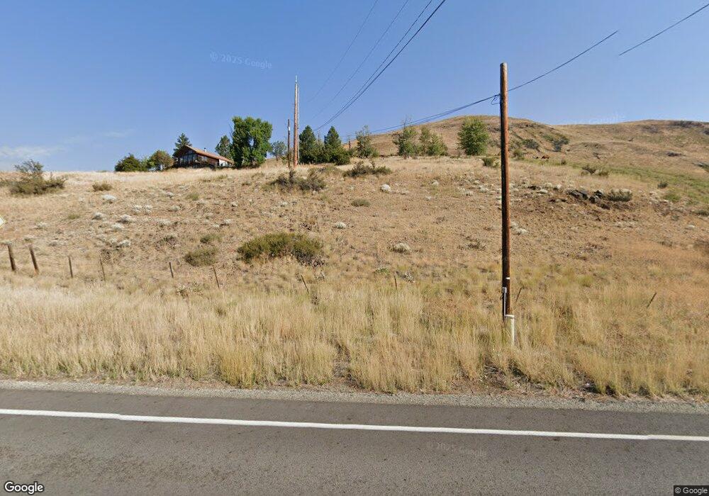
This home is located at 226 Twisp River Rd, Twisp, WA 98856 and is currently estimated at $628,718, approximately $498 per square foot. 226 Twisp River Rd is a home located in Okanogan County with nearby schools including Methow Valley Elementary School, Liberty Bell Junior/Senior High School, and Methow Valley Independent Learning Center.
Ownership History
Date
Name
Owned For
Owner Type
Purchase Details
Closed on
Apr 5, 2022
Sold by
Post Iii Russell L
Bought by
Post Lincoln S and Post Emily A
Current Estimated Value
Home Financials for this Owner
Home Financials are based on the most recent Mortgage that was taken out on this home.
Original Mortgage
$367,500
Outstanding Balance
$346,688
Interest Rate
4.67%
Mortgage Type
New Conventional
Estimated Equity
$282,030
Create a Home Valuation Report for This Property
The Home Valuation Report is an in-depth analysis detailing your home's value as well as a comparison with similar homes in the area
Purchase History
| Date | Buyer | Sale Price | Title Company |
|---|---|---|---|
| Post Lincoln S | -- | Wfg National Title |
Source: Public Records
Mortgage History
| Date | Status | Borrower | Loan Amount |
|---|---|---|---|
| Open | Post Lincoln S | $367,500 |
Source: Public Records
Tax History
| Year | Tax Paid | Tax Assessment Tax Assessment Total Assessment is a certain percentage of the fair market value that is determined by local assessors to be the total taxable value of land and additions on the property. | Land | Improvement |
|---|---|---|---|---|
| 2025 | $4,509 | $609,700 | $202,800 | $406,900 |
| 2024 | $4,509 | $567,600 | $202,800 | $364,800 |
| 2022 | $3,725 | $344,300 | $118,500 | $225,800 |
| 2021 | $3,957 | $344,300 | $118,500 | $225,800 |
| 2020 | $3,311 | $344,300 | $118,500 | $225,800 |
| 2019 | $3,158 | $292,200 | $118,500 | $173,700 |
| 2018 | $3,310 | $292,200 | $118,500 | $173,700 |
| 2017 | $3,007 | $292,200 | $118,500 | $173,700 |
| 2016 | $2,907 | $286,000 | $117,900 | $168,100 |
| 2015 | $3,057 | $325,300 | $157,200 | $168,100 |
| 2013 | -- | $325,300 | $157,200 | $168,100 |
Source: Public Records
Map
Nearby Homes
- 115 Johnson St N Unit 1,2,3
- 140 Twisp Ave W Unit 204
- 136 Johnson St
- 318 Lombard St
- 805 Marble St
- 0 Lot 2 Amended Surface Short Plat
- 1110 Riverside Ave
- 1221 Riverside Ave
- 7 Howerton Rd
- 143 Harrier Hill Rd
- 15 Howerton Rd
- 2992 Washington 153
- 5 Chase Rd
- 21 Twin Lakes Dr
- 40 TBD Rabbit House Rd
- 7 Round Rock Ln
- 88 Horizon Flat Rd
- 302 Cascadian Ct Unit 18
- 300 Cascadian Ct Unit 15
- 920 Castle Ave
- 214 Twisp River Rd
- 229 Twisp River Rd
- 213 Twisp River Rd
- 217 Twisp River Rd
- 204 Twisp River Rd
- 245 Twisp River Rd
- 235 Twisp River Rd
- 248 Twisp River Rd
- 185 Twisp River Rd
- 194 Twisp River Rd
- 251 Twisp River Rd
- 84A Poorman Creek Rd
- 250 Twisp River Rd
- 84B Poorman Creek Rd
- 191 Twisp River Rd
- 262 Twisp River Rd
- 0 Poorman Creek Rd
- 0 Poorman Creek Rd Unit NWM1419495
- 0 Poorman Creek Rd Unit NWM1243418
Your Personal Tour Guide
Ask me questions while you tour the home.