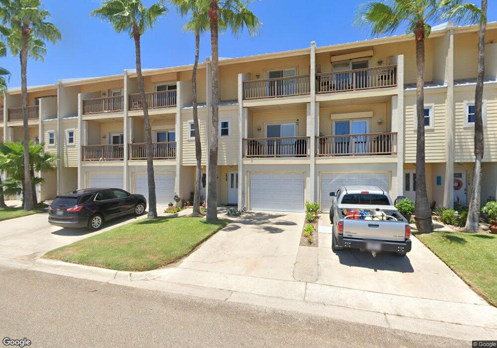
226 W Houston St Unit 226A Port Isabel, TX 78578
Estimated Value: $347,496 - $388,000
3
Beds
4
Baths
1,438
Sq Ft
$262/Sq Ft
Est. Value
About This Home
This home is located at 226 W Houston St Unit 226A, Port Isabel, TX 78578 and is currently estimated at $376,374, approximately $261 per square foot. 226 W Houston St Unit 226A is a home located in Cameron County with nearby schools including Garriga Elementary School, Derry Elementary School, and Port Isabel Junior High School.
Ownership History
Date
Name
Owned For
Owner Type
Purchase Details
Closed on
Oct 30, 2020
Sold by
Kincaid Allen J and Kincaid Lorna
Bought by
Gridley Glenn Allen and Schlabach Gridley Lenise
Current Estimated Value
Home Financials for this Owner
Home Financials are based on the most recent Mortgage that was taken out on this home.
Original Mortgage
$230,350
Outstanding Balance
$204,979
Interest Rate
2.8%
Mortgage Type
New Conventional
Estimated Equity
$171,395
Purchase Details
Closed on
May 16, 1997
Sold by
Dodson Marion E and Dodson Joyce H
Bought by
Curtis Charles and Curtis Julie
Home Financials for this Owner
Home Financials are based on the most recent Mortgage that was taken out on this home.
Original Mortgage
$115,900
Interest Rate
8.17%
Create a Home Valuation Report for This Property
The Home Valuation Report is an in-depth analysis detailing your home's value as well as a comparison with similar homes in the area
Home Values in the Area
Average Home Value in this Area
Purchase History
| Date | Buyer | Sale Price | Title Company |
|---|---|---|---|
| Gridley Glenn Allen | -- | Stewart Title Company | |
| Curtis Charles | -- | Southern Texas Title Co |
Source: Public Records
Mortgage History
| Date | Status | Borrower | Loan Amount |
|---|---|---|---|
| Open | Gridley Glenn Allen | $230,350 | |
| Previous Owner | Curtis Charles | $115,900 |
Source: Public Records
Tax History Compared to Growth
Tax History
| Year | Tax Paid | Tax Assessment Tax Assessment Total Assessment is a certain percentage of the fair market value that is determined by local assessors to be the total taxable value of land and additions on the property. | Land | Improvement |
|---|---|---|---|---|
| 2025 | $6,156 | $347,816 | $86,171 | $261,645 |
| 2024 | $6,156 | $284,928 | -- | -- |
| 2023 | $5,158 | $237,440 | $86,171 | $151,269 |
| 2022 | $4,668 | $202,651 | $46,545 | $156,106 |
| 2021 | $4,692 | $195,706 | $37,183 | $158,523 |
| 2020 | $4,521 | $187,519 | $37,183 | $150,336 |
| 2019 | $4,387 | $184,658 | $37,183 | $147,475 |
| 2018 | $4,545 | $191,446 | $54,165 | $137,281 |
| 2017 | $4,580 | $193,385 | $54,165 | $139,220 |
| 2016 | $4,672 | $197,269 | $54,165 | $143,104 |
| 2015 | $4,793 | $199,211 | $54,165 | $145,046 |
Source: Public Records
Map
Nearby Homes
- 226 W Houston St Unit 216B
- 226 W Houston St Unit 206B
- 0 Yturria St Unit 17A 100539
- 0 Yturria St Unit 16A 100538
- 0 Gomez St Unit 1A 103250
- 814 Tarpon Ave Unit 28
- 813 Tarpon Ave
- 0 Pompano Ave Unit 2 103128
- 917 Pompano Ave
- 813 N Shore Dr
- 906 W Polk St Unit 27
- 905 N Shore Dr
- 00 Tarpon Ave
- 00 Tarpon Ave Unit 19
- 909 N Shore Dr
- 909 Trout Ave
- 1013 Tarpon Ave
- 301 E Houston St Unit 1201
- 301 E Houston St Unit 3303
- 301 E Houston St
- 226 W Houston St Unit 204
- 226 W Houston St Unit 238A
- 226 W Houston St Unit 234A
- 226 W Houston St Unit 224A
- 226 W Houston St Unit 222A
- 226 W Houston St Unit 220A
- 226 W Houston St Unit 214B
- 226 W Houston St Unit 210B
- 226 W Houston St Unit 208
- 226 W Houston St Unit 202B
- 226 W Houston St Unit 218
- 226 W Houston St
- 226 W Houston St Unit 236
- 226 W Houston St Unit 212
- 250 W Houston St Unit 232
- 232 W Houston St
- 250 Houston St Unit 228
- 250 Houston St Unit 232
- 250 Houston St Unit 236
- 216 W Houston St Unit 216B