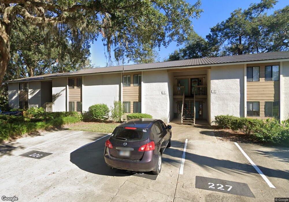
226 Walmar Grove St. Simons Island, GA 31522
Estimated Value: $278,000 - $331,000
2
Beds
2
Baths
1,100
Sq Ft
$277/Sq Ft
Est. Value
About This Home
This home is located at 226 Walmar Grove, St. Simons Island, GA 31522 and is currently estimated at $304,377, approximately $276 per square foot. 226 Walmar Grove is a home located in Glynn County with nearby schools including Oglethorpe Point Elementary School, Glynn Middle School, and Glynn Academy.
Ownership History
Date
Name
Owned For
Owner Type
Purchase Details
Closed on
Nov 8, 2012
Sold by
Morse Katherine
Bought by
Echols Vickie and Echols Kenneth J
Current Estimated Value
Purchase Details
Closed on
May 4, 2006
Sold by
Wicker Elizabeth C
Bought by
Morse Katherine and Morse John
Home Financials for this Owner
Home Financials are based on the most recent Mortgage that was taken out on this home.
Original Mortgage
$156,000
Interest Rate
6.39%
Mortgage Type
New Conventional
Create a Home Valuation Report for This Property
The Home Valuation Report is an in-depth analysis detailing your home's value as well as a comparison with similar homes in the area
Home Values in the Area
Average Home Value in this Area
Purchase History
| Date | Buyer | Sale Price | Title Company |
|---|---|---|---|
| Echols Vickie | $134,000 | -- | |
| Morse Katherine | $195,000 | -- |
Source: Public Records
Mortgage History
| Date | Status | Borrower | Loan Amount |
|---|---|---|---|
| Previous Owner | Morse Katherine | $156,000 |
Source: Public Records
Tax History Compared to Growth
Tax History
| Year | Tax Paid | Tax Assessment Tax Assessment Total Assessment is a certain percentage of the fair market value that is determined by local assessors to be the total taxable value of land and additions on the property. | Land | Improvement |
|---|---|---|---|---|
| 2025 | $2,709 | $108,000 | $0 | $108,000 |
| 2024 | $2,408 | $96,000 | $0 | $96,000 |
| 2023 | $2,359 | $96,000 | $0 | $96,000 |
| 2022 | $2,408 | $96,000 | $0 | $96,000 |
| 2021 | $1,717 | $66,400 | $0 | $66,400 |
| 2020 | $1,734 | $66,400 | $0 | $66,400 |
| 2019 | $1,734 | $66,400 | $0 | $66,400 |
| 2018 | $1,734 | $66,400 | $0 | $66,400 |
| 2017 | $1,384 | $53,000 | $0 | $53,000 |
| 2016 | $1,210 | $50,400 | $0 | $50,400 |
| 2015 | $1,432 | $50,400 | $0 | $50,400 |
| 2014 | $1,432 | $59,400 | $0 | $59,400 |
Source: Public Records
Map
Nearby Homes
- 222 Walmar Grove
- 109 Shady Brook Cir Unit 301
- 99 Brook Dr
- 117 Quamley Wells Dr
- 105 Brook Dr
- 101 Barkentine Ct Unit A-1
- 146 Shady Brook Cir Unit 301
- 150 Shady Brook Cir Unit 201
- 156 Shady Brook Cir Unit 101
- 361 Brockinton Marsh
- 122 Shady Brook Cir Unit 201
- 622 Brockinton Point
- 103 Travellers Way
- 512 Brockinton S
- 123 Shadow Wood Bend
- 24 Orchard Rd
- 104 Ashwood Way
- 129 Shadow Wood Bend
- 112 Brookfield Trace
- 131 Shadow Wood Bend
- 228 Walmar Grove Unit 28
- 228 Walmar Grove
- 228 Walmar Grove
- 227 Walmar Grove Unit 27
- 227 Walmar Grove
- 227 Walmar Grove Unit 227
- 229 Walmar Grove Unit 29
- 229 Walmar Grove
- 226 Walmar Grove
- 226 Walmar Grove Unit 226
- 225 Walmar Grove
- 231 Walmar Grove
- 231 Walmar Grove Unit 231
- 224 Walmar Grove Unit 24
- 232 Walmar Grove
- 232 Walmar Grove Unit 32
- 223 Walmar Grove
- 223 Walmar Grove Unit 223
- 222 Walmar Grove Unit 22
- 221 Walmar Grove