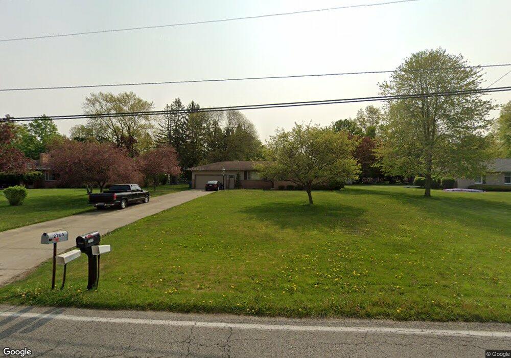
2260 Howland Wilson Rd NE Warren, OH 44484
Estimated Value: $206,000 - $251,000
3
Beds
2
Baths
1,308
Sq Ft
$173/Sq Ft
Est. Value
About This Home
This home is located at 2260 Howland Wilson Rd NE, Warren, OH 44484 and is currently estimated at $226,842, approximately $173 per square foot. 2260 Howland Wilson Rd NE is a home located in Trumbull County with nearby schools including Howland High School.
Ownership History
Date
Name
Owned For
Owner Type
Purchase Details
Closed on
Feb 17, 2015
Sold by
Helsely Helen
Bought by
Helsley Melvin and Helsley Patricia L
Current Estimated Value
Purchase Details
Closed on
Dec 7, 2004
Sold by
Helsley Wayne S and Helsley Helen
Bought by
Helsley Wayne S and Helsley Helen
Purchase Details
Closed on
Dec 3, 2004
Sold by
Helsley Wayne S and Helsley Helen
Bought by
Helsley Wayne S and Helsley Helen
Purchase Details
Closed on
Jan 1, 1990
Bought by
Wayne Wayne S and Wayne Helen
Create a Home Valuation Report for This Property
The Home Valuation Report is an in-depth analysis detailing your home's value as well as a comparison with similar homes in the area
Home Values in the Area
Average Home Value in this Area
Purchase History
| Date | Buyer | Sale Price | Title Company |
|---|---|---|---|
| Helsley Melvin | -- | None Available | |
| Helsley Wayne S | -- | -- | |
| Helsley Wayne S | -- | -- | |
| Wayne Wayne S | -- | -- |
Source: Public Records
Tax History Compared to Growth
Tax History
| Year | Tax Paid | Tax Assessment Tax Assessment Total Assessment is a certain percentage of the fair market value that is determined by local assessors to be the total taxable value of land and additions on the property. | Land | Improvement |
|---|---|---|---|---|
| 2024 | $4,071 | $55,900 | $13,340 | $42,560 |
| 2023 | $4,071 | $55,900 | $13,340 | $42,560 |
| 2022 | $3,182 | $41,660 | $13,340 | $28,320 |
| 2021 | $3,114 | $41,660 | $13,340 | $28,320 |
| 2020 | $3,110 | $41,660 | $13,340 | $28,320 |
| 2019 | $3,106 | $39,070 | $13,340 | $25,730 |
| 2018 | $2,996 | $39,070 | $13,340 | $25,730 |
| 2017 | $2,750 | $39,070 | $13,340 | $25,730 |
| 2016 | $2,692 | $37,000 | $13,340 | $23,660 |
| 2015 | $2,001 | $37,000 | $13,340 | $23,660 |
| 2014 | $1,679 | $37,000 | $13,340 | $23,660 |
| 2013 | $1,522 | $37,000 | $13,340 | $23,660 |
Source: Public Records
Map
Nearby Homes
- 2193 Howland Wilson Rd NE
- 1015 Cambridge Ct NE
- 1750 Portal Dr NE
- 8848 King Graves Rd NE
- 2212 Celestial Dr NE
- 9550 Hunt Club Trail NE
- 2158 Celestial Dr NE
- 2133 Silver Fox Ln NE
- 5 Oh-46
- 4 Niles Cortland Rd NE
- 0 #3 Niles Cortland Rd- Sr 46 Unit 4274646
- 1 Oh-46
- 0 Niles Cortland Rd Sr 46 Unit 4273262
- Lot 4 N Gulch Ln
- 2329 Henn Hyde Rd NE
- 0 Muir Woods Dr
- 8545 Carriage Hill Dr NE
- 8531 Red Oak Dr NE
- 0 Palette Dr NE Unit 5010848
- 0 King Graves Rd NE
- 2280 Howland Wilson Rd NE
- 2230 Howland Wilson Rd NE
- 2300 Howland Wilson Rd NE
- 2225 Brittainy Oaks Trail NE
- 2245 Brittainy Oaks Trail NE
- 2205 Brittainy Oaks Trail NE
- 2265 Brittainy Oaks Trail NE
- 2271 Howland Wilson Rd NE
- 2200 Howland Wilson Rd NE
- 2324 Howland Wilson Rd NE
- 2261 Howland Wilson Rd NE
- 2281 Howland Wilson Rd NE
- 2185 Brittainy Oaks Trail NE
- 2291 Howland Wilson Rd NE
- 2285 Brittainy Oaks Trail NE
- 2180 Howland Wilson Rd NE
- 2165 Brittainy Oaks Trail NE
- 2301 Howland Wilson Rd NE
- 9301 Hillview Dr NE
- 2360 Howland Wilson Rd NE