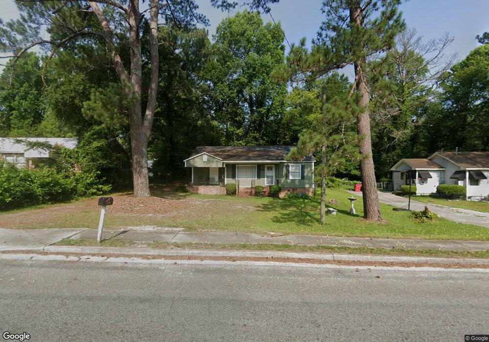
2260 New Clinton Rd Macon, GA 31217
Estimated Value: $73,000 - $120,000
2
Beds
1
Bath
1,128
Sq Ft
$84/Sq Ft
Est. Value
About This Home
This home is located at 2260 New Clinton Rd, Macon, GA 31217 and is currently estimated at $94,784, approximately $84 per square foot. 2260 New Clinton Rd is a home located in Bibb County with nearby schools including Martin Luther King Jr. Elementary School, Appling Middle School, and Northeast High School.
Ownership History
Date
Name
Owned For
Owner Type
Purchase Details
Closed on
Nov 15, 2017
Sold by
Harrell Angela
Bought by
K & H Realty Llc
Current Estimated Value
Purchase Details
Closed on
Feb 7, 2017
Sold by
Croft Tanya
Bought by
Harrell Angela
Purchase Details
Closed on
Jun 17, 2016
Bought by
Rogers Tanya D
Purchase Details
Closed on
Aug 22, 2007
Sold by
Rogers Tanya Deason and Croft Tanya Deason
Bought by
Associates Housing Group Llc
Purchase Details
Closed on
May 10, 2005
Create a Home Valuation Report for This Property
The Home Valuation Report is an in-depth analysis detailing your home's value as well as a comparison with similar homes in the area
Home Values in the Area
Average Home Value in this Area
Purchase History
| Date | Buyer | Sale Price | Title Company |
|---|---|---|---|
| K & H Realty Llc | -- | None Available | |
| Harrell Angela | $5,000 | -- | |
| Rogers Tanya D | -- | -- | |
| Associates Housing Group Llc | -- | None Available | |
| -- | -- | -- |
Source: Public Records
Tax History Compared to Growth
Tax History
| Year | Tax Paid | Tax Assessment Tax Assessment Total Assessment is a certain percentage of the fair market value that is determined by local assessors to be the total taxable value of land and additions on the property. | Land | Improvement |
|---|---|---|---|---|
| 2025 | $601 | $24,462 | $2,581 | $21,881 |
| 2024 | $560 | $22,057 | $2,244 | $19,813 |
| 2023 | $575 | $22,628 | $2,244 | $20,384 |
| 2022 | $593 | $17,126 | $2,316 | $14,810 |
| 2021 | $478 | $12,573 | $1,544 | $11,029 |
| 2020 | $417 | $10,740 | $1,286 | $9,454 |
| 2019 | $420 | $10,740 | $1,286 | $9,454 |
| 2018 | $300 | $10,740 | $1,286 | $9,454 |
| 2017 | $224 | $7,040 | $1,286 | $5,754 |
| 2016 | $368 | $10,643 | $1,286 | $9,357 |
| 2015 | $542 | $11,072 | $1,715 | $9,357 |
| 2014 | $672 | $11,930 | $2,573 | $9,357 |
Source: Public Records
Map
Nearby Homes
- 2229 New Clinton Rd
- 2146 Melton Ave
- 2130 New Clinton Rd
- 2066 Melton Ave
- 1840 Kinder Kare Dr
- 837 Artic Cir
- 1818 Kinder Kare Dr
- 875 Artic Cir
- 875 Artic Place
- 4436 Jeffersonville Rd
- 909 Johnson St
- 2370 Recreation Rd
- 2371 Kensington Rd
- 2458 Tredway Dr
- 2675 Andy Dr
- 1008 Sunnydale Dr
- 2630 Pauladale Dr
- 860 Morningside Dr
- 2792 Skyline Dr
- 1030 Forsyth Ave
- 2250 New Clinton Rd
- 2270 New Clinton Rd
- 2274 New Clinton Rd
- 2240 New Clinton Rd
- 2261 Melton Ave
- 2271 Melton Ave
- 2251 Melton Ave
- 2237 New Clinton Rd
- 2265 New Clinton Rd
- 2230 New Clinton Rd
- 2241 Melton Ave
- 2235 New Clinton Rd
- 2267 New Clinton Rd
- 2231 Melton Ave
- 2200 New Clinton Rd
- 2200 New Clinton Rd Unit 1
- 2284 New Clinton Rd
- 2220 Companion Dr
- 2290 Melton Ave
- 2080 Karen Dr