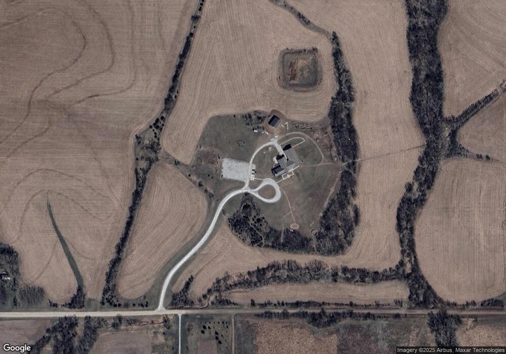
2260 W Wittstruck Rd Martell, NE 68404
Estimated Value: $480,000 - $1,669,132
--
Bed
--
Bath
--
Sq Ft
23.52
Acres
About This Home
This home is located at 2260 W Wittstruck Rd, Martell, NE 68404 and is currently estimated at $1,074,566. 2260 W Wittstruck Rd is a home located in Lancaster County with nearby schools including Norris Elementary School, Norris Middle School, and Norris High School.
Ownership History
Date
Name
Owned For
Owner Type
Purchase Details
Closed on
Jun 22, 2021
Sold by
Narrow Gate Llc
Bought by
Sonshine Camp
Current Estimated Value
Home Financials for this Owner
Home Financials are based on the most recent Mortgage that was taken out on this home.
Original Mortgage
$1,160,000
Outstanding Balance
$1,050,235
Interest Rate
2.9%
Mortgage Type
Commercial
Estimated Equity
$24,331
Purchase Details
Closed on
Dec 31, 2012
Sold by
Radix Inc
Bought by
Narrow Gate Llc
Purchase Details
Closed on
Nov 7, 2007
Sold by
Winter James Blake and Winter Cheryl
Bought by
Radix Inc
Purchase Details
Closed on
Jan 18, 2003
Sold by
Little Jonathan S and Little Trisha A
Bought by
Winter James Blake and Winter Cheryl
Purchase Details
Closed on
Aug 9, 2002
Sold by
Hotovy Steven P and Hotovy Lee A
Bought by
Manzitto Inc
Purchase Details
Closed on
Aug 29, 2001
Sold by
Bentzinger Grain & Equipment Co
Bought by
Hotovy Steven P and Hotovy Lee A
Create a Home Valuation Report for This Property
The Home Valuation Report is an in-depth analysis detailing your home's value as well as a comparison with similar homes in the area
Home Values in the Area
Average Home Value in this Area
Purchase History
| Date | Buyer | Sale Price | Title Company |
|---|---|---|---|
| Sonshine Camp | $1,450,000 | None Available | |
| Narrow Gate Llc | -- | None Available | |
| Radix Inc | $60,000 | Nt | |
| Winter James Blake | $46,000 | -- | |
| Manzitto Inc | $38,000 | -- | |
| Hotovy Steven P | $33,000 | -- |
Source: Public Records
Mortgage History
| Date | Status | Borrower | Loan Amount |
|---|---|---|---|
| Open | Sonshine Camp | $1,160,000 |
Source: Public Records
Tax History Compared to Growth
Tax History
| Year | Tax Paid | Tax Assessment Tax Assessment Total Assessment is a certain percentage of the fair market value that is determined by local assessors to be the total taxable value of land and additions on the property. | Land | Improvement |
|---|---|---|---|---|
| 2024 | $240 | $2,107,700 | $199,200 | $1,908,500 |
| 2023 | $318 | $1,649,200 | $198,400 | $1,450,800 |
| 2022 | $426 | $1,441,900 | $198,400 | $1,243,500 |
| 2021 | $392 | $1,441,900 | $198,400 | $1,243,500 |
| 2020 | $21,725 | $1,403,500 | $160,000 | $1,243,500 |
| 2019 | $21,842 | $1,403,700 | $160,200 | $1,243,500 |
| 2018 | $21,225 | $1,373,300 | $164,300 | $1,209,000 |
| 2017 | $20,581 | $1,358,200 | $164,300 | $1,193,900 |
| 2016 | $20,836 | $1,349,200 | $166,700 | $1,182,500 |
| 2015 | $20,905 | $1,343,300 | $160,800 | $1,182,500 |
| 2014 | -- | $1,232,300 | $157,600 | $1,074,700 |
| 2013 | -- | $1,226,700 | $152,000 | $1,074,700 |
Source: Public Records
Map
Nearby Homes
- 14201 SW 15th St
- 5231 W Roca Rd
- Lot 6 Block 5 W Lady May Ln
- Lot 1 Block 6 W Lady May Ln
- Lot 3 Block 5 W Lady May Ln
- Lot 2 Block 5 W Lady May Ln
- SW 36th Street W Lady May Ln
- TBD 2 W Lady May Ln
- TBD 1 W Lady May Ln
- Lot 2 Block 3 W Lady May Ln
- Lot 1 Block 4 W Lady May Ln
- Lot 2 Block 4 W Lady May Ln
- 4500 W Bluestem Rd
- TBD 4 SW 54th St
- TBD 3 SW 54th St
- TBD 2 SW 54th St
- TBD 1 SW 54th St
- 4510 S 1st St
- 4500 S 1st St
- 4456 S 1st St
- 2260 W Wittstruck Rd
- 14401 SW 15th St
- 14301 SW 15th St
- 2500 W Wittstruck Rd
- 0 0 SW 15th Cir
- 0 SW 15th Cir
- 14445 SW 15th St
- 14445 SW 15th St
- 14200 SW 15th St
- 2520 W Wittstruck Rd
- 2660 W Wittstruck Rd
- 14440 SW 15th St
- 1400 Stella Maria Ave
- 13652 SW 14th St
- 14445 SW 29th St
- 13515 SW 14th St
- 13455 SW 14th St
- 15000 SW 29th St
- 1910 W Bennet Rd
- 13200 SW 29th St
