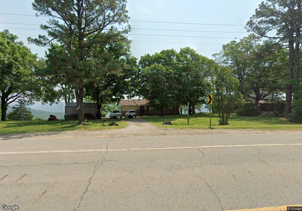
22600 N Highway 71 Winslow, AR 72959
Estimated Value: $168,535 - $252,000
--
Bed
2
Baths
1,352
Sq Ft
$157/Sq Ft
Est. Value
About This Home
This home is located at 22600 N Highway 71, Winslow, AR 72959 and is currently estimated at $212,512, approximately $157 per square foot. 22600 N Highway 71 is a home located in Crawford County with nearby schools including Mountainburg Elementary School, Mountainburg Middle School, and Mountainburg High School.
Ownership History
Date
Name
Owned For
Owner Type
Purchase Details
Closed on
Oct 11, 2016
Sold by
Blankey Glen D and Blankey Andrea K
Bought by
Blankey Glen D and Blankey Andrea K
Current Estimated Value
Purchase Details
Closed on
Oct 9, 2015
Sold by
Minor Moon Ei
Bought by
Blakney Glen D and Blakney Andrea K
Purchase Details
Closed on
Feb 24, 2004
Bought by
Minor-Blakney
Purchase Details
Closed on
Sep 25, 2001
Bought by
Caveness-Caveness Trust
Purchase Details
Closed on
May 15, 2001
Bought by
Caveness Trust-Blakney
Purchase Details
Closed on
Jan 7, 1999
Bought by
Caviness-Caviness
Create a Home Valuation Report for This Property
The Home Valuation Report is an in-depth analysis detailing your home's value as well as a comparison with similar homes in the area
Home Values in the Area
Average Home Value in this Area
Purchase History
| Date | Buyer | Sale Price | Title Company |
|---|---|---|---|
| Blankey Glen D | -- | None Available | |
| Blakney Glen D | $25,000 | None Available | |
| Minor-Blakney | -- | -- | |
| Caveness-Caveness Trust | -- | -- | |
| Caveness Trust-Blakney | $58,000 | -- | |
| Caviness-Caviness | -- | -- |
Source: Public Records
Tax History Compared to Growth
Tax History
| Year | Tax Paid | Tax Assessment Tax Assessment Total Assessment is a certain percentage of the fair market value that is determined by local assessors to be the total taxable value of land and additions on the property. | Land | Improvement |
|---|---|---|---|---|
| 2025 | $5 | $18,610 | $1,090 | $17,520 |
| 2024 | $5 | $18,610 | $1,090 | $17,520 |
| 2023 | $12 | $18,610 | $1,090 | $17,520 |
| 2022 | $55 | $8,360 | $1,100 | $7,260 |
| 2021 | $55 | $8,360 | $1,100 | $7,260 |
| 2020 | $14 | $8,360 | $1,100 | $7,260 |
| 2019 | $14 | $8,360 | $1,100 | $7,260 |
| 2018 | $39 | $8,360 | $1,100 | $7,260 |
| 2017 | $74 | $9,130 | $1,110 | $8,020 |
| 2016 | $74 | $9,130 | $1,110 | $8,020 |
| 2015 | $74 | $10,400 | $2,540 | $7,860 |
| 2014 | $133 | $10,400 | $2,540 | $7,860 |
Source: Public Records
Map
Nearby Homes
- 22764 Carter Lane Rd
- 21701 Mount Gaylor Point
- 21588 S Highway 71
- 20805 Pine Dr
- 20845 U S 71
- 47 Acres Wc 4275
- 20255 N Highway 71
- 610 Blueberry Hill Rd
- TBD N Devils Den Rd
- 156 Pinehaven Dr
- 1327 Copperhead Rd
- 11939 Canova Trail
- 11901 Canova Trail
- 18708 S Highway 71
- 19108 Canova Trail
- 21710 Wc 274
- 15800 Sand Point Terrace
- 15802 Sand Point Terrace
- 15801 Sand Point Terrace
- 10347 Devils Den Rd
- 22600 N Highway 71
- 22536 N Highway 71
- 22324 N Highway 71
- 22300 N Highway 71
- 22605 N Highway 71
- 22520 N Highway 71
- 22520 N Highway 71
- 22535 N Highway 71
- 22535 N Highway 71
- 22640 N Highway 71
- 22515 N Highway 71
- 22515 N Highway 71
- 22202 N Highway 71
- 22258 N Highway 71
- 22647 N Highway 71
- 22647 N Highway 71
- 22708 N Highway 71
- 22500 N Highway 71
- 22522 N Highway 71
- 22709 N Highway 71