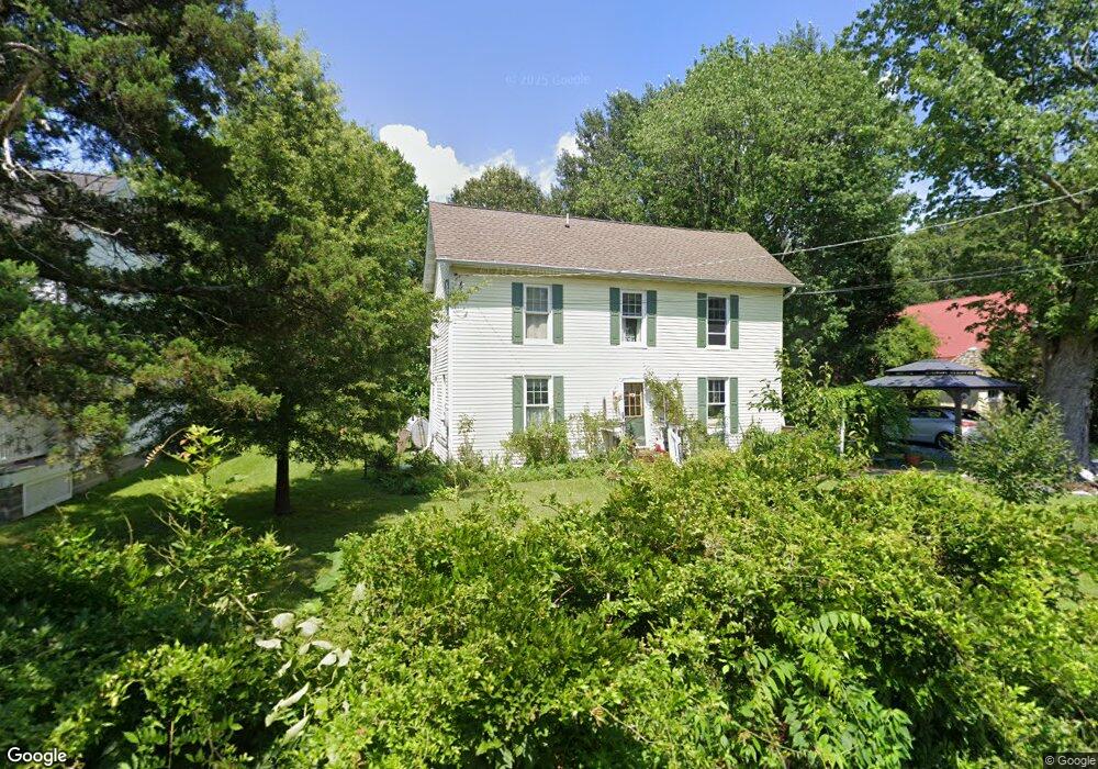
22600 Pot Pie Rd Wittman, MD 21676
Estimated Value: $173,135 - $291,000
Studio
1
Bath
1,184
Sq Ft
$207/Sq Ft
Est. Value
About This Home
This home is located at 22600 Pot Pie Rd, Wittman, MD 21676 and is currently estimated at $245,284, approximately $207 per square foot. 22600 Pot Pie Rd is a home located in Talbot County with nearby schools including Tilghman Elementary School, St. Michaels Middle/High School, and Easton High School.
Ownership History
Date
Name
Owned For
Owner Type
Purchase Details
Closed on
Oct 2, 1998
Sold by
Mcquay David A and Mcquay Rita J
Bought by
Kemp Susan E
Current Estimated Value
Purchase Details
Closed on
Aug 1, 1996
Sold by
Kreick John A
Bought by
Mcquay David A and Mcquay Rita J
Purchase Details
Closed on
Aug 30, 1990
Sold by
Racey Eston R and Racey Pamela K
Bought by
Kreick John A
Home Financials for this Owner
Home Financials are based on the most recent Mortgage that was taken out on this home.
Original Mortgage
$83,604
Interest Rate
10.29%
Create a Home Valuation Report for This Property
The Home Valuation Report is an in-depth analysis detailing your home's value as well as a comparison with similar homes in the area
Purchase History
| Date | Buyer | Sale Price | Title Company |
|---|---|---|---|
| Kemp Susan E | $66,000 | -- | |
| Mcquay David A | $74,600 | -- | |
| Kreick John A | $88,100 | -- |
Source: Public Records
Mortgage History
| Date | Status | Borrower | Loan Amount |
|---|---|---|---|
| Previous Owner | Kreick John A | $83,604 | |
| Closed | Mcquay David A | -- |
Source: Public Records
Tax History
| Year | Tax Paid | Tax Assessment Tax Assessment Total Assessment is a certain percentage of the fair market value that is determined by local assessors to be the total taxable value of land and additions on the property. | Land | Improvement |
|---|---|---|---|---|
| 2025 | $627 | $115,800 | $52,500 | $63,300 |
| 2024 | $616 | $111,367 | $0 | $0 |
| 2023 | $585 | $106,933 | $0 | $0 |
| 2022 | $546 | $102,500 | $52,500 | $50,000 |
| 2021 | $522 | $102,500 | $52,500 | $50,000 |
| 2020 | $522 | $102,500 | $52,500 | $50,000 |
| 2019 | $529 | $109,000 | $61,000 | $48,000 |
| 2018 | $514 | $107,200 | $0 | $0 |
| 2017 | $492 | $105,400 | $0 | $0 |
| 2016 | $468 | $103,600 | $0 | $0 |
| 2015 | $397 | $103,600 | $0 | $0 |
| 2014 | $397 | $103,600 | $0 | $0 |
Source: Public Records
Map
Nearby Homes
- 8805 Cummings Rd
- 22582 Pot Pie Rd
- 8915 Palmer Ln
- 22707 Marshall Ln
- 22314 Pot Pie Rd
- 22349 Cooper Ln
- 8781 Tilghman Island Rd
- 9262 Macks Ln
- 8620 Bozman Neavitt Rd
- 9681 Macks Ln
- 8034 Bozman Neavitt Rd
- 21869 Albie Rd
- 23869 Mount Misery Rd
- 7651 Main St
- 7508 Cooper Point Rd
- 23961 Lynnewood Dr
- 0 Cooper Point Rd Unit MDTA2013120
- 23857 Ebb Point Rd
- 9180 Saint Michaels Rd
- 24354 Widgeon Place Unit 20
- 22590 Pot Pie Rd
- 22606 Pot Pie Rd
- 22588 Pot Pie Rd
- 22601 Pot Pie Rd
- 22595 Pot Pie Rd
- 8872 New Rd
- 22585 Pot Pie Rd
- 8880 New Rd
- 22611 Pot Pie Rd
- 8880 New Rd
- 22581 Pot Pie Rd
- 22580 Pot Pie Rd
- 22619 Pot Pie Rd
- 8830 Cummings Rd
- 8890 New Rd
- 22623 Pot Pie Rd
- 22597 Pot Pie Rd
- 22569 Pot Pie Rd
- 8848 Howeth Rd
- 8850 Howeth Rd
Your Personal Tour Guide
Ask me questions while you tour the home.