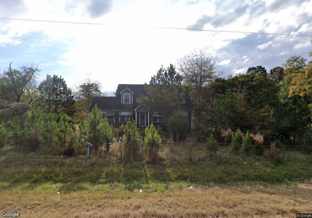
2261 Union Point Hwy Greensboro, GA 30642
Estimated Value: $386,000 - $1,752,000
3
Beds
2
Baths
1,900
Sq Ft
$694/Sq Ft
Est. Value
About This Home
This home is located at 2261 Union Point Hwy, Greensboro, GA 30642 and is currently estimated at $1,317,742, approximately $693 per square foot. 2261 Union Point Hwy is a home located in Greene County with nearby schools including Greene County High School.
Ownership History
Date
Name
Owned For
Owner Type
Purchase Details
Closed on
Aug 2, 2012
Sold by
Linger Longer Development Co
Bought by
Oconee Land Development Co Llc
Current Estimated Value
Purchase Details
Closed on
Mar 15, 2011
Sold by
Georgia Fall Line Properties Llc
Bought by
Reynolds James M and Reynolds Mercer
Purchase Details
Closed on
Jun 29, 2006
Sold by
Pettay Kenneth A
Bought by
Georgia Fall Line Properties L
Create a Home Valuation Report for This Property
The Home Valuation Report is an in-depth analysis detailing your home's value as well as a comparison with similar homes in the area
Home Values in the Area
Average Home Value in this Area
Purchase History
| Date | Buyer | Sale Price | Title Company |
|---|---|---|---|
| Oconee Land Development Co Llc | $44,428,100 | -- | |
| Reynolds James M | $729,295 | -- | |
| Linger Longer Development Company | $729,295 | -- | |
| Georgia Fall Line Properties L | -- | -- | |
| Georgia Fall Line Properties L | $1,200,000 | -- | |
| English Willie Mae | -- | -- |
Source: Public Records
Tax History Compared to Growth
Tax History
| Year | Tax Paid | Tax Assessment Tax Assessment Total Assessment is a certain percentage of the fair market value that is determined by local assessors to be the total taxable value of land and additions on the property. | Land | Improvement |
|---|---|---|---|---|
| 2024 | $7,884 | $502,600 | $487,640 | $14,960 |
| 2023 | $6,572 | $416,880 | $402,520 | $14,360 |
| 2022 | $4,513 | $252,160 | $243,920 | $8,240 |
| 2021 | $4,812 | $251,360 | $243,920 | $7,440 |
| 2020 | $4,514 | $213,000 | $205,120 | $7,880 |
| 2019 | $4,648 | $213,000 | $205,120 | $7,880 |
| 2018 | $4,634 | $213,000 | $205,120 | $7,880 |
| 2017 | $4,332 | $213,043 | $205,129 | $7,914 |
| 2016 | $4,339 | $213,297 | $205,129 | $8,168 |
| 2015 | $4,325 | $213,297 | $205,129 | $8,168 |
| 2014 | $8,342 | $406,077 | $389,495 | $16,582 |
Source: Public Records
Map
Nearby Homes
- 1141 Planing Mill Rd
- 1131 Planing Mill Rd
- 0 Union Point Hwy Unit 69532
- 0 Union Point Hwy Unit 7607786
- 0 Union Point Hwy Unit 10555176
- LOT 1 Penfield
- 0 Cunningham Rd
- 2260 Cunningham Rd
- 0 Shady Side Ln
- 1641 Bowden Pond Rd
- 1531 E Broad St
- 0 Railroad St Unit 218854
- 0 Railroad St Unit 10578007
- 0 Railroad St Unit 531919
- 1020 Horton Dr
- 1060 Twin Pines Cir
- 301 N East St
- 0 Old Union Point Rd Unit 1 10557753
- 1251 Brickhouse Rd
- 1251 Brick House Rd
- 2331 Union Point Hwy
- 2330 Union Point Hwy
- 2191 Union Point Hwy
- 2351 Union Point Hwy
- 2350 Union Point Hwy
- 1071 Ball Field Rd
- 0 Airport Rd Unit 8260315
- 0 Airport Rd Unit 7214425
- 0 Airport Rd Unit 2
- 0 Airport Rd Unit 7380076
- 0 Airport Rd Unit 7218292
- 0 Airport Rd Unit 2 7320881
- 0 Airport Rd Unit 7584757
- 0 Airport Rd Unit 9073110
- 0 Airport Rd Unit 9073063
- 0 Airport Rd Unit 8285513
- 0 Airport Rd Unit 3091373
- 0 Airport Rd Unit 48479
- 0 Airport Rd Unit 8500094
- 1021 Airport Rd