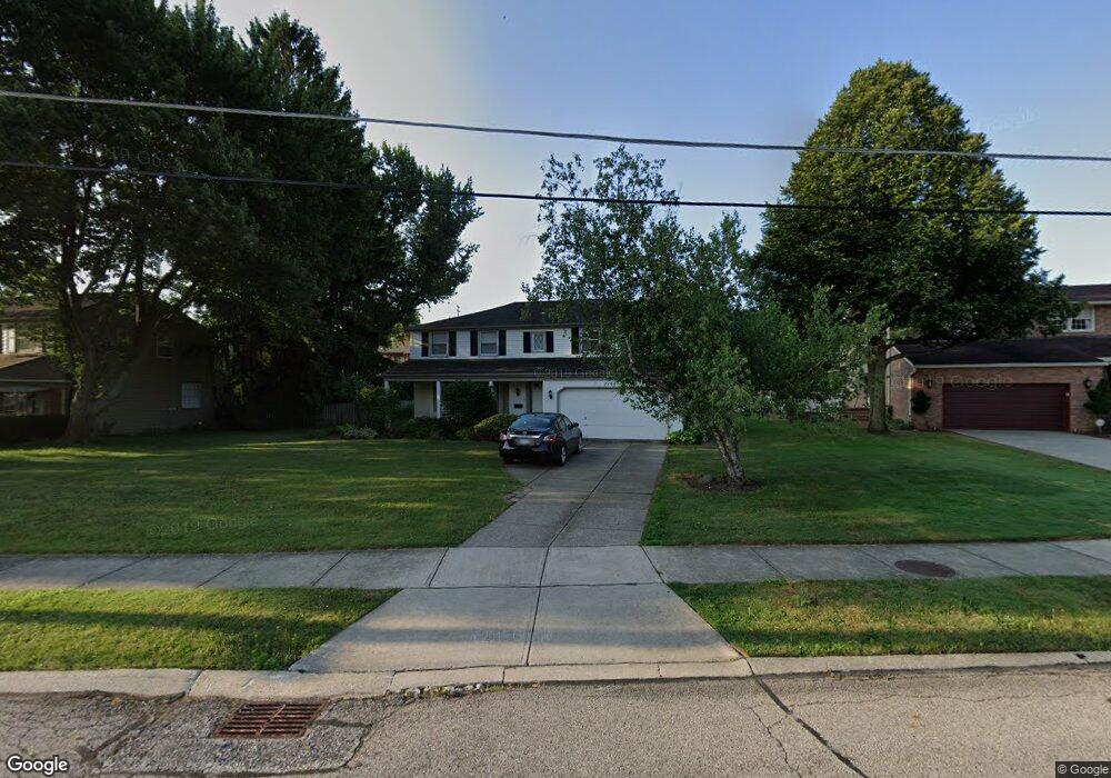
22627 Laramie Dr Rocky River, OH 44116
Estimated Value: $430,408 - $533,000
4
Beds
3
Baths
2,046
Sq Ft
$230/Sq Ft
Est. Value
About This Home
This home is located at 22627 Laramie Dr, Rocky River, OH 44116 and is currently estimated at $470,602, approximately $230 per square foot. 22627 Laramie Dr is a home located in Cuyahoga County with nearby schools including Goldwood Primary Elementary School, Kensington Intermediate Elementary School, and Rocky River Middle School.
Ownership History
Date
Name
Owned For
Owner Type
Purchase Details
Closed on
Feb 29, 2016
Sold by
Dawe Family Limited Partnership
Bought by
Rokakis Alex and Rokakis Raffaela
Current Estimated Value
Home Financials for this Owner
Home Financials are based on the most recent Mortgage that was taken out on this home.
Original Mortgage
$150,000
Outstanding Balance
$119,352
Interest Rate
3.81%
Mortgage Type
New Conventional
Estimated Equity
$351,250
Purchase Details
Closed on
Nov 27, 2009
Sold by
Dawe Mary Jane
Bought by
Dawe Family Limited Partnership
Home Financials for this Owner
Home Financials are based on the most recent Mortgage that was taken out on this home.
Original Mortgage
$100,000
Interest Rate
4.84%
Mortgage Type
Purchase Money Mortgage
Purchase Details
Closed on
Dec 31, 1975
Sold by
Dawe Edward L and Mary Jane
Bought by
Dawe Mary J
Purchase Details
Closed on
Jan 1, 1975
Bought by
Dawe Edward L and Mary Jane
Create a Home Valuation Report for This Property
The Home Valuation Report is an in-depth analysis detailing your home's value as well as a comparison with similar homes in the area
Home Values in the Area
Average Home Value in this Area
Purchase History
| Date | Buyer | Sale Price | Title Company |
|---|---|---|---|
| Rokakis Alex | $200,000 | Insight Title | |
| Dawe Family Limited Partnership | -- | Attorney | |
| Dawe Mary J | -- | -- | |
| Dawe Edward L | -- | -- |
Source: Public Records
Mortgage History
| Date | Status | Borrower | Loan Amount |
|---|---|---|---|
| Open | Rokakis Alex | $150,000 | |
| Previous Owner | Dawe Family Limited Partnership | $100,000 |
Source: Public Records
Tax History Compared to Growth
Tax History
| Year | Tax Paid | Tax Assessment Tax Assessment Total Assessment is a certain percentage of the fair market value that is determined by local assessors to be the total taxable value of land and additions on the property. | Land | Improvement |
|---|---|---|---|---|
| 2024 | $7,179 | $127,120 | $23,800 | $103,320 |
| 2023 | $6,948 | $102,060 | $23,660 | $78,400 |
| 2022 | $6,901 | $102,060 | $23,660 | $78,400 |
| 2021 | $6,336 | $102,060 | $23,660 | $78,400 |
| 2020 | $6,360 | $89,530 | $20,760 | $68,780 |
| 2019 | $6,252 | $255,800 | $59,300 | $196,500 |
| 2018 | $5,815 | $89,530 | $20,760 | $68,780 |
| 2017 | $5,529 | $72,110 | $18,240 | $53,870 |
| 2016 | $5,393 | $72,110 | $18,240 | $53,870 |
| 2015 | $5,394 | $72,110 | $18,240 | $53,870 |
| 2014 | $5,486 | $70,000 | $17,710 | $52,290 |
Source: Public Records
Map
Nearby Homes
- 2743 W Asplin Dr
- 21 Bristol Ln
- 22259 River Walk Rd
- 9 River Side Dr
- 22555 Center Ridge Rd Unit 403
- 26 Grandview Dr
- 30 Grandview Dr
- 22701 Center Ridge Rd Unit 207
- 2659 W Asplin Dr
- 1 Aberdeen Ct
- 24 Somerset Dr
- 22091 River Oaks Dr Unit C2
- 2694 Goldwood Dr
- 2168 Vuila Ct
- 3385 Palmer Dr
- 2169 Vuila Ct
- 2160 Vuila Ct
- 2187 Vuila Way
- 2161 Vuila Ct
- 3520 Archwood Dr
- 22595 Laramie Dr
- 22655 Laramie Dr
- 22534 Center Ridge Rd Unit C
- 22532 Center Ridge Rd
- 22532 Center Ridge Rd Unit J
- 22543 Laramie Dr
- 22524 Center Ridge Rd Unit D
- 22522 Center Ridge Rd
- 22530 Center Ridge Rd
- 22526 Center Ridge Rd
- 22528 Center Ridge Rd
- 22528 Center Ridge Rd Unit B
- 22530 Center Ridge Rd Unit A
- 22522 Center Ridge Rd Unit E
- 22677 Laramie Dr
- 2820 W Asplin Dr
- 22487 Laramie Dr
- 22698 Laramie Dr
- 22596 Laramie Dr
- 22510 Center Ridge Rd Unit A