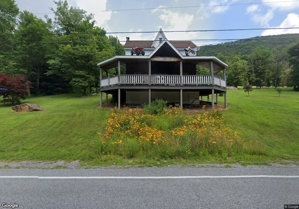
2263 Upper Rd Shamokin, PA 17872
Estimated Value: $117,000 - $322,000
Studio
--
Bath
--
Sq Ft
227,819
Sq Ft Lot
About This Home
This home is located at 2263 Upper Rd, Shamokin, PA 17872 and is currently estimated at $218,579. 2263 Upper Rd is a home located in Northumberland County with nearby schools including Line Mountain Elementary School, Line Mountain Middle School, and Line Mountain Junior/Senior High School.
Ownership History
Date
Name
Owned For
Owner Type
Purchase Details
Closed on
Jun 5, 2012
Sold by
Britton Walter J and Britton Michelle
Bought by
Bressi Joseph A and Bressi Maria C
Current Estimated Value
Purchase Details
Closed on
Oct 27, 2005
Sold by
Willier Bruce H and Willier Arfie M
Bought by
Britton Walter J and Britton Michelle
Home Financials for this Owner
Home Financials are based on the most recent Mortgage that was taken out on this home.
Original Mortgage
$75,000
Interest Rate
6.07%
Mortgage Type
New Conventional
Create a Home Valuation Report for This Property
The Home Valuation Report is an in-depth analysis detailing your home's value as well as a comparison with similar homes in the area
Purchase History
| Date | Buyer | Sale Price | Title Company |
|---|---|---|---|
| Bressi Joseph A | $35,000 | None Available | |
| Britton Walter J | $85,000 | None Available |
Source: Public Records
Mortgage History
| Date | Status | Borrower | Loan Amount |
|---|---|---|---|
| Previous Owner | Britton Walter J | $75,000 |
Source: Public Records
Tax History
| Year | Tax Paid | Tax Assessment Tax Assessment Total Assessment is a certain percentage of the fair market value that is determined by local assessors to be the total taxable value of land and additions on the property. | Land | Improvement |
|---|---|---|---|---|
| 2025 | $1,223 | $10,300 | $1,700 | $8,600 |
| 2024 | $1,171 | $10,300 | $1,700 | $8,600 |
| 2023 | $1,171 | $10,300 | $1,700 | $8,600 |
| 2022 | $1,171 | $10,300 | $1,700 | $8,600 |
| 2021 | $1,171 | $10,300 | $1,700 | $8,600 |
| 2020 | $1,171 | $10,300 | $1,700 | $8,600 |
| 2019 | $1,139 | $10,300 | $1,700 | $8,600 |
| 2018 | $1,114 | $10,300 | $1,700 | $8,600 |
| 2017 | $1,053 | $10,300 | $1,700 | $8,600 |
| 2016 | -- | $10,300 | $1,700 | $8,600 |
| 2015 | -- | $10,300 | $1,700 | $8,600 |
| 2014 | -- | $5,300 | $1,660 | $3,640 |
Source: Public Records
Map
Nearby Homes
- LOT# 3 Blacks Ln
- LOT#2 Blacks Ln
- 576 E Shamokin St
- 783 Trevorton Rd
- 377 Trevorton Rd
- 234 Trevorton Rd
- 0 Hedge Ln
- 100 W Shamokin St
- 223 E Market St
- 120 Dans Way
- 417 W Shamokin St
- 347 W Market St
- 444 W Market St
- 1714 W Pine St
- 1610 W Willow St
- 901 W Coal St
- 231 N 7th St
- 1728 W Walnut St
- 1839 Trevorton Rd
- 225 S 11th St
Your Personal Tour Guide
Ask me questions while you tour the home.