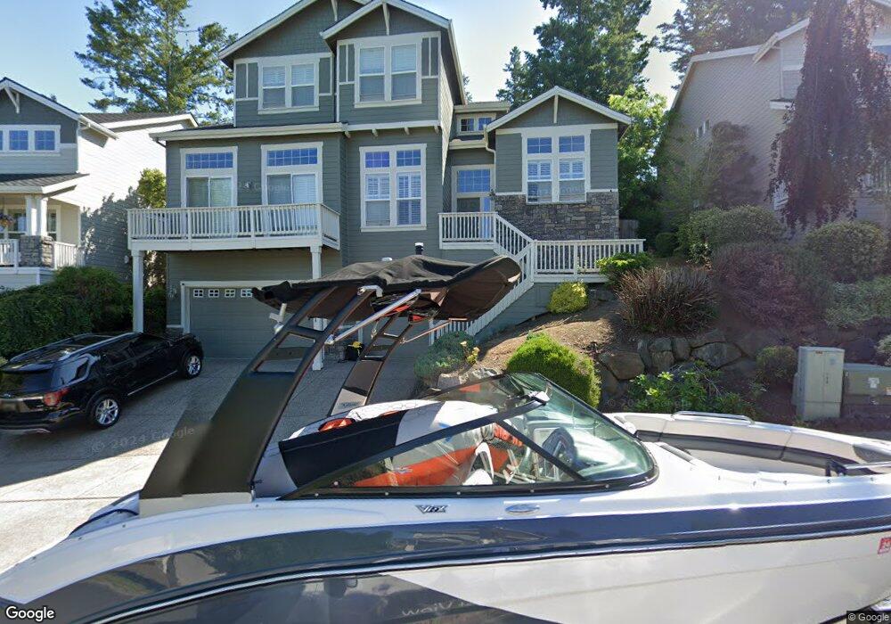
2265 Crestview Dr West Linn, OR 97068
Tanner Basin NeighborhoodEstimated Value: $910,463 - $1,106,000
4
Beds
3
Baths
3,484
Sq Ft
$289/Sq Ft
Est. Value
About This Home
This home is located at 2265 Crestview Dr, West Linn, OR 97068 and is currently estimated at $1,008,116, approximately $289 per square foot. 2265 Crestview Dr is a home located in Clackamas County with nearby schools including Trillium Creek Primary School, Rosemont Ridge Middle School, and West Linn High School.
Ownership History
Date
Name
Owned For
Owner Type
Purchase Details
Closed on
Aug 10, 2005
Sold by
King Michael J and King Susan M
Bought by
Karr Darren and Karr Leslie
Current Estimated Value
Home Financials for this Owner
Home Financials are based on the most recent Mortgage that was taken out on this home.
Original Mortgage
$419,000
Outstanding Balance
$151,396
Interest Rate
1%
Mortgage Type
Fannie Mae Freddie Mac
Estimated Equity
$856,720
Purchase Details
Closed on
Mar 19, 2003
Sold by
Portland D R Horton Inc
Bought by
King Michael J and King Susan M
Home Financials for this Owner
Home Financials are based on the most recent Mortgage that was taken out on this home.
Original Mortgage
$319,400
Interest Rate
5.79%
Mortgage Type
Balloon
Create a Home Valuation Report for This Property
The Home Valuation Report is an in-depth analysis detailing your home's value as well as a comparison with similar homes in the area
Home Values in the Area
Average Home Value in this Area
Purchase History
| Date | Buyer | Sale Price | Title Company |
|---|---|---|---|
| Karr Darren | $523,848 | Fidelity Natl Title Co Of Or | |
| King Michael J | $399,338 | First Amer Title Ins Co Of O |
Source: Public Records
Mortgage History
| Date | Status | Borrower | Loan Amount |
|---|---|---|---|
| Open | Karr Darren | $419,000 | |
| Previous Owner | King Michael J | $319,400 |
Source: Public Records
Tax History Compared to Growth
Tax History
| Year | Tax Paid | Tax Assessment Tax Assessment Total Assessment is a certain percentage of the fair market value that is determined by local assessors to be the total taxable value of land and additions on the property. | Land | Improvement |
|---|---|---|---|---|
| 2025 | $10,493 | $544,462 | -- | -- |
| 2024 | $10,100 | $528,604 | -- | -- |
| 2023 | $10,100 | $513,208 | $0 | $0 |
| 2022 | $9,533 | $498,261 | $0 | $0 |
| 2021 | $8,837 | $483,749 | $0 | $0 |
| 2020 | $8,774 | $469,660 | $0 | $0 |
| 2019 | $8,409 | $455,981 | $0 | $0 |
| 2018 | $8,000 | $442,700 | $0 | $0 |
| 2017 | $7,688 | $429,806 | $0 | $0 |
| 2016 | $7,358 | $417,287 | $0 | $0 |
| 2015 | $7,030 | $405,133 | $0 | $0 |
| 2014 | $6,650 | $393,333 | $0 | $0 |
Source: Public Records
Map
Nearby Homes
- 2201 Satter St
- 2285 Satter St
- 2258 Satter St
- 22872 Weatherhill Rd
- 23073 Bland Cir
- Allstone Plan at Savannah Summit
- Milton Plan at Savannah Summit
- 2155 Alpine Dr
- 2025 De Vries Way
- 2037 De Vries Way
- 23019 Bland Cir
- 23000 Bland Cir
- 2134 Eleanor Rd
- 22998 Bland Cir
- 22994 Bland Cir
- 22990 Bland Cir
- 2050 Alpine Dr
- 23136 Bland Cir
- 2311 Falcon Dr
- 2762 Dahlia Dr
- 2275 Crestview Dr
- 2255 Crestview Dr
- 2285 Crestview Dr
- 2260 Crestview Dr
- 2295 Crestview Dr
- 2270 Crestview Dr
- 2245 Crestview Dr
- 2160 Fircrest Dr
- 2280 Crestview Dr
- 2442 Crestview Dr Unit Lot 9
- 2442 Crestview Dr
- 2305 Crestview Dr
- 2235 Crestview Dr
- 2290 Crestview Dr
- 2220 Crestview Dr
- 2150 Fircrest Dr
- 23055 Bland Cir
- 2454 Crestview Dr
- 2454 Crestview Dr Unit Lot10
- 22864 Weatherhill Rd