Estimated Value: $294,000 - $403,000
Studio
2
Baths
1,613
Sq Ft
$214/Sq Ft
Est. Value
About This Home
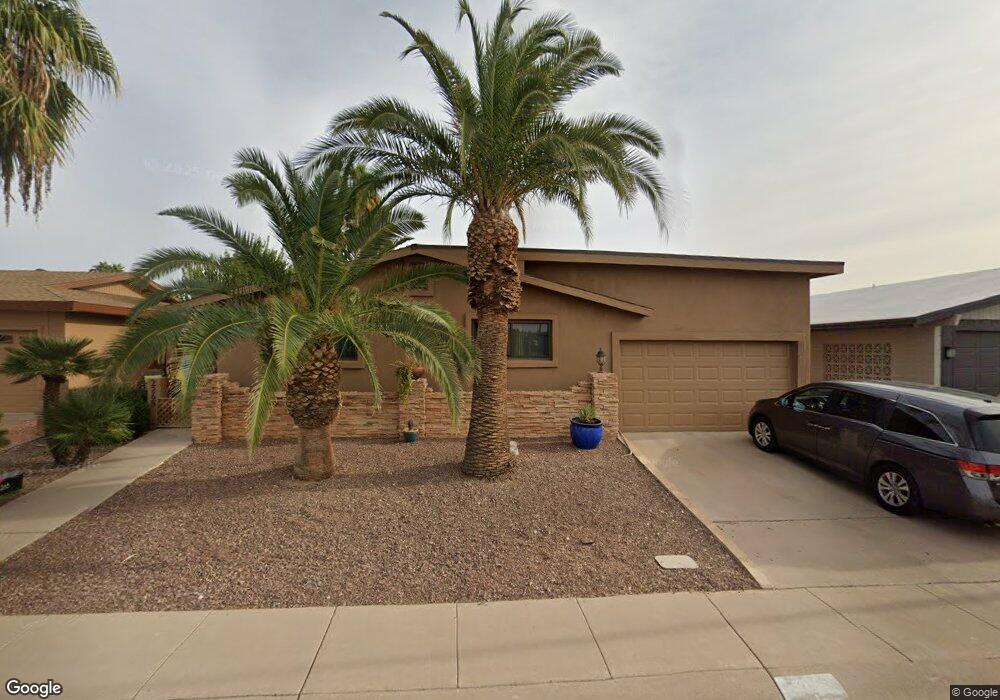
This home is located at 2265 N Middlecoff Dr, Mesa, AZ 85215 and is currently estimated at $345,310, approximately $214 per square foot. 2265 N Middlecoff Dr is a home located in Maricopa County with nearby schools including Bush Elementary School, Franklin at Brimhall Elementary School, and Franklin West Elementary School.
Ownership History
Date
Name
Owned For
Owner Type
Purchase Details
Closed on
Jun 1, 2005
Sold by
Sb Partners Llp
Bought by
Swenson Robert H and Swenson Lucinda F
Current Estimated Value
Purchase Details
Closed on
Jan 14, 1998
Sold by
Swenson Robert H and Swenson Lucinda
Bought by
Sb Partners Llp
Purchase Details
Closed on
Dec 30, 1997
Sold by
Gulson Marie Swenson and Neuman Marie Swenson
Bought by
Swenson Robert H and Swenson Lucinda
Create a Home Valuation Report for This Property
The Home Valuation Report is an in-depth analysis detailing your home's value as well as a comparison with similar homes in the area
Purchase History
| Date | Buyer | Sale Price | Title Company |
|---|---|---|---|
| Swenson Robert H | $142,500 | Grand Canyon Title Agency In | |
| Sb Partners Llp | -- | -- | |
| Swenson Robert H | -- | -- |
Source: Public Records
Tax History
| Year | Tax Paid | Tax Assessment Tax Assessment Total Assessment is a certain percentage of the fair market value that is determined by local assessors to be the total taxable value of land and additions on the property. | Land | Improvement |
|---|---|---|---|---|
| 2025 | $2,073 | $20,601 | -- | -- |
| 2024 | $2,081 | $19,620 | -- | -- |
| 2023 | $2,081 | $27,260 | $5,450 | $21,810 |
| 2022 | $2,035 | $22,300 | $4,460 | $17,840 |
| 2021 | $2,060 | $22,130 | $4,420 | $17,710 |
| 2020 | $2,032 | $20,560 | $4,110 | $16,450 |
| 2019 | $1,904 | $17,480 | $3,490 | $13,990 |
| 2018 | $1,830 | $15,880 | $3,170 | $12,710 |
| 2017 | $1,781 | $15,470 | $3,090 | $12,380 |
| 2016 | $1,744 | $15,210 | $3,040 | $12,170 |
| 2015 | $1,640 | $15,260 | $3,050 | $12,210 |
Source: Public Records
Map
Nearby Homes
- 2260 N Middlecoff Dr
- 2307 N Lema Dr
- 2302 N Lema Dr
- 2152 N Stockton Place
- 2254 N Lema Dr
- 2374 N Nicklaus Dr
- 2161 N Middlecoff Dr
- 2136 N Stockton Place
- 5424 E Hermosa Vista Dr
- 2313 N Floyd Dr
- 5518 E Lindstrom Ln Unit 2016
- 5518 E Lindstrom Ln Unit 3012
- 5518 E Lindstrom Ln Unit 3010
- 5518 E Lindstrom Ln Unit 8
- 5518 E Lindstrom Ln Unit 1009
- 5518 E Lindstrom Ln Unit 2020
- 5518 E Lindstrom Ln Unit 1011
- 5518 E Lindstrom Ln Unit 2024
- 5518 E Lindstrom Ln Unit 2004
- 5518 E Lindstrom Ln Unit 1044
- 2259 N Middlecoff Dr
- 2303 N Middlecoff Dr
- 2238 N Stockton Place
- 2255 N Middlecoff Dr
- 2234 N Stockton Place
- 2252 N 56th St Unit 4B
- 2309 N Middlecoff Dr Unit 4
- 2300 N Middlecoff Dr
- 2304 N Middlecoff Dr
- 2230 N Stockton Place
- 2230 N Stockton Place
- 2249 N Middlecoff Dr Unit 4
- 2256 N Middlecoff Dr
- 2308 N Middlecoff Dr
- 2226 N Stockton Place
- 2250 N Middlecoff Dr
- 2314 N 56th St
- 2245 N Middlecoff Dr
- 2220 N Stockton Place Unit 4B
- 2246 N Middlecoff Dr
Your Personal Tour Guide
Ask me questions while you tour the home.