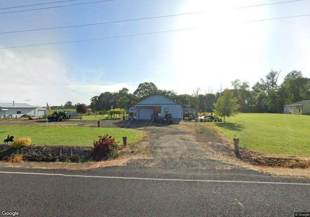
22655 Powerline Rd Harrisburg, OR 97446
Estimated Value: $642,000
3
Beds
2
Baths
1,688
Sq Ft
$380/Sq Ft
Est. Value
About This Home
This home is located at 22655 Powerline Rd, Harrisburg, OR 97446 and is currently estimated at $642,000, approximately $380 per square foot. 22655 Powerline Rd is a home located in Linn County with nearby schools including Harrisburg Elementary School, Harrisburg Middle School, and Harrisburg High School.
Ownership History
Date
Name
Owned For
Owner Type
Purchase Details
Closed on
Sep 14, 2022
Sold by
Cooper Wayne D
Bought by
Cooper Trust
Current Estimated Value
Purchase Details
Closed on
May 28, 2015
Sold by
Martinka Anthony and Martinka Norma H
Bought by
Cooper Wayne D and Cooper Sherilyn
Home Financials for this Owner
Home Financials are based on the most recent Mortgage that was taken out on this home.
Original Mortgage
$218,000
Interest Rate
3.64%
Mortgage Type
New Conventional
Purchase Details
Closed on
Jul 22, 2009
Sold by
Johnson Mary A
Bought by
Martinka Anthony and Martinka Norma H
Create a Home Valuation Report for This Property
The Home Valuation Report is an in-depth analysis detailing your home's value as well as a comparison with similar homes in the area
Home Values in the Area
Average Home Value in this Area
Purchase History
| Date | Buyer | Sale Price | Title Company |
|---|---|---|---|
| Cooper Trust | -- | -- | |
| Cooper Wayne D | $308,000 | Cascade Title Co | |
| Martinka Anthony | $175,000 | First American Title |
Source: Public Records
Mortgage History
| Date | Status | Borrower | Loan Amount |
|---|---|---|---|
| Previous Owner | Cooper Wayne D | $218,000 |
Source: Public Records
Tax History Compared to Growth
Tax History
| Year | Tax Paid | Tax Assessment Tax Assessment Total Assessment is a certain percentage of the fair market value that is determined by local assessors to be the total taxable value of land and additions on the property. | Land | Improvement |
|---|---|---|---|---|
| 2025 | $3,809 | $282,460 | -- | -- |
| 2024 | $3,702 | $274,240 | -- | -- |
| 2023 | $3,593 | $266,260 | $0 | $0 |
| 2022 | $3,502 | $258,510 | $0 | $0 |
| 2021 | $3,383 | $250,990 | $0 | $0 |
| 2020 | $3,333 | $243,680 | $0 | $0 |
| 2019 | $3,266 | $236,590 | $0 | $0 |
| 2018 | $3,083 | $229,700 | $0 | $0 |
| 2017 | $2,948 | $223,010 | $0 | $0 |
| 2016 | $2,547 | $204,820 | $0 | $0 |
| 2015 | $2,477 | $198,860 | $0 | $0 |
| 2014 | $2,427 | $193,070 | $0 | $0 |
Source: Public Records
Map
Nearby Homes
- 30540 Priceboro Dr
- 1001 Sommerville Loop
- 961 S 9th St
- 970 Lasalle St
- 950 Lasalle St
- 1025 S 6th St
- 1025 S 6th St Unit 83
- 1025 S 6th St Unit 78
- 888 S 9th St
- 955 Territorial St
- Lot 9th St
- 525 S 6th St Unit 4
- Lot 7 Territorial St
- 370 S 6th St
- 735 N Periander
- 741 N Periander
- 729 N Periander
- 375 N 6th St
- 645 Riley Way
- 881 Arrow Leaf Place
- 22631 Powerline Rd
- 22436 Powerline Rd
- 31717 Priceboro Dr
- 22411 Powerline Rd
- 31276 Priceboro Dr
- 31276 Powerline Rd
- 23015 Powerline Rd
- 31161 Priceboro Dr
- 31970 Priceboro Dr
- 22274 Powerline Rd
- 31696 Priceboro Dr
- 23115 Powerline Rd
- 23095 Powerline Rd
- 32022 Priceboro Dr
- 246 School St
- 0 Peoria (Ta #340980) Rd Unit 788275