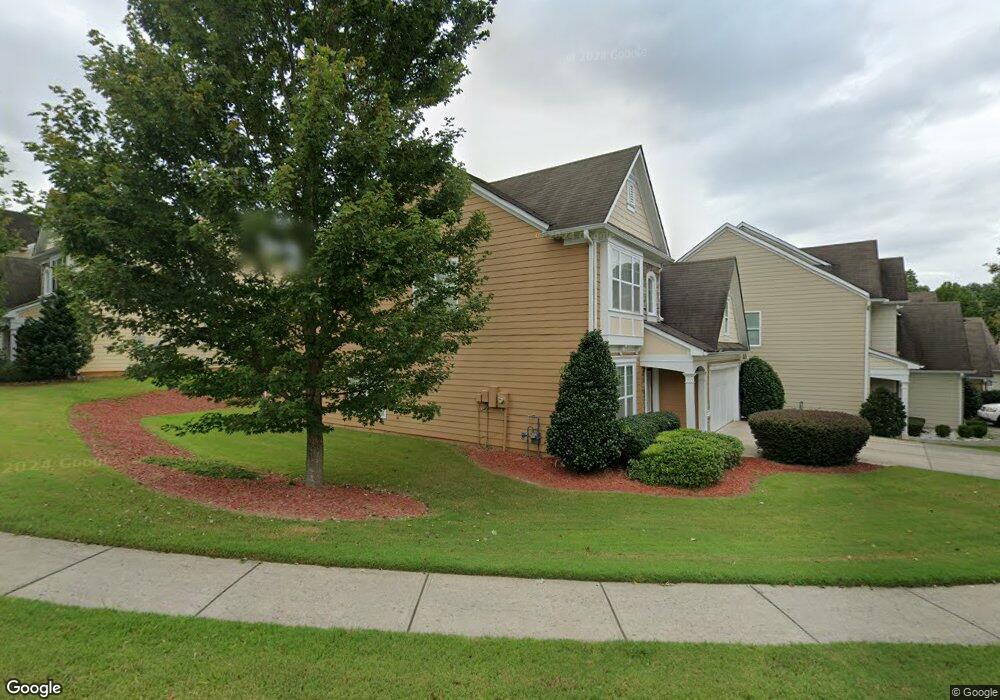
2266 Worrall Hill Dr Duluth, GA 30096
Estimated Value: $480,000 - $507,000
4
Beds
3
Baths
2,239
Sq Ft
$219/Sq Ft
Est. Value
About This Home
This home is located at 2266 Worrall Hill Dr, Duluth, GA 30096 and is currently estimated at $489,820, approximately $218 per square foot. 2266 Worrall Hill Dr is a home located in Gwinnett County with nearby schools including M. H. Mason Elementary School, Hull Middle School, and Peachtree Ridge High School.
Ownership History
Date
Name
Owned For
Owner Type
Purchase Details
Closed on
Aug 7, 2019
Sold by
Hanberry Katherine
Bought by
Cummings Robert and Robert Cumming Liv Tr
Current Estimated Value
Purchase Details
Closed on
May 9, 2014
Sold by
Cummings Catherine G
Bought by
Hanberry Katherine and Cummings Family Trust
Purchase Details
Closed on
Apr 8, 2005
Sold by
Bowen Family Homes Inc
Bought by
Cummings Catherine G
Create a Home Valuation Report for This Property
The Home Valuation Report is an in-depth analysis detailing your home's value as well as a comparison with similar homes in the area
Home Values in the Area
Average Home Value in this Area
Purchase History
| Date | Buyer | Sale Price | Title Company |
|---|---|---|---|
| Cummings Robert | -- | -- | |
| Hanberry Katherine | -- | -- | |
| Cummings Catherine G | $230,400 | -- |
Source: Public Records
Tax History
| Year | Tax Paid | Tax Assessment Tax Assessment Total Assessment is a certain percentage of the fair market value that is determined by local assessors to be the total taxable value of land and additions on the property. | Land | Improvement |
|---|---|---|---|---|
| 2025 | -- | $197,880 | $30,240 | $167,640 |
| 2024 | -- | $181,360 | $37,200 | $144,160 |
| 2023 | $1,790 | $181,360 | $37,200 | $144,160 |
| 2022 | $0 | $141,920 | $28,000 | $113,920 |
| 2021 | $1,437 | $115,320 | $20,000 | $95,320 |
| 2020 | $1,437 | $115,320 | $20,000 | $95,320 |
| 2019 | $1,437 | $115,320 | $20,000 | $95,320 |
| 2018 | $1,419 | $109,200 | $20,000 | $89,200 |
| 2016 | $1,379 | $88,040 | $18,400 | $69,640 |
| 2015 | $1,328 | $82,440 | $18,400 | $64,040 |
| 2014 | -- | $69,680 | $16,000 | $53,680 |
Source: Public Records
Map
Nearby Homes
- 2208 Staunton Dr
- 3003 Brookhavenrun Cir
- 2816 Staunton Dr
- 2491 Cannon Farm Ln
- 2470 Gramercy Park Cir
- 2198 Alnwick Dr
- 2934 Seagull Dr
- 2775 Whippoorwill Cir
- 2620 Ridge Run Trail
- 2893 Thurleston Ln
- 2820 Bluebird Cir NW
- 2820 Bluebird Cir
- 2394 Stout Trail
- 2391 Stout Trail
- 2061 Meadow Peak Rd
- 2741 Willowstone Dr
- 2010 Meadow Peak Rd
- 2098 Meadow Peak Rd
- 2201 Landing Walk Dr
- 2120 Meadow Peak Rd
- 2316 Worrall Hill Dr
- 2236 Worrall Hill Dr
- 2326 Worrall Hill Dr
- 2226 Worrall Hill Dr
- 2253 Worrall Hill Dr
- 2243 Worrall Hill Dr
- 2216 Worrall Hill Dr
- 2303 Worrall Hill Dr
- 2293 Worrall Hill Dr
- 2177 Staunton Dr
- 2263 Worrall Hill Dr
- 2187 Staunton Dr
- 2233 Worrall Hill Dr
- 2197 Staunton Dr
- 2313 Worrall Hill Dr
- 2346 Worrall Hill Dr
- 2283 Worrall Hill Dr
- 2167 Staunton Dr
- 2223 Worrall Hill Dr
- 2323 Worrall Hill Dr
Your Personal Tour Guide
Ask me questions while you tour the home.