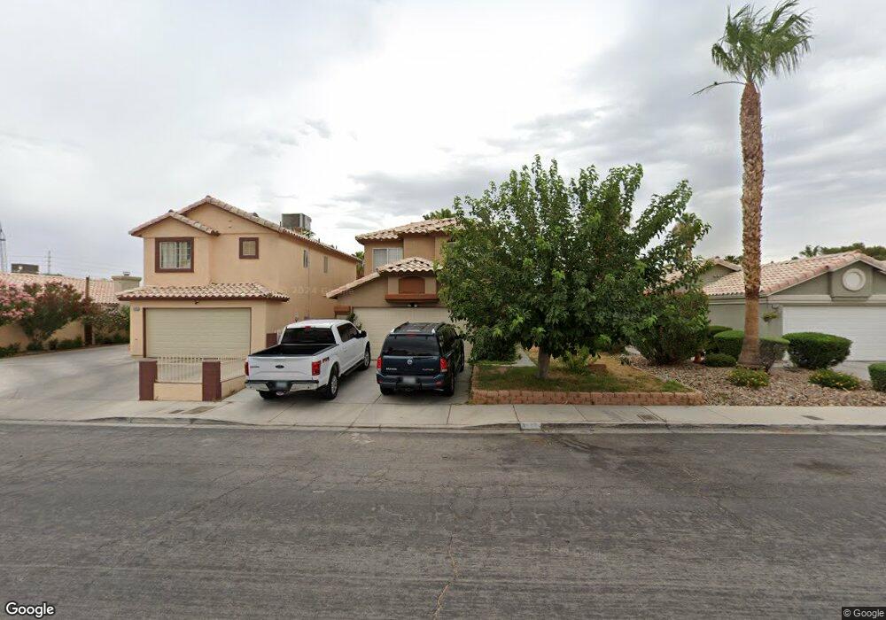
2267 Bowstring Dr Las Vegas, NV 89142
Estimated Value: $381,558 - $417,000
4
Beds
3
Baths
1,636
Sq Ft
$244/Sq Ft
Est. Value
About This Home
This home is located at 2267 Bowstring Dr, Las Vegas, NV 89142 and is currently estimated at $399,140, approximately $243 per square foot. 2267 Bowstring Dr is a home located in Clark County with nearby schools including John F. Mendoza Elementary School, Duane D. Keller Middle School, and Las Vegas High School.
Ownership History
Date
Name
Owned For
Owner Type
Purchase Details
Closed on
Jan 24, 2025
Sold by
Arroyo Elizabeth
Bought by
Elizabeth Arroyo Revocable Living Trust and Arroyo
Current Estimated Value
Purchase Details
Closed on
Oct 21, 2006
Sold by
Arroyo Sanchez Armando and Arroyo Armando
Bought by
Arroyo Elizabeth
Purchase Details
Closed on
Mar 3, 1994
Sold by
Pacific Homes
Bought by
Arroyo Armando and Arroyo Elizabeth
Home Financials for this Owner
Home Financials are based on the most recent Mortgage that was taken out on this home.
Original Mortgage
$110,848
Interest Rate
7%
Mortgage Type
FHA
Create a Home Valuation Report for This Property
The Home Valuation Report is an in-depth analysis detailing your home's value as well as a comparison with similar homes in the area
Home Values in the Area
Average Home Value in this Area
Purchase History
| Date | Buyer | Sale Price | Title Company |
|---|---|---|---|
| Elizabeth Arroyo Revocable Living Trust | -- | None Listed On Document | |
| Arroyo Elizabeth | -- | None Available | |
| Arroyo Armando | $111,500 | Nevada Title Company |
Source: Public Records
Mortgage History
| Date | Status | Borrower | Loan Amount |
|---|---|---|---|
| Previous Owner | Arroyo Armando | $110,848 |
Source: Public Records
Tax History
| Year | Tax Paid | Tax Assessment Tax Assessment Total Assessment is a certain percentage of the fair market value that is determined by local assessors to be the total taxable value of land and additions on the property. | Land | Improvement |
|---|---|---|---|---|
| 2026 | $1,213 | $72,855 | $23,450 | $49,405 |
| 2025 | $1,177 | $73,263 | $22,750 | $50,513 |
| 2024 | $1,143 | $73,263 | $22,750 | $50,513 |
| 2023 | $1,143 | $74,610 | $26,250 | $48,360 |
| 2022 | $1,164 | $66,067 | $21,700 | $44,367 |
| 2021 | $1,078 | $62,414 | $19,950 | $42,464 |
| 2020 | $998 | $61,108 | $18,900 | $42,208 |
| 2019 | $935 | $57,831 | $16,100 | $41,731 |
| 2018 | $893 | $53,443 | $13,300 | $40,143 |
| 2017 | $1,485 | $50,617 | $9,800 | $40,817 |
| 2016 | $837 | $45,362 | $8,400 | $36,962 |
| 2015 | $834 | $33,237 | $5,600 | $27,637 |
| 2014 | $808 | $26,984 | $5,250 | $21,734 |
Source: Public Records
Map
Nearby Homes
- 5650 E Sahara Ave Unit 2026
- 5650 E Sahara Ave Unit 1057
- 5650 E Sahara Ave Unit 2010
- 5655 E Sahara Ave Unit 1023
- 1841 Skywood Way
- 5832 Ballinger Dr
- 5686 Roundrock Dr
- 5679 Roundrock Dr
- 5915 Woodfield Dr
- 5747 Coleridge Way
- 5634 Alcott Ave
- 5391 Aston Ave
- 5816 Glory Canyon Way
- 1919 Niblick Cir
- 1689 Foxglove Dr
- 1718 S Christy Ln
- 2184 Raspberry Hill Rd
- 6045 Peach Orchard Rd
- 5984 Emerald Canyon Dr
- 2711 Morning Break Ct
- 2259 Bowstring Dr
- 2275 Bowstring Dr
- 2251 Bowstring Dr
- 2285 Bowstring Dr
- 2256 Seahurst Dr
- 2264 Seahurst Dr
- 2241 Bowstring Dr
- 2246 Seahurst Dr
- 2274 Seahurst Dr
- 2291 Bowstring Dr
- 2240 Seahurst Dr
- 2272 Bowstring Dr
- 2266 Bowstring Dr
- 2235 Bowstring Dr
- 2280 Bowstring Dr
- 2284 Seahurst Dr
- 2258 Bowstring Dr
- 2288 Bowstring Dr
- 2234 Seahurst Dr
- 2250 Bowstring Dr
Your Personal Tour Guide
Ask me questions while you tour the home.