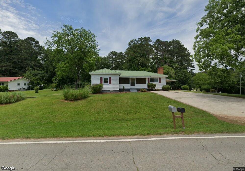
2267 Lovvorn Rd Carrollton, GA 30117
Estimated Value: $207,212 - $242,000
3
Beds
2
Baths
1,620
Sq Ft
$138/Sq Ft
Est. Value
About This Home
This home is located at 2267 Lovvorn Rd, Carrollton, GA 30117 and is currently estimated at $223,303, approximately $137 per square foot. 2267 Lovvorn Rd is a home located in Carroll County with nearby schools including Mt. Zion Elementary School, Mt. Zion Middle School, and Mt. Zion High School.
Ownership History
Date
Name
Owned For
Owner Type
Purchase Details
Closed on
May 23, 2013
Sold by
Burdette Jean T
Bought by
Cole Day Properties
Current Estimated Value
Purchase Details
Closed on
Mar 25, 2005
Sold by
Turner Julia
Bought by
Burdette Jean T and Burdette Martha T
Create a Home Valuation Report for This Property
The Home Valuation Report is an in-depth analysis detailing your home's value as well as a comparison with similar homes in the area
Home Values in the Area
Average Home Value in this Area
Purchase History
| Date | Buyer | Sale Price | Title Company |
|---|---|---|---|
| Cole Day Properties | $95,000 | -- | |
| Burdette Jean T | -- | -- |
Source: Public Records
Tax History Compared to Growth
Tax History
| Year | Tax Paid | Tax Assessment Tax Assessment Total Assessment is a certain percentage of the fair market value that is determined by local assessors to be the total taxable value of land and additions on the property. | Land | Improvement |
|---|---|---|---|---|
| 2024 | $1,384 | $61,199 | $9,622 | $51,577 |
| 2023 | $1,384 | $54,849 | $7,698 | $47,151 |
| 2022 | $1,077 | $42,938 | $5,132 | $37,806 |
| 2021 | $943 | $36,791 | $4,106 | $32,685 |
| 2020 | $848 | $33,052 | $3,732 | $29,320 |
| 2019 | $802 | $30,993 | $3,732 | $27,261 |
| 2018 | $738 | $28,096 | $3,488 | $24,608 |
| 2017 | $740 | $28,096 | $3,488 | $24,608 |
| 2016 | $736 | $32,840 | $1,278 | $31,562 |
| 2015 | $625 | $22,337 | $3,984 | $18,353 |
| 2014 | $627 | $22,338 | $3,984 | $18,353 |
Source: Public Records
Map
Nearby Homes
- 2070 Lovvorn Rd
- 101 Bonnie Lynn Ln
- 190 Marvin Gray Rd
- 142 Riversong Rd Unit 56
- 181 Riversong Rd Unit 55
- 181 Riversong Rd
- 142 Riversong Rd
- 1423 Beulah Church Rd
- 33 & 67 Lambert Ln
- 0 Wynn Rd
- 85 Eureka Church Rd Unit 152
- 304 Kodiak Rd
- 1202 Mount Zion Rd
- 295 Timber Ridge Trail
- 40 Red Holly Gap
- 132 Pinnacle Way
- 113 Natures Pointe Trail
- 107 Hickory Chase Unit 102
- 107 Hickory Chase
- 2285 Lovvorn Rd
- 2239 Lovvorn Rd
- 2245 Lovvorn Rd
- 2305 Lovvorn Rd
- 2300 Lovvorn Rd
- 2317 Lovvorn Rd
- 2221 Lovvorn Rd
- 2329 Lovvorn Rd
- 2351 Lovvorn Rd
- 2185 Lovvorn Rd
- 2253 Lovvorn Rd
- 2361 Lovvorn Rd
- 2167 Lovvorn Rd
- 2377 Lovvorn Rd
- 2376 Lovvorn Rd
- 2144 Lovvorn Rd
- 81 Ingram Rd
- 138 Ingram Rd
- 2398 Lovvorn Rd
- 2405 Lovvorn Rd