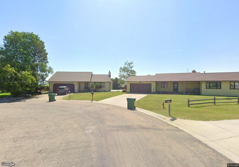
2267 Papago Ct Sheridan, WY 82801
Estimated Value: $426,000 - $474,000
4
Beds
2
Baths
1,184
Sq Ft
$383/Sq Ft
Est. Value
About This Home
This home is located at 2267 Papago Ct, Sheridan, WY 82801 and is currently estimated at $453,949, approximately $383 per square foot. 2267 Papago Ct is a home with nearby schools including Sheridan High School, Holy Name Catholic School, and Reaching Higher.
Ownership History
Date
Name
Owned For
Owner Type
Purchase Details
Closed on
Dec 15, 2005
Sold by
Cooper Larry D and Cooper Sandra L
Bought by
Zhang Difan and Sui Lisa
Current Estimated Value
Home Financials for this Owner
Home Financials are based on the most recent Mortgage that was taken out on this home.
Original Mortgage
$213,000
Outstanding Balance
$119,246
Interest Rate
6.3%
Mortgage Type
New Conventional
Estimated Equity
$334,703
Create a Home Valuation Report for This Property
The Home Valuation Report is an in-depth analysis detailing your home's value as well as a comparison with similar homes in the area
Home Values in the Area
Average Home Value in this Area
Purchase History
| Date | Buyer | Sale Price | Title Company |
|---|---|---|---|
| Zhang Difan | -- | None Available |
Source: Public Records
Mortgage History
| Date | Status | Borrower | Loan Amount |
|---|---|---|---|
| Open | Zhang Difan | $213,000 |
Source: Public Records
Tax History Compared to Growth
Tax History
| Year | Tax Paid | Tax Assessment Tax Assessment Total Assessment is a certain percentage of the fair market value that is determined by local assessors to be the total taxable value of land and additions on the property. | Land | Improvement |
|---|---|---|---|---|
| 2025 | $2,883 | $30,733 | $7,309 | $23,424 |
| 2024 | $2,883 | $40,321 | $9,371 | $30,950 |
| 2023 | $2,802 | $39,187 | $8,761 | $30,426 |
| 2022 | $2,599 | $36,352 | $8,286 | $28,066 |
| 2021 | $2,065 | $28,876 | $6,606 | $22,270 |
| 2020 | $1,957 | $27,366 | $5,458 | $21,908 |
| 2019 | $1,914 | $26,772 | $5,458 | $21,314 |
| 2018 | $1,832 | $25,620 | $5,298 | $20,322 |
| 2017 | $1,812 | $25,342 | $5,298 | $20,044 |
| 2015 | $1,683 | $23,532 | $4,182 | $19,350 |
| 2014 | $1,655 | $23,145 | $4,182 | $18,963 |
| 2013 | -- | $22,795 | $4,182 | $18,613 |
Source: Public Records
Map
Nearby Homes
- 2164 Pima Dr
- 235 Weeping Birch Ct
- 400 Legacy Rd
- 420 Airport Rd Unit 56E
- 2413 Juniper Ln
- 2645 Morrison Ranch Rd
- 386 Legacy Rd Unit Lot 24
- 2647 Morrison Ranch Rd Unit Lot 12
- 2408 Weeping Willow Ct
- 2649 Morrison Ranch Rd Unit Lot 11
- 2086 Big Horn Ave
- 520 Airport Rd
- 0 Morrison Ranch Rd
- 1805 Zuni Dr
- TBD Big Horn Ave
- 1705 Martin Ave
- 1963 Colonial Dr
- 2899 Big Horn Ave
- 1500 de Smet Ave Unit 3-B
- 1491 Thomas Dr
- 2269 Papago Ct
- 2266 Papago Ct
- 2271 Papago Ct
- 2286 Papago Dr
- 2258 Papago Dr
- 2260 Papago Ct
- 527 Falcon Ridge Ct
- 2306 Papago Dr
- 472 Falcon Ridge Dr
- 2263 Papago Ct
- 2256 Papago Ct
- 523 Falcon Ridge Ct
- 466 Falcon Ridge Dr
- 2273 Papago Dr
- 507 Falcon Ridge Ct
- 2283 Papago Dr
- 550 Falcon Ridge Ct
- 2243 Papago Dr
- 449 Falcon Ridge Dr
- 454 Falcon Ridge Dr