Estimated Value: $589,000 - $720,000
3
Beds
3
Baths
2,210
Sq Ft
$293/Sq Ft
Est. Value
About This Home
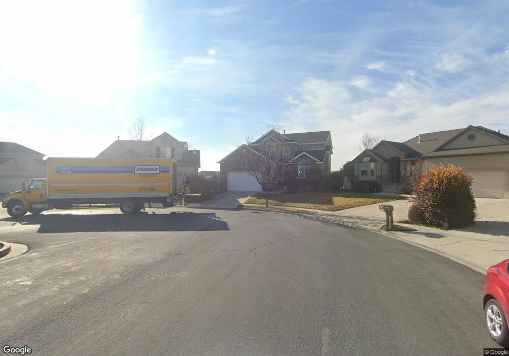
This home is located at 2267 W Pointe Meadow Dr, Lehi, UT 84043 and is currently estimated at $647,596, approximately $293 per square foot. 2267 W Pointe Meadow Dr is a home located in Utah County with nearby schools including Liberty Hills Elementary School, Skyridge High School, and Ascent Academies of Utah - Lehi Campus.
Ownership History
Date
Name
Owned For
Owner Type
Purchase Details
Closed on
Oct 11, 2024
Sold by
Alvarado Jose A and Alvarado Deborah
Bought by
Alvarado Family Trust and Alvarado
Current Estimated Value
Purchase Details
Closed on
Oct 7, 2009
Sold by
Alvarado Jose A
Bought by
Alvarado Jose A and Alvarado Deborah
Home Financials for this Owner
Home Financials are based on the most recent Mortgage that was taken out on this home.
Original Mortgage
$217,000
Interest Rate
5.02%
Mortgage Type
New Conventional
Purchase Details
Closed on
Jan 23, 2004
Sold by
Ivory Homes Ltd
Bought by
Alvarado Jose A
Home Financials for this Owner
Home Financials are based on the most recent Mortgage that was taken out on this home.
Original Mortgage
$190,300
Interest Rate
5.86%
Mortgage Type
Purchase Money Mortgage
Create a Home Valuation Report for This Property
The Home Valuation Report is an in-depth analysis detailing your home's value as well as a comparison with similar homes in the area
Home Values in the Area
Average Home Value in this Area
Purchase History
| Date | Buyer | Sale Price | Title Company |
|---|---|---|---|
| Alvarado Family Trust | -- | None Listed On Document | |
| Alvarado Jose A | -- | Nations Title Agency Inc | |
| Alvarado Jose A | -- | Cottonwood Title |
Source: Public Records
Mortgage History
| Date | Status | Borrower | Loan Amount |
|---|---|---|---|
| Previous Owner | Alvarado Jose A | $217,000 | |
| Previous Owner | Alvarado Jose A | $190,300 | |
| Closed | Alvarado Jose A | $35,650 |
Source: Public Records
Tax History Compared to Growth
Tax History
| Year | Tax Paid | Tax Assessment Tax Assessment Total Assessment is a certain percentage of the fair market value that is determined by local assessors to be the total taxable value of land and additions on the property. | Land | Improvement |
|---|---|---|---|---|
| 2025 | $2,584 | $322,520 | $243,600 | $342,800 |
| 2024 | $2,584 | $302,445 | $0 | $0 |
| 2023 | $2,417 | $307,175 | $0 | $0 |
| 2022 | $2,730 | $336,325 | $0 | $0 |
| 2021 | $2,446 | $455,500 | $141,000 | $314,500 |
| 2020 | $2,306 | $424,500 | $130,600 | $293,900 |
| 2019 | $2,083 | $398,600 | $130,600 | $268,000 |
| 2018 | $1,968 | $356,100 | $123,100 | $233,000 |
| 2017 | $1,929 | $185,570 | $0 | $0 |
| 2016 | $1,965 | $175,340 | $0 | $0 |
| 2015 | $2,021 | $171,215 | $0 | $0 |
| 2014 | $1,871 | $157,575 | $0 | $0 |
Source: Public Records
Map
Nearby Homes
- 1968 N 2040 W Unit 40
- 1969 N 2040 St W
- 2013 N 2040 W
- 1990 N 2040 W
- 1990 N 2040 W Unit 41
- 2196 N 2350 W
- 1912 W 2250 N
- 1898 W Pointe Meadow Loop
- 2464 W 2250 N
- 1970 N 2090 St W
- Huntington Plan at Pioneer Meadows
- Silver Lake Plan at Pioneer Meadows
- Summit Plan at Pioneer Meadows
- Palisade Plan at Pioneer Meadows
- 1882 N 2230 St W Unit 24
- 2191 W Swift Fox Dr Unit 274
- 999 Empire St
- 2184 W Cape Fox Way N Unit 220
- 1920 N 2230 St W Unit 27
- 1060 N Canvasback Dr Unit 405
- 2271 W Pointe Meadow Dr
- 2285 W Pointe Meadow Dr
- 2285 W Pointe Meadow Dr
- 2164 W 2180 N
- 2285 W Pointe Meadow Dr
- 2158 W 2180 N
- 2291 W Pointe Meadow Dr
- 2152 W 2180 N
- 2152 W 2180 N Unit 17C
- 2344 Pointe Meadow Dr
- 2148 W 2180 N
- 2309 W Pointe Meadow Dr
- 2295 Pointe Meadow Dr
- 2275 N 2150 W
- 2327 W Pointe Meadow Dr
- 2327 Pointe Meadow Dr
- 2318 W Pointe Meadow Dr
- 2344 N Pointe Meadow Dr
- 2281 N 2150 W
- 2284 N 2150 W