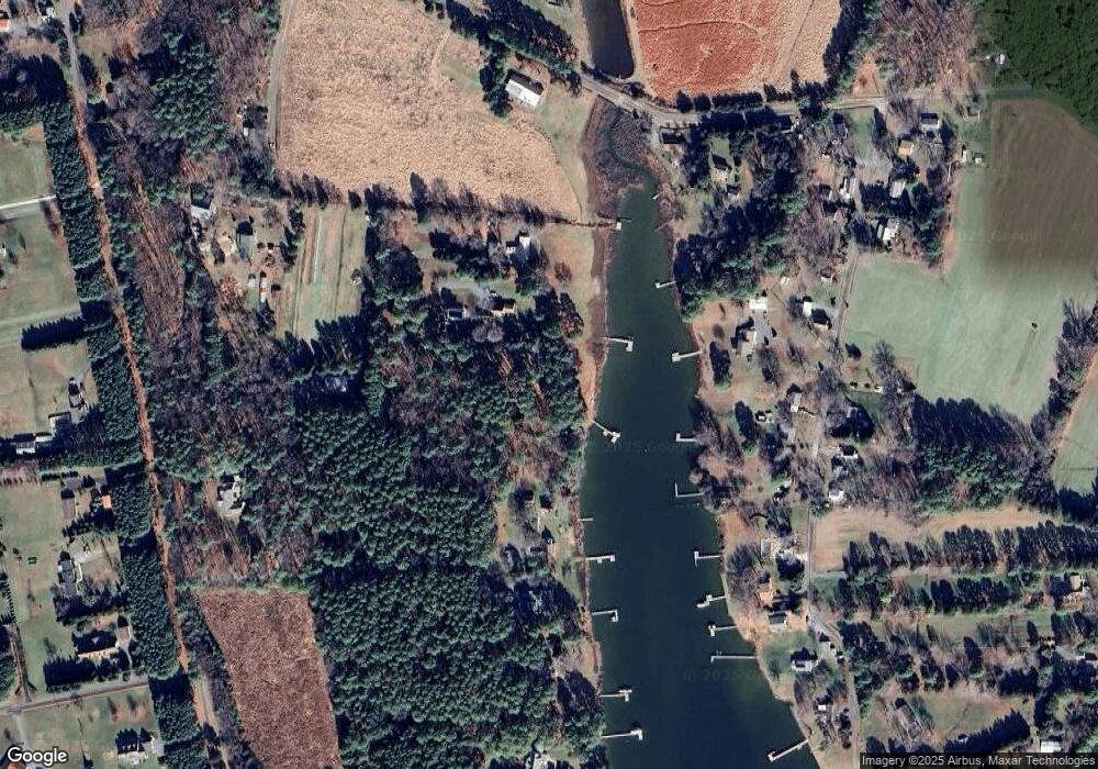
22672 Marshall Ln Wittman, MD 21676
Estimated Value: $828,000 - $971,000
Studio
--
Bath
1,403
Sq Ft
$651/Sq Ft
Est. Value
About This Home
This home is located at 22672 Marshall Ln, Wittman, MD 21676 and is currently estimated at $913,895, approximately $651 per square foot. 22672 Marshall Ln is a home located in Talbot County with nearby schools including Tilghman Elementary School, St. Michaels Middle/High School, and Easton High School.
Ownership History
Date
Name
Owned For
Owner Type
Purchase Details
Closed on
Jul 18, 2008
Sold by
Buchwald Jon Stephan
Bought by
Buchwald Jon Stephan and Buchwald Kimberly T
Current Estimated Value
Purchase Details
Closed on
Apr 4, 2008
Sold by
Buchwald Jon Stephan
Bought by
Buchwald Jon Stephan and Buchwald Kimberly
Purchase Details
Closed on
Mar 30, 2008
Sold by
Buchwald Jon Stephan
Bought by
Buchwald Jon Stephan and Buchwald Kimberly
Create a Home Valuation Report for This Property
The Home Valuation Report is an in-depth analysis detailing your home's value as well as a comparison with similar homes in the area
Purchase History
| Date | Buyer | Sale Price | Title Company |
|---|---|---|---|
| Buchwald Jon Stephan | -- | -- | |
| Buchwald Jon Stephan | -- | -- | |
| Buchwald Jon Stephan | -- | -- | |
| Buchwald Jon Stephan | -- | -- | |
| Buchwald Jon Stephan | -- | -- |
Source: Public Records
Tax History
| Year | Tax Paid | Tax Assessment Tax Assessment Total Assessment is a certain percentage of the fair market value that is determined by local assessors to be the total taxable value of land and additions on the property. | Land | Improvement |
|---|---|---|---|---|
| 2025 | $5,128 | $558,700 | $355,200 | $203,500 |
| 2024 | $4,917 | $542,667 | $0 | $0 |
| 2023 | $4,526 | $526,633 | $0 | $0 |
| 2022 | $4,079 | $510,600 | $355,200 | $155,400 |
| 2021 | $3,949 | $510,433 | $0 | $0 |
| 2020 | $3,850 | $510,267 | $0 | $0 |
| 2019 | $3,849 | $510,100 | $357,400 | $152,700 |
| 2018 | $3,723 | $510,100 | $357,400 | $152,700 |
| 2017 | $3,543 | $510,100 | $0 | $0 |
| 2016 | $3,536 | $540,900 | $0 | $0 |
| 2015 | $3,477 | $540,900 | $0 | $0 |
| 2014 | $3,477 | $540,900 | $0 | $0 |
Source: Public Records
Map
Nearby Homes
- 22707 Marshall Ln
- 8805 Cummings Rd
- 22582 Pot Pie Rd
- 22314 Pot Pie Rd
- 22349 Cooper Ln
- 8781 Tilghman Island Rd
- 9262 Macks Ln
- 8620 Bozman Neavitt Rd
- 8034 Bozman Neavitt Rd
- 9681 Macks Ln
- 23869 Mount Misery Rd
- 7508 Cooper Point Rd
- 23961 Lynnewood Dr
- 7090 Cooper Point Rd
- 216 Brooks Ln
- 24345 Widgeon Place Unit 25
- 21825 Langdon Farm Rd
- 24362 Widgeon Place Unit 4
- 117 Chesapeake Ave
- 209 Webb Ln
- 22743 Marshall Ln
- 22747 Marshall Ln
- 22674 Marshall Ln
- 22741 Marshall Ln
- 8663 Cummings Rd
- 8721 Cummings Rd
- 22687 Marshall Ln
- 8661 Cummings Rd
- 8662 Sewell Rd
- 8684 Sewell Point Rd
- 8670 Sewell Rd
- 0 Cummings Rd Unit 1007182050
- 0 Cummings Rd Unit 1007162628
- 0 Cummings Rd Unit 1007083978
- 0 Cummings Rd Lot A2 Unit 1006676980
- 0 Cummings Rd Unit TA10044037
- 0 Cummings Rd Lot A2 Unit TA7293566
- 0 Cummings Rd Unit TA8370510
- 0 Cummings Rd Unit TA8648303
- 0 Cummings Rd Unit MDTA139354
Your Personal Tour Guide
Ask me questions while you tour the home.
