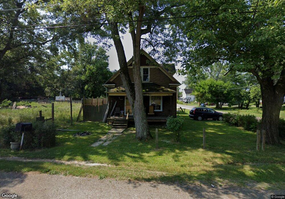
22679 Railroad St Alliance, OH 44601
Estimated Value: $50,000 - $104,000
3
Beds
2
Baths
936
Sq Ft
$74/Sq Ft
Est. Value
About This Home
This home is located at 22679 Railroad St, Alliance, OH 44601 and is currently estimated at $68,874, approximately $73 per square foot. 22679 Railroad St is a home located in Mahoning County with nearby schools including Alliance Intermediate School at Northside, Alliance Elementary School at Rockhill, and Alliance Middle School.
Ownership History
Date
Name
Owned For
Owner Type
Purchase Details
Closed on
Mar 9, 2006
Sold by
Oyster Daniel L and Oyster Phyllis C
Bought by
Wallace Carol S
Current Estimated Value
Purchase Details
Closed on
Aug 17, 1993
Bought by
Ingledue Richard E
Create a Home Valuation Report for This Property
The Home Valuation Report is an in-depth analysis detailing your home's value as well as a comparison with similar homes in the area
Home Values in the Area
Average Home Value in this Area
Purchase History
| Date | Buyer | Sale Price | Title Company |
|---|---|---|---|
| Wallace Carol S | $11,700 | None Available | |
| Ingledue Richard E | $4,500 | -- |
Source: Public Records
Tax History Compared to Growth
Tax History
| Year | Tax Paid | Tax Assessment Tax Assessment Total Assessment is a certain percentage of the fair market value that is determined by local assessors to be the total taxable value of land and additions on the property. | Land | Improvement |
|---|---|---|---|---|
| 2024 | $306 | $7,460 | $650 | $6,810 |
| 2023 | $318 | $7,460 | $650 | $6,810 |
| 2022 | $287 | $6,450 | $510 | $5,940 |
| 2021 | $288 | $6,450 | $510 | $5,940 |
| 2020 | $272 | $5,870 | $510 | $5,360 |
| 2019 | $242 | $5,010 | $510 | $4,500 |
| 2018 | $185 | $3,190 | $510 | $2,680 |
| 2017 | $133 | $3,190 | $510 | $2,680 |
| 2016 | $149 | $2,860 | $510 | $2,350 |
| 2015 | $154 | $2,850 | $510 | $2,340 |
| 2014 | $152 | $2,850 | $510 | $2,340 |
| 2013 | $150 | $2,850 | $510 | $2,340 |
Source: Public Records
Map
Nearby Homes
- 22841 Lake Park Blvd
- 831 Wade Ave
- 263 Franklin Ave
- 442 S Liberty Ave
- 814 Milner St
- 548 E High St
- 328 N Webb Ave
- V/L S Fredeom Ave
- 1233 Woodland Ave
- 1044 S Liberty Ave
- 404 S Linden Ave
- 432 S Linden Ave
- 452 E Summit St
- 652 N Webb Ave
- 361 E Main St
- 1005 S Freedom Ave
- 729 Waugh St
- 815 Grace St
- 834 Devine St
- 608 N Freedom Ave
- 22669 Railroad St
- 13791 Tank St
- 22709 Railroad St
- 13799 Tank St
- 13824 Tank St
- 13814 Tank St
- 13827 Tank St
- 13818 Tank St
- 22657 Railroad St
- 13848 Tank St
- 22761 Railroad St
- 13857 Tank St
- 13870 Tank St
- 22795 Railroad St
- 13795 Thompson St
- 13809 Thompson St
- 13821 Thompson St
- 22695 Smith St
- 13843 Thompson St
- 22519 Railroad St