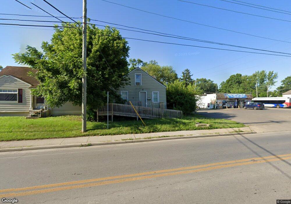
2269 Agler Rd Columbus, OH 43224
Arlington Park NeighborhoodEstimated Value: $126,733 - $171,000
3
Beds
1
Bath
913
Sq Ft
$159/Sq Ft
Est. Value
About This Home
This home is located at 2269 Agler Rd, Columbus, OH 43224 and is currently estimated at $145,433, approximately $159 per square foot. 2269 Agler Rd is a home located in Franklin County with nearby schools including East Linden Elementary School, Mifflin Middle School, and Mifflin High School.
Ownership History
Date
Name
Owned For
Owner Type
Purchase Details
Closed on
Nov 27, 2018
Sold by
Abu Kwick Samira H
Bought by
Waseqa Property Llc
Current Estimated Value
Purchase Details
Closed on
Feb 3, 2009
Sold by
Kondaur Capital Corporation
Bought by
Abu Kwiek Husam
Purchase Details
Closed on
Jan 28, 2009
Sold by
Kondaur Ventures V Llc
Bought by
Kondaur Capital Corporation
Purchase Details
Closed on
Dec 19, 2008
Sold by
National City Bank
Bought by
Kondaur Ventures V Llc
Purchase Details
Closed on
Dec 3, 2007
Sold by
Arbogast Jeann Annette and Arbogast Jeanne A
Bought by
National City Bank
Purchase Details
Closed on
Aug 1, 1975
Create a Home Valuation Report for This Property
The Home Valuation Report is an in-depth analysis detailing your home's value as well as a comparison with similar homes in the area
Home Values in the Area
Average Home Value in this Area
Purchase History
| Date | Buyer | Sale Price | Title Company |
|---|---|---|---|
| Waseqa Property Llc | -- | None Available | |
| Abu Kwiek Husam | $5,000 | Amerititle | |
| Kondaur Capital Corporation | $52,200 | Amerititle | |
| Kondaur Ventures V Llc | $52,200 | Amerititle | |
| National City Bank | $30,000 | None Available | |
| -- | $19,000 | -- |
Source: Public Records
Tax History Compared to Growth
Tax History
| Year | Tax Paid | Tax Assessment Tax Assessment Total Assessment is a certain percentage of the fair market value that is determined by local assessors to be the total taxable value of land and additions on the property. | Land | Improvement |
|---|---|---|---|---|
| 2024 | $1,323 | $20,580 | $6,510 | $14,070 |
| 2023 | $2,420 | $33,710 | $6,510 | $27,200 |
| 2022 | $1,102 | $9,100 | $2,030 | $7,070 |
| 2021 | $764 | $9,100 | $2,030 | $7,070 |
| 2020 | $743 | $9,100 | $2,030 | $7,070 |
| 2019 | $688 | $7,460 | $1,790 | $5,670 |
| 2018 | $344 | $7,460 | $1,790 | $5,670 |
| 2017 | $654 | $7,460 | $1,790 | $5,670 |
| 2016 | $512 | $5,260 | $2,560 | $2,700 |
| 2015 | $240 | $5,260 | $2,560 | $2,700 |
| 2014 | $481 | $5,260 | $2,560 | $2,700 |
| 2013 | $237 | $5,250 | $2,555 | $2,695 |
Source: Public Records
Map
Nearby Homes
- 2858 Woodland Ave
- 2210 Agler Rd
- 2810 Baughman Ave
- 2076 Agler Rd
- 2585 Perdue Ave
- 2559 Milford Ave
- 3137 Westerville Rd Unit 44
- 3137 Westerville Rd Unit 91
- 2765 Joyce Ave
- 2683 Club House Dr
- 0 Club House Dr
- 2096 Minnesota Ave
- 1967 Denune Ave
- 1944 E North Broadway St
- 1985 Aberdeen Ave
- 1980 Oakland Park Ave
- 3781 Aberdeen Ave
- 3775 Aberdeen Ave
- 2503 Hingham Ln
- 2480 Parkwood Ave