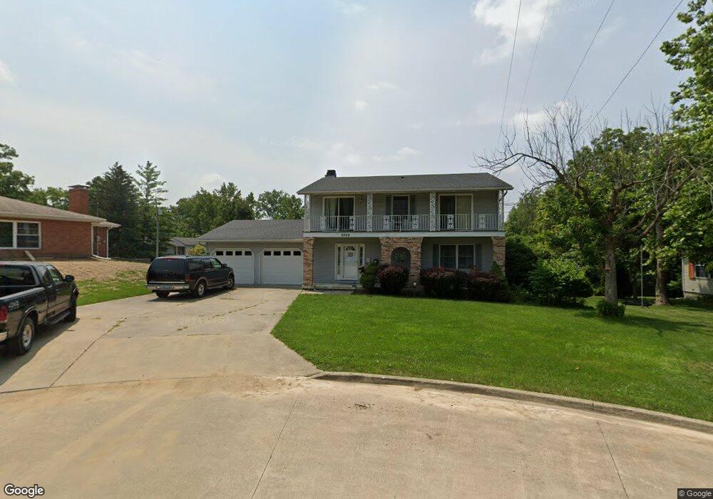
2269 Gary Dr Decatur, IL 62526
Home Park NeighborhoodEstimated Value: $110,000 - $182,000
4
Beds
4
Baths
2,652
Sq Ft
$54/Sq Ft
Est. Value
About This Home
This home is located at 2269 Gary Dr, Decatur, IL 62526 and is currently estimated at $143,971, approximately $54 per square foot. 2269 Gary Dr is a home located in Macon County with nearby schools including Stephen Decatur Middle School and Northwest Christian Campus.
Ownership History
Date
Name
Owned For
Owner Type
Purchase Details
Closed on
Jul 22, 2016
Sold by
Buena Vista National Bank
Bought by
Chandler Michael S P and Chandler Valerie S L
Current Estimated Value
Purchase Details
Closed on
Sep 29, 2015
Sold by
Dunning Wayne and George Linda K
Bought by
Buena Vista National Bank
Purchase Details
Closed on
Dec 31, 2010
Sold by
Moses Dow and Moses Deborah
Bought by
Faith Fellowship Christian Church
Home Financials for this Owner
Home Financials are based on the most recent Mortgage that was taken out on this home.
Original Mortgage
$114,793
Interest Rate
4.53%
Mortgage Type
Future Advance Clause Open End Mortgage
Purchase Details
Closed on
May 8, 2007
Sold by
Hsbc Bank Usa
Bought by
Moses Dow and Moses Deborah
Purchase Details
Closed on
Feb 6, 2007
Sold by
Dung Tran
Bought by
The Hsbc Bank Usa
Create a Home Valuation Report for This Property
The Home Valuation Report is an in-depth analysis detailing your home's value as well as a comparison with similar homes in the area
Home Values in the Area
Average Home Value in this Area
Purchase History
| Date | Buyer | Sale Price | Title Company |
|---|---|---|---|
| Chandler Michael S P | $80,000 | Central Illinois Title | |
| Buena Vista National Bank | $50,000 | None Available | |
| Faith Fellowship Christian Church | -- | Decatur Title Company Llc | |
| -- | $145,000 | -- | |
| Moses Dow | $118,000 | None Available | |
| The Hsbc Bank Usa | -- | None Available |
Source: Public Records
Mortgage History
| Date | Status | Borrower | Loan Amount |
|---|---|---|---|
| Previous Owner | -- | $114,793 |
Source: Public Records
Tax History Compared to Growth
Tax History
| Year | Tax Paid | Tax Assessment Tax Assessment Total Assessment is a certain percentage of the fair market value that is determined by local assessors to be the total taxable value of land and additions on the property. | Land | Improvement |
|---|---|---|---|---|
| 2024 | $3,233 | $39,397 | $6,224 | $33,173 |
| 2023 | $3,185 | $38,003 | $6,004 | $31,999 |
| 2022 | $2,397 | $29,436 | $5,556 | $23,880 |
| 2021 | $2,211 | $27,490 | $5,189 | $22,301 |
| 2020 | $1,937 | $26,214 | $4,949 | $21,265 |
| 2019 | $1,937 | $26,214 | $4,949 | $21,265 |
| 2018 | $1,888 | $25,974 | $5,260 | $20,714 |
| 2017 | $1,955 | $26,667 | $5,400 | $21,267 |
| 2016 | $5,297 | $50,135 | $5,455 | $44,680 |
| 2015 | $5,034 | $49,249 | $5,359 | $43,890 |
| 2014 | $4,674 | $48,761 | $5,306 | $43,455 |
| 2013 | $4,830 | $50,592 | $5,505 | $45,087 |
Source: Public Records
Map
Nearby Homes
- 2320 N Kenwood Ct
- 2404 N Longwood Dr
- 2131 N Oakcrest Ct
- 1929 W Ravina Park Rd
- 2281 N Summit Ave
- 2121 Barding Ave
- 2262 Yorkshire Dr
- 2406 W Olive St
- 2125 Clearmont Ave
- 1720 W Ravina Park Rd
- 1607 W Melrose Ct
- 2195 W Center St
- 1625 W Garfield Ave
- 1524 N Summit Ave
- 1706 W Division St
- 2848 N Primrose Ln
- 1675 W Center St
- 1415 N Dennis Ave
- 2273 N Fairview Ave
- 1645 W Center St