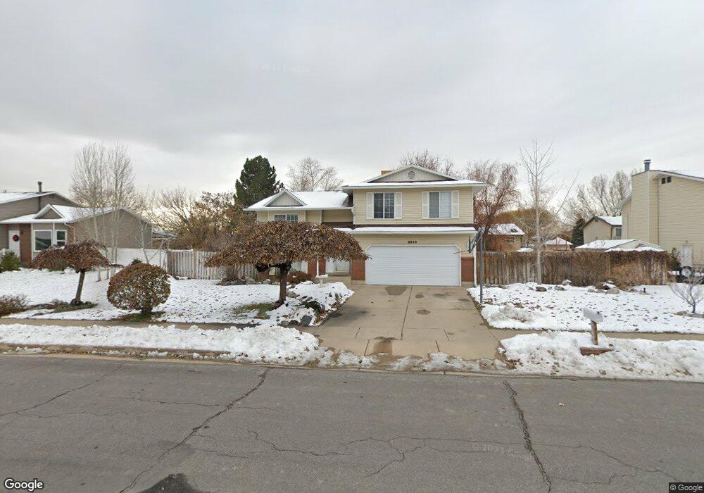
2269 N 2100 E Layton, UT 84040
Estimated Value: $487,687 - $526,000
5
Beds
3
Baths
2,169
Sq Ft
$233/Sq Ft
Est. Value
About This Home
This home is located at 2269 N 2100 E, Layton, UT 84040 and is currently estimated at $506,422, approximately $233 per square foot. 2269 N 2100 E is a home located in Davis County with nearby schools including Sarah Jane Adams Elementary School, North Layton Junior High School, and Northridge High School.
Ownership History
Date
Name
Owned For
Owner Type
Purchase Details
Closed on
Oct 4, 2019
Sold by
Lenox Julius Brockman and Lenox Ronda K
Bought by
Lenox Brock and Lenox Ronda
Current Estimated Value
Home Financials for this Owner
Home Financials are based on the most recent Mortgage that was taken out on this home.
Original Mortgage
$161,300
Outstanding Balance
$140,995
Interest Rate
3.5%
Mortgage Type
New Conventional
Estimated Equity
$365,427
Purchase Details
Closed on
Aug 27, 2012
Sold by
Lenox Brock and Lenox Ronda K
Bought by
Lenox Julius Brockman and Lenox Ronda K
Home Financials for this Owner
Home Financials are based on the most recent Mortgage that was taken out on this home.
Original Mortgage
$161,500
Interest Rate
3.49%
Mortgage Type
New Conventional
Purchase Details
Closed on
May 30, 2008
Sold by
Lenox Julius B
Bought by
Lenox Brock and Lenox Ronda K
Home Financials for this Owner
Home Financials are based on the most recent Mortgage that was taken out on this home.
Original Mortgage
$168,000
Interest Rate
6%
Mortgage Type
Purchase Money Mortgage
Purchase Details
Closed on
Apr 17, 2006
Sold by
Lenox Ronda K and Brock Lenox J
Bought by
Lenox Julius B
Purchase Details
Closed on
Apr 14, 2003
Sold by
Lenox J Brockman and Lenox Ronda K
Bought by
Lenox Ronda K and Brock Lenox J
Purchase Details
Closed on
Feb 11, 1999
Sold by
Freebairn Eric K and Freebairn Nancy A
Bought by
Lenox J Brockman and Lenox Ronda K
Home Financials for this Owner
Home Financials are based on the most recent Mortgage that was taken out on this home.
Original Mortgage
$130,050
Interest Rate
6.77%
Purchase Details
Closed on
May 28, 1996
Sold by
Stokes G Scott and Stokes Kimberly M
Bought by
Freebairn Eric K and Freebairn Nancy A
Home Financials for this Owner
Home Financials are based on the most recent Mortgage that was taken out on this home.
Original Mortgage
$131,439
Interest Rate
7.97%
Mortgage Type
FHA
Create a Home Valuation Report for This Property
The Home Valuation Report is an in-depth analysis detailing your home's value as well as a comparison with similar homes in the area
Home Values in the Area
Average Home Value in this Area
Purchase History
| Date | Buyer | Sale Price | Title Company |
|---|---|---|---|
| Lenox Brock | -- | Mountain View Title & | |
| Lenox Julius Brockman | -- | First American Title | |
| Lenox Brock | -- | Hickman Land Title Co | |
| Lenox Julius B | -- | Excel Title Ins Agency Llc | |
| Lenox Ronda K | -- | -- | |
| Lenox J Brockman | -- | Bonneville Title Company Inc | |
| Freebairn Eric K | -- | Bonneville Title Company |
Source: Public Records
Mortgage History
| Date | Status | Borrower | Loan Amount |
|---|---|---|---|
| Open | Lenox Brock | $161,300 | |
| Closed | Lenox Julius Brockman | $161,500 | |
| Closed | Lenox Brock | $168,000 | |
| Previous Owner | Lenox J Brockman | $130,050 | |
| Previous Owner | Freebairn Eric K | $131,439 |
Source: Public Records
Tax History
| Year | Tax Paid | Tax Assessment Tax Assessment Total Assessment is a certain percentage of the fair market value that is determined by local assessors to be the total taxable value of land and additions on the property. | Land | Improvement |
|---|---|---|---|---|
| 2025 | $2,435 | $238,150 | $112,234 | $125,916 |
| 2024 | $2,322 | $229,900 | $138,031 | $91,869 |
| 2023 | $2,279 | $401,000 | $190,768 | $210,232 |
| 2022 | $2,379 | $228,800 | $101,913 | $126,887 |
| 2021 | $2,143 | $307,000 | $154,444 | $152,556 |
| 2020 | $1,945 | $267,000 | $122,471 | $144,529 |
| 2019 | $1,906 | $258,000 | $109,957 | $148,043 |
| 2018 | $1,720 | $234,000 | $83,625 | $150,375 |
| 2016 | $1,535 | $109,120 | $44,425 | $64,695 |
| 2015 | $1,498 | $101,420 | $44,425 | $56,995 |
| 2014 | $1,421 | $98,664 | $44,425 | $54,239 |
| 2013 | -- | $93,779 | $20,528 | $73,251 |
Source: Public Records
Map
Nearby Homes
- 2340 N 2050 E
- 2273 N 1975 E
- 2189 N 1950 E
- 2202 N 2300 E
- 1907 N Bridge Ct
- 3142 E Thorley Dr
- 3138 E Thorley Dr
- 2597 N 2300 E
- 1843 Hayes Dr
- 2509 E 1900 N
- 1444 E 2400 N
- 2096 N 1450 E
- 2563 E 2250 N
- 1540 E Primrose Ln
- 1911 Deere Valley Dr
- 2547 E 1900 N
- 1935 Deere Valley Dr
- 2391 Kays Creek Dr
- 1954 N 2600 E
- 1785 E 2825 N
Your Personal Tour Guide
Ask me questions while you tour the home.