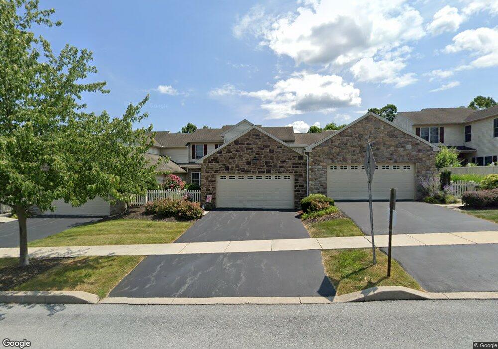
2269 Southpoint Dr Hummelstown, PA 17036
Estimated Value: $428,525 - $495,000
3
Beds
3
Baths
2,418
Sq Ft
$193/Sq Ft
Est. Value
About This Home
This home is located at 2269 Southpoint Dr, Hummelstown, PA 17036 and is currently estimated at $465,881, approximately $192 per square foot. 2269 Southpoint Dr is a home located in Dauphin County with nearby schools including Hershey Elementary School, Hershey Primary Elementary School, and Hershey Middle School.
Ownership History
Date
Name
Owned For
Owner Type
Purchase Details
Closed on
May 28, 2004
Sold by
Shaffer & Gelder Dev Corp
Bought by
Burnhart Cheryl
Current Estimated Value
Home Financials for this Owner
Home Financials are based on the most recent Mortgage that was taken out on this home.
Original Mortgage
$90,000
Outstanding Balance
$43,818
Interest Rate
5.94%
Mortgage Type
New Conventional
Estimated Equity
$422,063
Create a Home Valuation Report for This Property
The Home Valuation Report is an in-depth analysis detailing your home's value as well as a comparison with similar homes in the area
Home Values in the Area
Average Home Value in this Area
Purchase History
| Date | Buyer | Sale Price | Title Company |
|---|---|---|---|
| Burnhart Cheryl | $210,400 | -- |
Source: Public Records
Mortgage History
| Date | Status | Borrower | Loan Amount |
|---|---|---|---|
| Open | Burnhart Cheryl | $90,000 |
Source: Public Records
Tax History Compared to Growth
Tax History
| Year | Tax Paid | Tax Assessment Tax Assessment Total Assessment is a certain percentage of the fair market value that is determined by local assessors to be the total taxable value of land and additions on the property. | Land | Improvement |
|---|---|---|---|---|
| 2025 | $6,291 | $201,300 | $29,700 | $171,600 |
| 2024 | $5,913 | $201,300 | $29,700 | $171,600 |
| 2023 | $5,807 | $201,300 | $29,700 | $171,600 |
| 2022 | $5,679 | $201,300 | $29,700 | $171,600 |
| 2021 | $5,679 | $201,300 | $29,700 | $171,600 |
| 2020 | $5,679 | $201,300 | $29,700 | $171,600 |
| 2019 | $5,576 | $201,300 | $29,700 | $171,600 |
| 2018 | $5,428 | $201,300 | $29,700 | $171,600 |
| 2017 | $5,428 | $201,300 | $29,700 | $171,600 |
| 2016 | $0 | $201,300 | $29,700 | $171,600 |
| 2015 | -- | $201,300 | $29,700 | $171,600 |
| 2014 | -- | $201,300 | $29,700 | $171,600 |
Source: Public Records
Map
Nearby Homes
- 941 Powder Horn Dr
- 1959 Deer Run Dr
- 1919 Limestone Dr
- 2017B Raleigh Rd
- 2039H Raleigh Rd
- 2042 Locust Ln
- 497 Middletown Rd
- 1168 Cord Dr
- 285 Dogwood Dr
- 177 Middletown Rd
- 265 Redwood St
- 994 Clifton Heights Rd
- 112 Park Ave
- 30 N Walnut St
- 791 Gregs Dr
- 228 W Main St
- 589 Lovell Ct
- 610 Carrington Ct
- 721 S 82nd St Unit L111
- 235 W 2nd St
- 2267 Southpoint Dr
- 2271 Southpoint Dr
- 2265 Southpoint Dr Unit L171
- 2263 Southpoint Dr
- 2275 Southpoint Dr
- 2261 Southpoint Dr
- 2277 Southpoint Dr
- 2270 Southpoint Dr
- 2272 Southpoint Dr
- 2151 Gelder Park Dr
- 2274 Southpoint Dr
- 2259 Southpoint Dr Unit L174
- 2276 Southpoint Dr
- 2279 Southpoint Dr
- 2255 Southpoint Dr
- 2280 Southpoint Dr
- 2155 Gelder Park Dr
- 2283 Southpoint Dr
- 2253 Southpoint Dr
- 2150 Gelder Park Dr