Estimated Value: $322,000 - $417,000
4
Beds
3
Baths
2,666
Sq Ft
$143/Sq Ft
Est. Value
About This Home
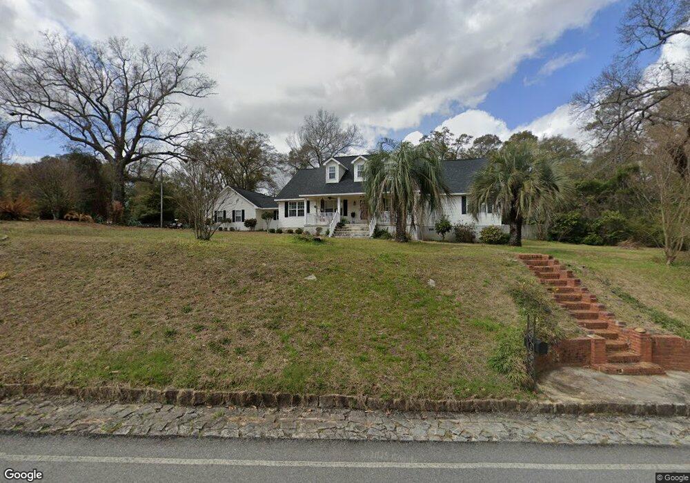
This home is located at 227 41 Cir, Perry, GA 31069 and is currently estimated at $380,915, approximately $142 per square foot. 227 41 Cir is a home located in Houston County with nearby schools including Langston Road Elementary School, Mossy Creek Middle School, and Perry High School.
Ownership History
Date
Name
Owned For
Owner Type
Purchase Details
Closed on
Jul 22, 2002
Sold by
Beltz Robert W
Bought by
Langford John W and Langford Shelia B
Current Estimated Value
Purchase Details
Closed on
Mar 14, 1996
Sold by
Floyd Rachel W
Bought by
Beltz Robert W and Beltz Robin L
Purchase Details
Closed on
Dec 21, 1992
Sold by
Floyd Floyd B and Floyd Rachel W
Bought by
Floyd Rachel W
Purchase Details
Closed on
Jul 11, 1990
Sold by
Trout John I and Trout Rebecca J
Bought by
Floyd Floyd B and Floyd Rachel W
Purchase Details
Closed on
Sep 30, 1986
Sold by
Buitenhuis Bernardus and Buitenhuis Anna P
Bought by
Trout John I and Trout Rebecca J
Purchase Details
Closed on
Sep 9, 1986
Sold by
Dent Virgie B Estate
Bought by
Buitenhuis Bernardus and Buitenhuis Anna P
Purchase Details
Closed on
Aug 28, 1985
Sold by
Dent Ben F and Dent Virgie B
Bought by
Dent Virgie B
Purchase Details
Closed on
Nov 1, 1965
Sold by
Harkins G P
Bought by
Dent Ben F and Dent Virgie B
Create a Home Valuation Report for This Property
The Home Valuation Report is an in-depth analysis detailing your home's value as well as a comparison with similar homes in the area
Home Values in the Area
Average Home Value in this Area
Purchase History
| Date | Buyer | Sale Price | Title Company |
|---|---|---|---|
| Langford John W | -- | -- | |
| Beltz Robert W | $11,800 | -- | |
| Floyd Rachel W | -- | -- | |
| Floyd Floyd B | $66,900 | -- | |
| Trout John I | $60,900 | -- | |
| Buitenhuis Bernardus | $79,000 | -- | |
| Dent Virgie B | -- | -- | |
| Dent Ben F | -- | -- |
Source: Public Records
Tax History
| Year | Tax Paid | Tax Assessment Tax Assessment Total Assessment is a certain percentage of the fair market value that is determined by local assessors to be the total taxable value of land and additions on the property. | Land | Improvement |
|---|---|---|---|---|
| 2025 | $2,655 | $129,280 | $17,400 | $111,880 |
| 2024 | $2,749 | $116,920 | $9,000 | $107,920 |
| 2023 | $2,237 | $94,560 | $9,000 | $85,560 |
| 2022 | $2,077 | $87,920 | $9,000 | $78,920 |
| 2021 | $1,973 | $83,200 | $9,000 | $74,200 |
| 2020 | $1,980 | $83,120 | $9,000 | $74,120 |
| 2019 | $1,927 | $80,960 | $9,000 | $71,960 |
| 2018 | $1,927 | $80,960 | $9,000 | $71,960 |
| 2017 | $1,929 | $80,960 | $9,000 | $71,960 |
| 2016 | $1,932 | $80,960 | $9,000 | $71,960 |
| 2015 | $1,936 | $80,960 | $9,000 | $71,960 |
| 2014 | -- | $80,960 | $9,000 | $71,960 |
| 2013 | -- | $80,960 | $9,000 | $71,960 |
Source: Public Records
Map
Nearby Homes
- 2327 Us Hwy 41
- 108 Tahoma Dr
- 115 Woody Dr
- 204 Greylock Dr
- 502 Arons Ct
- 501 Longhorn Trail
- 113 Lake Lillian Dr
- 108 Chimney Rock Rd
- 105 Senimor Ct
- 127 Bramblewood Ln
- 117 Bramblewood Ln
- 119 Bramblewood Ln
- 115 Bramblewood Ln
- 202 Woods Trail
- 309 Bermuda Ridge
- 200 River Oak Ct
- 111 Breakwater Way
- 304 N Lake Dr
- 620 Amherst St
- 333 Royal Crest Cir
Your Personal Tour Guide
Ask me questions while you tour the home.