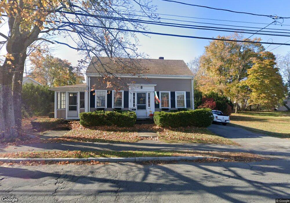
227 Ash St Reading, MA 01867
Estimated Value: $696,000 - $898,178
4
Beds
2
Baths
1,833
Sq Ft
$450/Sq Ft
Est. Value
About This Home
This home is located at 227 Ash St, Reading, MA 01867 and is currently estimated at $824,545, approximately $449 per square foot. 227 Ash St is a home located in Middlesex County with nearby schools including J. Warren Killam Elementary School, Walter S. Parker Middle School, and Reading Memorial High School.
Ownership History
Date
Name
Owned For
Owner Type
Purchase Details
Closed on
Mar 29, 2017
Sold by
Burton-Long Long G and Burton-Long George
Bought by
Wanda S Long Rt and Long
Current Estimated Value
Purchase Details
Closed on
Apr 13, 1971
Bought by
Long G Burton and Long Wanda S
Create a Home Valuation Report for This Property
The Home Valuation Report is an in-depth analysis detailing your home's value as well as a comparison with similar homes in the area
Home Values in the Area
Average Home Value in this Area
Purchase History
| Date | Buyer | Sale Price | Title Company |
|---|---|---|---|
| Wanda S Long Rt | -- | -- | |
| George Burton Long Rt | -- | -- | |
| Long G Burton | $21,200 | -- |
Source: Public Records
Mortgage History
| Date | Status | Borrower | Loan Amount |
|---|---|---|---|
| Previous Owner | Long G Burton | $60,000 |
Source: Public Records
Tax History Compared to Growth
Tax History
| Year | Tax Paid | Tax Assessment Tax Assessment Total Assessment is a certain percentage of the fair market value that is determined by local assessors to be the total taxable value of land and additions on the property. | Land | Improvement |
|---|---|---|---|---|
| 2025 | $8,172 | $717,500 | $445,500 | $272,000 |
| 2024 | $8,079 | $689,300 | $428,000 | $261,300 |
| 2023 | $7,827 | $621,700 | $385,900 | $235,800 |
| 2022 | $7,535 | $565,300 | $350,800 | $214,500 |
| 2021 | $3,713 | $539,300 | $331,600 | $207,700 |
| 2020 | $7,279 | $521,800 | $320,800 | $201,000 |
| 2019 | $7,051 | $495,500 | $304,600 | $190,900 |
| 2018 | $321,713 | $454,000 | $279,000 | $175,000 |
| 2017 | $6,193 | $441,400 | $269,600 | $171,800 |
| 2016 | $5,558 | $383,300 | $232,100 | $151,200 |
| 2015 | $5,530 | $376,200 | $221,000 | $155,200 |
| 2014 | $5,323 | $361,100 | $210,500 | $150,600 |
Source: Public Records
Map
Nearby Homes
- 24 Minot St
- 35 Park Ave
- 223 Washington St
- 237 Main St Unit A4
- 48 Village St Unit 1001
- 169 Green St
- 577 Summer Ave
- 52 Sanborn St Unit 408
- 5 Washington St Unit B2
- 103 High St
- 52 Salem St
- 77 Mount Vernon St
- 1 Charles St Unit N
- 89 Walnut St
- 7 Carnation Cir Unit C
- 2 Summit Dr Unit 18
- 114 Parker Rd
- 7 Leaning Elm Dr Unit 7
- 50 Quannapowitt Pkwy
- 4 Mcdonald Farm Rd