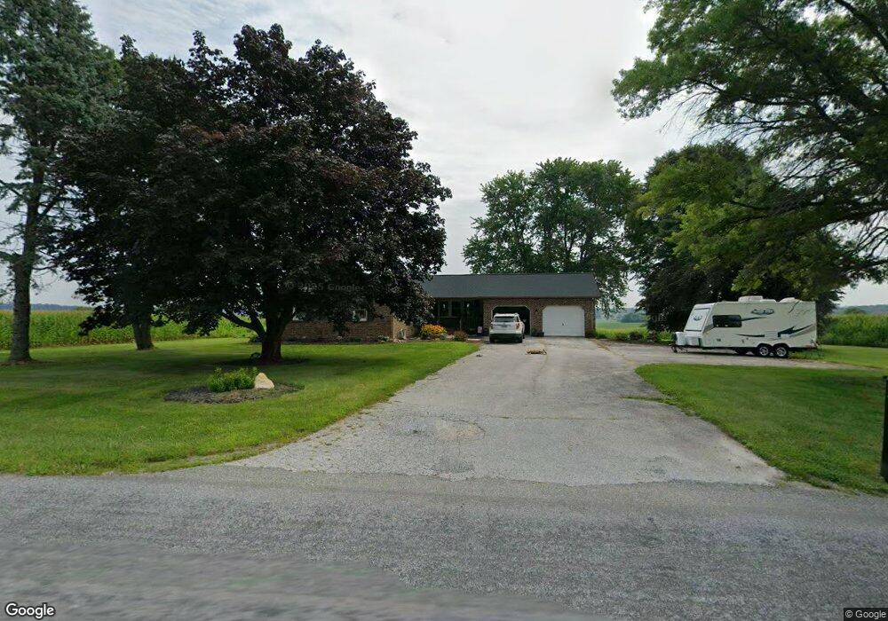
227 Brown Rd Fawn Grove, PA 17321
Estimated Value: $279,271 - $339,000
3
Beds
2
Baths
1,487
Sq Ft
$203/Sq Ft
Est. Value
About This Home
This home is located at 227 Brown Rd, Fawn Grove, PA 17321 and is currently estimated at $302,568, approximately $203 per square foot. 227 Brown Rd is a home located in York County with nearby schools including South Eastern Intermediate School, South Eastern Middle School, and Kennard-Dale High School.
Ownership History
Date
Name
Owned For
Owner Type
Purchase Details
Closed on
Dec 28, 2020
Sold by
Thompson Edwin L and Thompson Kim E
Bought by
Webb Heather D
Current Estimated Value
Home Financials for this Owner
Home Financials are based on the most recent Mortgage that was taken out on this home.
Original Mortgage
$25,000
Outstanding Balance
$22,309
Interest Rate
2.7%
Mortgage Type
Credit Line Revolving
Estimated Equity
$280,259
Purchase Details
Closed on
Apr 1, 1987
Bought by
Thompson Edwin L and Thompson Kim E
Create a Home Valuation Report for This Property
The Home Valuation Report is an in-depth analysis detailing your home's value as well as a comparison with similar homes in the area
Home Values in the Area
Average Home Value in this Area
Purchase History
| Date | Buyer | Sale Price | Title Company |
|---|---|---|---|
| Webb Heather D | $150,000 | None Available | |
| Thompson Edwin L | -- | -- |
Source: Public Records
Mortgage History
| Date | Status | Borrower | Loan Amount |
|---|---|---|---|
| Open | Webb Heather D | $25,000 |
Source: Public Records
Tax History Compared to Growth
Tax History
| Year | Tax Paid | Tax Assessment Tax Assessment Total Assessment is a certain percentage of the fair market value that is determined by local assessors to be the total taxable value of land and additions on the property. | Land | Improvement |
|---|---|---|---|---|
| 2025 | $5,472 | $183,010 | $50,170 | $132,840 |
| 2024 | $5,472 | $183,010 | $50,170 | $132,840 |
| 2023 | $5,472 | $183,010 | $50,170 | $132,840 |
| 2022 | $5,472 | $183,010 | $50,170 | $132,840 |
| 2021 | $5,289 | $183,010 | $50,170 | $132,840 |
| 2020 | $5,289 | $183,010 | $50,170 | $132,840 |
| 2019 | $5,271 | $183,010 | $50,170 | $132,840 |
| 2018 | $5,271 | $183,010 | $50,170 | $132,840 |
| 2017 | $5,271 | $183,010 | $50,170 | $132,840 |
| 2016 | $0 | $183,010 | $50,170 | $132,840 |
| 2015 | -- | $183,010 | $50,170 | $132,840 |
| 2014 | -- | $183,010 | $50,170 | $132,840 |
Source: Public Records
Map
Nearby Homes
- 31 N Market St
- 1701 Scott Rd
- 2131 Channel Rd
- 387 Garvine Mill Rd
- 0 Lutz Rd Unit PAYK2091350
- 4816 Amos Rd
- 194 Cook Rd
- 5403 New Park Rd
- 267 Cook Rd
- 14292 Kilgore Rd
- 2913 Whiteford Rd
- 2623 Urey Rd
- 2735 Meadow Tree Dr
- Lot 4 Ridge Rd
- 2913 Duncan Rd
- 101 Saint Marys Rd
- 8290 Woodbine Rd
- Parcel 859 Neill Run Rd
- 46 Corn Tassel Rd
- 216 Meadow Trail
- 234 Brown Rd
- 252 Brown Rd
- 119 Brown Rd
- 4 Kunkle Rd
- 18 Kunkle Rd
- 32 Kunkle Rd
- 46 Kunkle Rd
- 41 Kunkle Rd
- 485 Thompson Rd
- 375 Thompson Rd
- 0 Lot #3 Thompson Rd
- 445 Thompson Rd
- 463 Thompson Rd
- 56 Kunkle Rd
- 26 Brown Rd
- Vacant lan Main & Hunt Club Rd
- 623 Main St
- 5713 Main St
- Vacant land Main St
- 169 Kunkle Rd