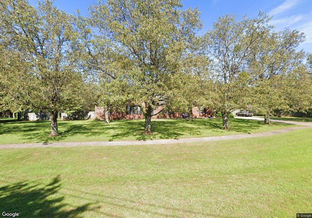
227 Case Rd Huntsville, AL 35811
Ryland NeighborhoodEstimated Value: $297,000 - $309,889
3
Beds
2
Baths
1,830
Sq Ft
$166/Sq Ft
Est. Value
About This Home
This home is located at 227 Case Rd, Huntsville, AL 35811 and is currently estimated at $304,472, approximately $166 per square foot. 227 Case Rd is a home located in Madison County with nearby schools including Mt Carmel Elementary School, Riverton Intermediate School, and Buckhorn Middle School.
Ownership History
Date
Name
Owned For
Owner Type
Purchase Details
Closed on
May 23, 2012
Sold by
Smith Janis R
Bought by
Smith Jennye C
Current Estimated Value
Purchase Details
Closed on
Jul 23, 2008
Sold by
Graham Jennifer and Graham Daniel L
Bought by
Smith Janis R and Smith Jennye
Home Financials for this Owner
Home Financials are based on the most recent Mortgage that was taken out on this home.
Original Mortgage
$102,000
Interest Rate
6.27%
Mortgage Type
New Conventional
Purchase Details
Closed on
Aug 30, 2005
Sold by
Weldy Allan R
Bought by
Carroll Jennifer
Home Financials for this Owner
Home Financials are based on the most recent Mortgage that was taken out on this home.
Original Mortgage
$154,939
Interest Rate
5.64%
Mortgage Type
FHA
Create a Home Valuation Report for This Property
The Home Valuation Report is an in-depth analysis detailing your home's value as well as a comparison with similar homes in the area
Home Values in the Area
Average Home Value in this Area
Purchase History
| Date | Buyer | Sale Price | Title Company |
|---|---|---|---|
| Smith Jennye C | -- | None Available | |
| Smith Janis R | -- | -- | |
| Carroll Jennifer | -- | -- |
Source: Public Records
Mortgage History
| Date | Status | Borrower | Loan Amount |
|---|---|---|---|
| Previous Owner | Smith Janis R | $102,000 | |
| Previous Owner | Carroll Jennifer | $154,939 |
Source: Public Records
Tax History Compared to Growth
Tax History
| Year | Tax Paid | Tax Assessment Tax Assessment Total Assessment is a certain percentage of the fair market value that is determined by local assessors to be the total taxable value of land and additions on the property. | Land | Improvement |
|---|---|---|---|---|
| 2024 | $1,022 | $28,360 | $4,500 | $23,860 |
| 2023 | $1,022 | $27,740 | $4,500 | $23,240 |
| 2022 | $1,695 | $46,840 | $5,000 | $41,840 |
| 2021 | $718 | $21,180 | $2,500 | $18,680 |
| 2020 | $640 | $19,050 | $2,500 | $16,550 |
| 2019 | $613 | $18,310 | $2,500 | $15,810 |
| 2018 | $577 | $17,320 | $0 | $0 |
| 2017 | $560 | $16,860 | $0 | $0 |
| 2016 | $560 | $16,860 | $0 | $0 |
| 2015 | $560 | $16,860 | $0 | $0 |
| 2014 | $555 | $16,720 | $0 | $0 |
Source: Public Records
Map
Nearby Homes
- 197 Sawmill Rd
- 130 Blackburn Trace
- 319 Jackson Point Cir
- 136 Ranna Dr
- 134 Ranna Dr
- 103 Trackside Trail
- 130 Ranna Dr
- 135 Lanwood Dr
- 157 Lanwood Dr
- 1761 Winchester Rd NE
- The Shelburne Plan at Blue Ridge at Mount Carmel - Signature Series
- The Lincoln Plan at Blue Ridge at Mount Carmel - Signature Series
- The Jamestown Plan at Blue Ridge at Mount Carmel - Founders Series
- The Winston Plan at Blue Ridge at Mount Carmel - Signature Series
- The Raleigh Plan at Blue Ridge at Mount Carmel - Signature Series
- The Cambridge Plan at Blue Ridge at Mount Carmel - Signature Series
- The Savannah Plan at Blue Ridge at Mount Carmel - Signature Series
- The Potomac Plan at Blue Ridge at Mount Carmel - Founders Series
- The Lexington Plan at Blue Ridge at Mount Carmel - Founders Series
- The Bennington Plan at Blue Ridge at Mount Carmel - Signature Series