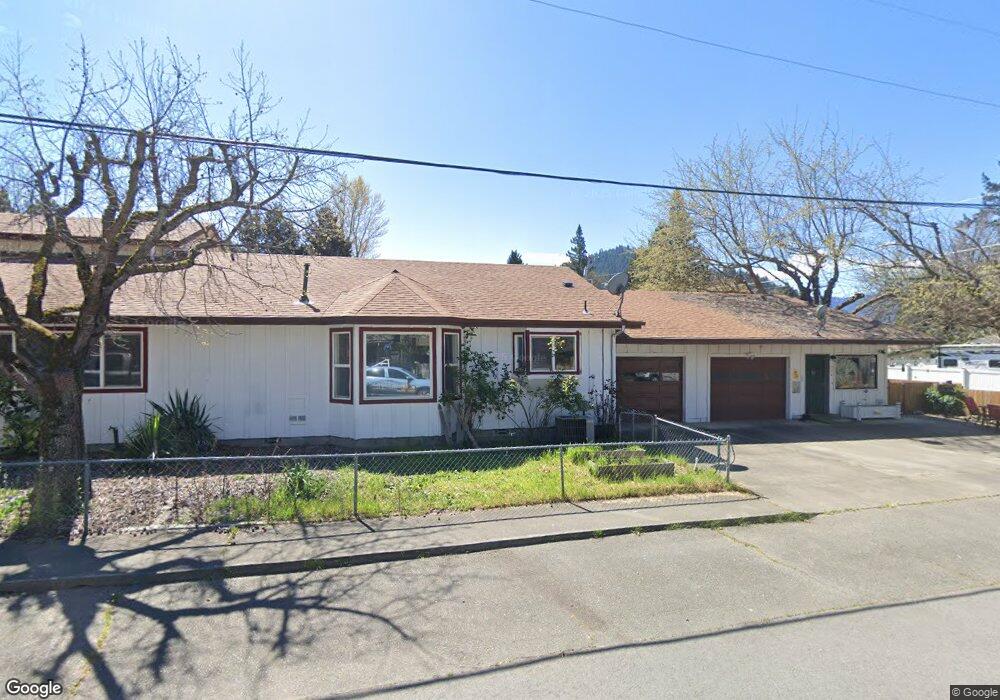
227 Cedar St Rogue River, OR 97537
Estimated Value: $529,551 - $603,000
3
Beds
3
Baths
3,426
Sq Ft
$167/Sq Ft
Est. Value
About This Home
This home is located at 227 Cedar St, Rogue River, OR 97537 and is currently estimated at $570,638, approximately $166 per square foot. 227 Cedar St is a home located in Jackson County with nearby schools including South Valley Academy, Rogue River Elementary School, and Rogue River Junior/Senior High School.
Ownership History
Date
Name
Owned For
Owner Type
Purchase Details
Closed on
Feb 26, 2020
Sold by
Equity Trust Company
Bought by
Moore Brent W
Current Estimated Value
Home Financials for this Owner
Home Financials are based on the most recent Mortgage that was taken out on this home.
Original Mortgage
$262,500
Outstanding Balance
$230,932
Interest Rate
3.6%
Mortgage Type
New Conventional
Estimated Equity
$339,706
Purchase Details
Closed on
Jun 24, 2011
Sold by
Guilbert Sam L
Bought by
Equity Trust Company and Michelle Worley Ira
Purchase Details
Closed on
Apr 1, 2011
Sold by
Asher Debbie
Bought by
Guilbert Sam L
Purchase Details
Closed on
Jul 11, 2007
Sold by
Guilbert Sam
Bought by
Asher Debbie
Home Financials for this Owner
Home Financials are based on the most recent Mortgage that was taken out on this home.
Original Mortgage
$235,000
Interest Rate
6.41%
Mortgage Type
Purchase Money Mortgage
Create a Home Valuation Report for This Property
The Home Valuation Report is an in-depth analysis detailing your home's value as well as a comparison with similar homes in the area
Home Values in the Area
Average Home Value in this Area
Purchase History
| Date | Buyer | Sale Price | Title Company |
|---|---|---|---|
| Moore Brent W | $350,000 | First American | |
| Moore Brent W | $350,000 | First American | |
| Equity Trust Company | $135,000 | First American | |
| Equity Trust Company | $135,000 | First American | |
| Guilbert Sam L | -- | Fa | |
| Guilbert Sam L | -- | Fa | |
| Asher Debbie | $295,000 | First American | |
| Asher Debbie | $295,000 | First American |
Source: Public Records
Mortgage History
| Date | Status | Borrower | Loan Amount |
|---|---|---|---|
| Open | Moore Brent W | $262,500 | |
| Previous Owner | Asher Debbie | $235,000 |
Source: Public Records
Tax History
| Year | Tax Paid | Tax Assessment Tax Assessment Total Assessment is a certain percentage of the fair market value that is determined by local assessors to be the total taxable value of land and additions on the property. | Land | Improvement |
|---|---|---|---|---|
| 2026 | $4,221 | $294,740 | -- | -- |
| 2025 | $4,086 | $286,160 | $61,900 | $224,260 |
| 2024 | $4,086 | $277,830 | $60,090 | $217,740 |
| 2023 | $3,953 | $269,740 | $58,350 | $211,390 |
| 2022 | $3,861 | $269,740 | $58,350 | $211,390 |
| 2021 | $3,752 | $261,890 | $56,650 | $205,240 |
| 2020 | $3,655 | $254,270 | $55,000 | $199,270 |
| 2019 | $3,567 | $239,680 | $51,840 | $187,840 |
| 2018 | $3,474 | $232,700 | $50,320 | $182,380 |
| 2017 | $3,395 | $232,700 | $50,320 | $182,380 |
| 2016 | $3,310 | $219,350 | $47,430 | $171,920 |
| 2015 | $3,217 | $219,350 | $51,210 | $168,140 |
| 2014 | $3,114 | $206,770 | $48,270 | $158,500 |
Source: Public Records
Map
Nearby Homes
- 105 Brolin Ct
- 101 Cedar Ridge Terrace
- 111 Cedar St
- 904 Broadway St Unit 503
- 214 Berglund St
- 512 Pine St
- 207 Madrone St
- 208 W Main St
- 210 W Main St
- 182 Wards Creek Rd
- 2661 Wards Creek Rd
- 4794 Foothill Blvd
- 8401 Rogue River Hwy
- 815 Pine St
- 815 Pine St Unit 10
- 5525 Red Tail Ln
- 5500 Red Tail Ln
- 315 W Evans Creek Rd Unit 22
- 5508 Rogue River Hwy
- 4529 E Evans Creek Rd
Your Personal Tour Guide
Ask me questions while you tour the home.