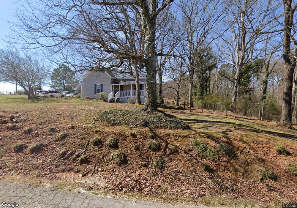
227 Davis Lake Rd Locust Grove, GA 30248
Estimated Value: $244,000 - $325,000
3
Beds
2
Baths
1,325
Sq Ft
$205/Sq Ft
Est. Value
About This Home
This home is located at 227 Davis Lake Rd, Locust Grove, GA 30248 and is currently estimated at $271,623, approximately $204 per square foot. 227 Davis Lake Rd is a home located in Henry County with nearby schools including Unity Grove Elementary School, Locust Grove Middle School, and Locust Grove High School.
Ownership History
Date
Name
Owned For
Owner Type
Purchase Details
Closed on
Sep 22, 2023
Sold by
Gray Jerry W
Bought by
Gray Barbara A and Gray Jerry W
Current Estimated Value
Purchase Details
Closed on
Aug 31, 1999
Sold by
Wells Cynthia A
Bought by
Gary Jerry W and Gary Barbara A
Home Financials for this Owner
Home Financials are based on the most recent Mortgage that was taken out on this home.
Original Mortgage
$85,000
Interest Rate
7.73%
Mortgage Type
New Conventional
Purchase Details
Closed on
Mar 31, 1994
Sold by
Wells Audrey C
Bought by
Morris Cynthia
Home Financials for this Owner
Home Financials are based on the most recent Mortgage that was taken out on this home.
Original Mortgage
$56,907
Interest Rate
7.26%
Mortgage Type
FHA
Create a Home Valuation Report for This Property
The Home Valuation Report is an in-depth analysis detailing your home's value as well as a comparison with similar homes in the area
Home Values in the Area
Average Home Value in this Area
Purchase History
| Date | Buyer | Sale Price | Title Company |
|---|---|---|---|
| Gray Barbara A | -- | -- | |
| Gary Jerry W | $95,000 | -- | |
| Morris Cynthia | $65,000 | -- |
Source: Public Records
Mortgage History
| Date | Status | Borrower | Loan Amount |
|---|---|---|---|
| Previous Owner | Gary Jerry W | $85,000 | |
| Previous Owner | Morris Cynthia | $56,907 |
Source: Public Records
Tax History Compared to Growth
Tax History
| Year | Tax Paid | Tax Assessment Tax Assessment Total Assessment is a certain percentage of the fair market value that is determined by local assessors to be the total taxable value of land and additions on the property. | Land | Improvement |
|---|---|---|---|---|
| 2025 | $322 | $85,280 | $20,040 | $65,240 |
| 2024 | $322 | $82,760 | $18,040 | $64,720 |
| 2023 | $170 | $81,200 | $17,360 | $63,840 |
| 2022 | $320 | $66,880 | $16,040 | $50,840 |
| 2021 | $321 | $54,400 | $13,760 | $40,640 |
| 2020 | $322 | $47,720 | $12,960 | $34,760 |
| 2019 | $928 | $43,800 | $12,280 | $31,520 |
| 2018 | $833 | $40,040 | $11,360 | $28,680 |
| 2016 | $1,098 | $35,720 | $10,040 | $25,680 |
| 2015 | $934 | $30,640 | $11,560 | $19,080 |
| 2014 | $863 | $28,720 | $11,560 | $17,160 |
Source: Public Records
Map
Nearby Homes
- 1129 Abundance Dr
- 340 Colvin Dr
- 700 Patriots Point St
- 23 Club Dr
- 107 Club Dr
- 648 Kimberwick Dr
- 708 Curb Ct
- 220 Umber Rd
- 733 Myrica Ave
- 417 Hazel Dr
- 409 Hazel Dr
- 421 Hazel Dr
- 155 Club Dr
- 0 Courtney Ct Unit 10432404
- 1321 Deutz Dr
- 419 Grier Dr
- 551 Rosalind Terrace
- Roswell Plan at Peeksville Landing
- Oakland Plan at Peeksville Landing
- Portland Plan at Peeksville Landing
- 173 Davis Lake Rd
- 174 Davis Lake Rd
- 198 Davis Lake Rd
- 154 Davis Lake Rd
- 165 Jackson St
- 1156 Abundance Dr Unit 3
- 1156 Abundance Dr
- 0 Abundance Dr Unit 7520993
- 0 Abundance Dr Unit 3229158
- 0 Abundance Dr Unit 8988358
- 0 Abundance Dr Unit 9014675
- 0 Abundance Dr Unit 8792343
- 0 Abundance Dr Unit 8172822
- 1154 Abundance Dr Unit 4
- 1154 Abundance Dr
- 1152 Abundance Dr
- 1152 Abundance Dr Unit 5
- 141 Jodi Place
- 1100 Abundance Dr
- 0 Davis Lake Rd Unit 10197648