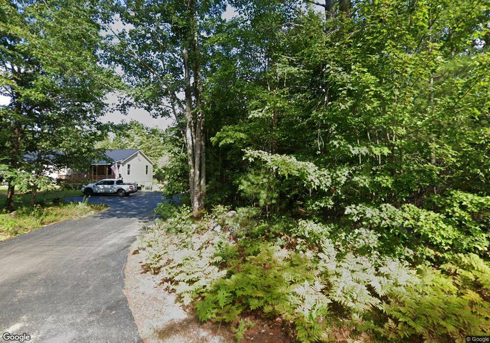
227 Foss Rd Limerick, ME 04048
Estimated Value: $430,000 - $518,168
--
Bed
--
Bath
1,120
Sq Ft
$427/Sq Ft
Est. Value
About This Home
This home is located at 227 Foss Rd, Limerick, ME 04048 and is currently estimated at $477,792, approximately $426 per square foot. 227 Foss Rd is a home with nearby schools including Massabesic High School.
Ownership History
Date
Name
Owned For
Owner Type
Purchase Details
Closed on
Jun 12, 2023
Sold by
Cormier Marilyn and Cormier Philip
Bought by
Cormier Marilyn and Cormier Mckenzie
Current Estimated Value
Create a Home Valuation Report for This Property
The Home Valuation Report is an in-depth analysis detailing your home's value as well as a comparison with similar homes in the area
Home Values in the Area
Average Home Value in this Area
Purchase History
| Date | Buyer | Sale Price | Title Company |
|---|---|---|---|
| Cormier Marilyn | -- | None Available | |
| Cormier Marilyn | -- | None Available | |
| Cormier Marilyn | -- | None Available |
Source: Public Records
Tax History Compared to Growth
Tax History
| Year | Tax Paid | Tax Assessment Tax Assessment Total Assessment is a certain percentage of the fair market value that is determined by local assessors to be the total taxable value of land and additions on the property. | Land | Improvement |
|---|---|---|---|---|
| 2025 | $4,359 | $458,818 | $207,720 | $251,098 |
| 2024 | $4,359 | $458,818 | $207,720 | $251,098 |
| 2023 | $7,518 | $494,593 | $135,963 | $358,630 |
| 2022 | $4,998 | $351,963 | $128,462 | $223,501 |
| 2021 | $3,740 | $225,327 | $92,770 | $132,557 |
| 2020 | $2,247 | $137,027 | $86,770 | $50,257 |
| 2019 | $4,641 | $76,770 | $76,770 | $0 |
| 2018 | $1,511 | $93,543 | $76,770 | $16,773 |
| 2017 | $5,744 | $109,993 | $93,220 | $16,773 |
| 2016 | $1,587 | $105,423 | $88,650 | $16,773 |
| 2015 | $1,539 | $105,423 | $88,650 | $16,773 |
| 2014 | $1,492 | $105,423 | $88,650 | $16,773 |
Source: Public Records
Map
Nearby Homes
- 545 Foss Rd
- 7 Echo Ln
- 91 Patterson Rd
- 515 Range East Rd
- 50 Island Rd
- 0 Island Rd Unit 1643509
- Lot 14b Patterson Rd
- 36 Elm St
- 0 Stone Hill Rd
- 4 Dragonfly Cir
- 157 Silver Ln
- Mp44Lt270 Silver Ln
- M13L30 Clarks Bridge Rd
- 17 High Point Cir
- 107 Sequoia Ln
- LOT# 8 Business Park Rd
- Lot# 11 Business Park Rd
- 685 Crystal Ln
- 386 Lenox Cir
- 48 King Hill Rd
- 229 Foss Rd
- 235 Foss Rd
- 0 Waters Way Unit 848382
- 0 Waters Way Unit 839264
- 0 Waters Way Unit 872901
- 0 Waters Way Unit 871365
- 0 Waters Way Unit 910931
- 44 Waters Way
- 44 Waters Way
- Lot 1-5A Water's Way
- Lot 1-5 Waters
- 171 Foss Rd
- 00 Foss Rd
- 151 Foss Rd
- 287 Foss Rd
- 301 Foss Rd
- 316 Foss Rd
- 79 Foss Rd
- TBD Foss Rd
- 355 Foss Rd
