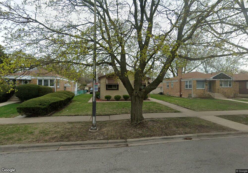
227 Hartrey Ave Evanston, IL 60202
Southwest Evanston NeighborhoodEstimated Value: $472,000 - $503,827
3
Beds
2
Baths
1,245
Sq Ft
$387/Sq Ft
Est. Value
About This Home
This home is located at 227 Hartrey Ave, Evanston, IL 60202 and is currently estimated at $481,957, approximately $387 per square foot. 227 Hartrey Ave is a home located in Cook County with nearby schools including Dawes Elementary School, Chute Middle School, and Evanston Township High School.
Ownership History
Date
Name
Owned For
Owner Type
Purchase Details
Closed on
Sep 27, 1994
Sold by
Jackson Don E and Jackson Maggie A
Bought by
Scott Clouis and Cleveland Scott Penny
Current Estimated Value
Home Financials for this Owner
Home Financials are based on the most recent Mortgage that was taken out on this home.
Original Mortgage
$147,250
Interest Rate
7.62%
Create a Home Valuation Report for This Property
The Home Valuation Report is an in-depth analysis detailing your home's value as well as a comparison with similar homes in the area
Home Values in the Area
Average Home Value in this Area
Purchase History
| Date | Buyer | Sale Price | Title Company |
|---|---|---|---|
| Scott Clouis | $155,000 | -- |
Source: Public Records
Mortgage History
| Date | Status | Borrower | Loan Amount |
|---|---|---|---|
| Closed | Scott Clouis | $147,250 |
Source: Public Records
Tax History Compared to Growth
Tax History
| Year | Tax Paid | Tax Assessment Tax Assessment Total Assessment is a certain percentage of the fair market value that is determined by local assessors to be the total taxable value of land and additions on the property. | Land | Improvement |
|---|---|---|---|---|
| 2024 | $7,526 | $34,000 | $8,758 | $25,242 |
| 2023 | $7,195 | $34,000 | $8,758 | $25,242 |
| 2022 | $7,195 | $34,000 | $8,758 | $25,242 |
| 2021 | $5,710 | $24,560 | $4,652 | $19,908 |
| 2020 | $5,692 | $24,560 | $4,652 | $19,908 |
| 2019 | $5,692 | $27,411 | $4,652 | $22,759 |
| 2018 | $7,170 | $29,262 | $3,831 | $25,431 |
| 2017 | $6,998 | $29,262 | $3,831 | $25,431 |
| 2016 | $6,860 | $29,262 | $3,831 | $25,431 |
| 2015 | $5,644 | $23,379 | $3,284 | $20,095 |
| 2014 | $5,605 | $23,379 | $3,284 | $20,095 |
| 2013 | $5,460 | $23,379 | $3,284 | $20,095 |
Source: Public Records
Map
Nearby Homes
- 220 Richmond St
- 235 Richmond St
- 2011 Brummel St
- 309 Darrow Ave
- 3024 W Fargo Ave
- 1927 Warren St
- 1810 South Blvd
- 401 Dewey Ave
- 1615 W Howard St Unit 303
- 604 Dodge Ave
- 7433 N Washtenaw Ave
- 347 Florence Ave
- 419 Florence Ave
- 2213 Cleveland St
- 1406 Brummel St
- 3123 W Chase Ave
- 2522 W Jarvis Ave
- 704 Florence Ave
- 1217 Hull Terrace Unit 3A
- 1810 Washington St
- 225 Hartrey Ave
- 233 Hartrey Ave
- 235 Hartrey Ave
- 221 Hartrey Ave
- 228 Richmond St
- 224 Richmond St
- 230 Richmond St
- 232 Richmond St
- 217 Hartrey Ave
- 218 Richmond St
- 213 Hartrey Ave
- 216 Richmond St
- 212 Richmond St
- 2141 Brummel St
- 2137 Brummel St
- 2145 Brummel St
- 2135 Brummel St
- 2131 Brummel St
- 227 Richmond St
- 231 Richmond St