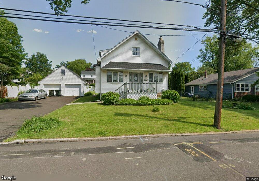
227 Madison Rd Willow Grove, PA 19090
Estimated Value: $471,255 - $522,000
4
Beds
1
Bath
2,197
Sq Ft
$225/Sq Ft
Est. Value
About This Home
This home is located at 227 Madison Rd, Willow Grove, PA 19090 and is currently estimated at $495,314, approximately $225 per square foot. 227 Madison Rd is a home located in Montgomery County with nearby schools including Upper Moreland Intermediate School, Upper Moreland Primary School, and Upper Moreland Middle School.
Ownership History
Date
Name
Owned For
Owner Type
Purchase Details
Closed on
Jul 27, 2001
Sold by
Filiault Paul
Bought by
Myers Latanya R
Current Estimated Value
Purchase Details
Closed on
Mar 13, 2001
Sold by
Federal Home Loan Mortgage Corporation
Bought by
Filiault Paul
Purchase Details
Closed on
Feb 2, 2001
Sold by
Ogle Brett and Ge Capital Mtg Services Inc
Bought by
Federal Home Loan Mortgage Corporation
Purchase Details
Closed on
Oct 25, 1996
Sold by
Ogle Brett and Ogle Kathleen
Bought by
Ogle Brett
Create a Home Valuation Report for This Property
The Home Valuation Report is an in-depth analysis detailing your home's value as well as a comparison with similar homes in the area
Home Values in the Area
Average Home Value in this Area
Purchase History
| Date | Buyer | Sale Price | Title Company |
|---|---|---|---|
| Myers Latanya R | $184,900 | -- | |
| Filiault Paul | $112,000 | -- | |
| Federal Home Loan Mortgage Corporation | $70,000 | -- | |
| Ogle Brett | -- | -- |
Source: Public Records
Tax History Compared to Growth
Tax History
| Year | Tax Paid | Tax Assessment Tax Assessment Total Assessment is a certain percentage of the fair market value that is determined by local assessors to be the total taxable value of land and additions on the property. | Land | Improvement |
|---|---|---|---|---|
| 2025 | $6,810 | $143,270 | -- | -- |
| 2024 | $6,810 | $143,270 | -- | -- |
| 2023 | $6,528 | $143,270 | $0 | $0 |
| 2022 | $6,138 | $143,270 | $0 | $0 |
| 2021 | $6,056 | $143,270 | $0 | $0 |
| 2020 | $5,856 | $143,270 | $0 | $0 |
| 2019 | $5,728 | $143,270 | $0 | $0 |
| 2018 | $5,728 | $143,270 | $0 | $0 |
| 2017 | $5,471 | $143,270 | $0 | $0 |
| 2016 | $5,416 | $143,270 | $0 | $0 |
| 2015 | $5,140 | $143,270 | $0 | $0 |
| 2014 | $5,140 | $143,270 | $0 | $0 |
Source: Public Records
Map
Nearby Homes
- 310 Dallas Rd
- 16 Lawnton Rd
- 121 Dallas Rd
- 22 Fitzwatertown Rd Unit F-4
- 1948 Lukens Ave
- 14 Knock N Knoll Cir Unit L-14
- 510 Grant Ave
- 1972 Coolidge Ave
- 605 Fairhill St
- 509 Lincoln Ave
- 505 Crown St
- 612 Brook St
- 1838 Lukens Ave
- 1822 Osbourne Ave
- 712 N York Rd
- 885 N York Rd Unit 12C
- 1006 N York Rd Unit 1
- 1014 N York Rd
- 3024 Windsor Ave
- 2814 Old Welsh Rd