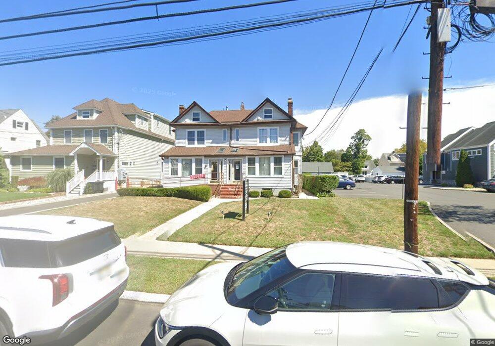
227 Maple Ave Unit 229 Red Bank, NJ 07701
Estimated Value: $893,000 - $1,082,541
2
Beds
3
Baths
1,845
Sq Ft
$536/Sq Ft
Est. Value
About This Home
This home is located at 227 Maple Ave Unit 229, Red Bank, NJ 07701 and is currently estimated at $989,135, approximately $536 per square foot. 227 Maple Ave Unit 229 is a home located in Monmouth County with nearby schools including Red Bank Primary School, Red Bank Middle School, and Red Bank Reg High School.
Ownership History
Date
Name
Owned For
Owner Type
Purchase Details
Closed on
May 8, 2024
Sold by
Feldman Robert D
Bought by
Shady Property 5 Llc
Current Estimated Value
Home Financials for this Owner
Home Financials are based on the most recent Mortgage that was taken out on this home.
Original Mortgage
$838,500
Outstanding Balance
$290,723
Interest Rate
6%
Mortgage Type
Seller Take Back
Estimated Equity
$698,412
Create a Home Valuation Report for This Property
The Home Valuation Report is an in-depth analysis detailing your home's value as well as a comparison with similar homes in the area
Home Values in the Area
Average Home Value in this Area
Purchase History
| Date | Buyer | Sale Price | Title Company |
|---|---|---|---|
| Shady Property 5 Llc | $915,000 | Foundation Title | |
| Shady Property 5 Llc | $915,000 | Foundation Title |
Source: Public Records
Mortgage History
| Date | Status | Borrower | Loan Amount |
|---|---|---|---|
| Open | Shady Property 5 Llc | $838,500 | |
| Closed | Shady Property 5 Llc | $838,500 |
Source: Public Records
Tax History Compared to Growth
Tax History
| Year | Tax Paid | Tax Assessment Tax Assessment Total Assessment is a certain percentage of the fair market value that is determined by local assessors to be the total taxable value of land and additions on the property. | Land | Improvement |
|---|---|---|---|---|
| 2025 | $16,134 | $915,000 | $351,800 | $563,200 |
| 2024 | $16,033 | $854,100 | $313,400 | $540,700 |
| 2023 | $16,033 | $839,000 | $313,400 | $525,600 |
| 2022 | $15,681 | $794,700 | $291,600 | $503,100 |
| 2021 | $15,681 | $701,000 | $243,000 | $458,000 |
| 2020 | $15,020 | $661,100 | $243,000 | $418,100 |
| 2019 | $14,341 | $648,600 | $243,000 | $405,600 |
| 2018 | $13,855 | $633,500 | $243,000 | $390,500 |
| 2017 | $13,314 | $631,000 | $243,000 | $388,000 |
| 2016 | $13,084 | $621,000 | $243,000 | $378,000 |
| 2015 | $12,552 | $617,400 | $270,800 | $346,600 |
| 2014 | $12,957 | $677,300 | $308,000 | $369,300 |
Source: Public Records
Map
Nearby Homes
- 205 Maple Ave
- 27 Irving Place
- 44 Waverly Place
- 253 Pearl St S
- 232 S Pearl St
- 17 Leroy Place Unit 3B
- 17 Leroy Place Unit 1C
- 137 E Bergen Place
- 3 Cedar Crossing
- 24 Cedar Crossing
- 23 Cedar Crossing
- 26 Pinckney Rd Unit C
- 24 River St
- 42 Chestnut St
- 195 Bridge Ave
- 244 S Bridge Ave
- 19 Sunset Ave E
- 132 Trafford St
- 82 Linden Place
- 38 Bank St
- 227 Maple Ave
- 231 Maple Ave
- 223 Maple Ave Unit 3
- 223 Maple Ave Unit 2
- 223 Maple Ave Unit 3
- 219 Maple Ave
- 215 Maple Ave
- 30 Arthur Place
- 32 Arthur Place
- 241 Maple Ave Unit 5
- 241 Maple Ave
- 36 Arthur Place
- 28 Arthur Place
- 24 Arthur Place
- 40 Arthur Place
- 20 Arthur Place
- 224 Maple Ave
- 228 Maple Ave
- 16 Arthur Place
- 249 Maple Ave