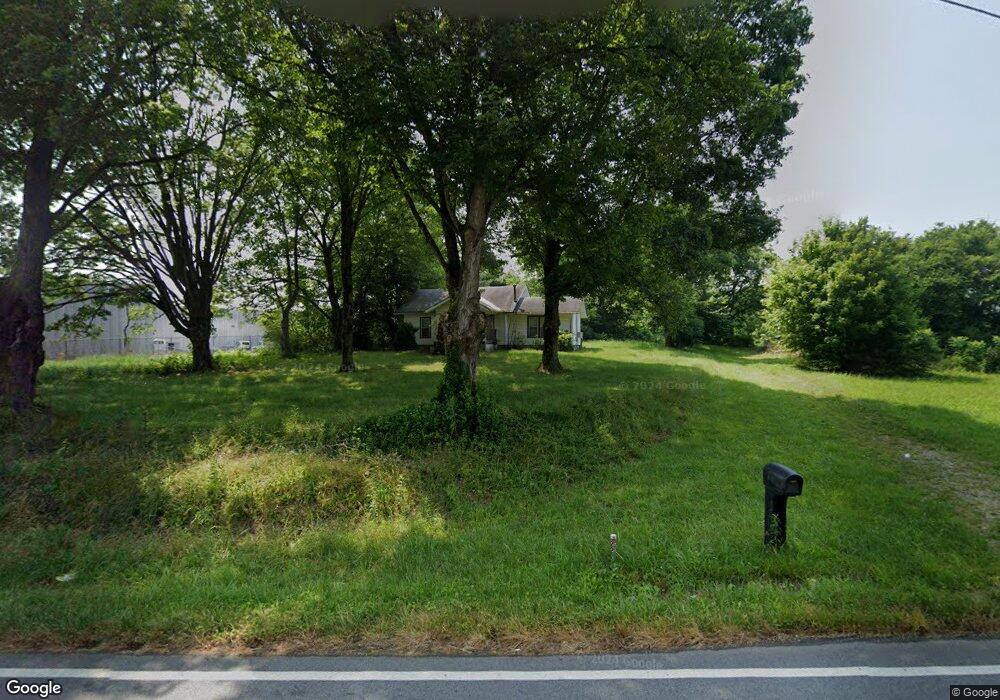
227 Mount Pisgah Rd Ringgold, GA 30736
Beaumont NeighborhoodEstimated Value: $105,000 - $186,000
--
Bed
1
Bath
936
Sq Ft
$148/Sq Ft
Est. Value
About This Home
This home is located at 227 Mount Pisgah Rd, Ringgold, GA 30736 and is currently estimated at $138,598, approximately $148 per square foot. 227 Mount Pisgah Rd is a home located in Catoosa County with nearby schools including Woodstation Elementary School, Heritage Middle School, and Heritage High School.
Ownership History
Date
Name
Owned For
Owner Type
Purchase Details
Closed on
Aug 28, 2023
Sold by
Debord Hillary Joyce
Bought by
B & T Developments
Current Estimated Value
Purchase Details
Closed on
Feb 20, 2020
Sold by
Allen Lynn
Bought by
Deboard Hillary Joyce and Deboard Anthony
Purchase Details
Closed on
Jan 9, 2010
Sold by
Baker Walter B
Bought by
Allen Lynn
Purchase Details
Closed on
Dec 1, 1987
Bought by
Baker Walter B
Create a Home Valuation Report for This Property
The Home Valuation Report is an in-depth analysis detailing your home's value as well as a comparison with similar homes in the area
Home Values in the Area
Average Home Value in this Area
Purchase History
| Date | Buyer | Sale Price | Title Company |
|---|---|---|---|
| B & T Developments | $100,000 | -- | |
| Deboard Hillary Joyce | $70,000 | -- | |
| Allen Lynn | -- | -- | |
| Allen Lynn | -- | -- | |
| Baker Walter B | -- | -- |
Source: Public Records
Tax History Compared to Growth
Tax History
| Year | Tax Paid | Tax Assessment Tax Assessment Total Assessment is a certain percentage of the fair market value that is determined by local assessors to be the total taxable value of land and additions on the property. | Land | Improvement |
|---|---|---|---|---|
| 2024 | $853 | $42,134 | $13,531 | $28,603 |
| 2023 | $740 | $34,700 | $13,531 | $21,169 |
| 2022 | $628 | $28,038 | $12,887 | $15,151 |
| 2021 | $586 | $28,038 | $12,887 | $15,151 |
| 2020 | $571 | $24,683 | $12,273 | $12,410 |
| 2019 | $577 | $24,683 | $12,273 | $12,410 |
| 2018 | $610 | $24,683 | $12,273 | $12,410 |
| 2017 | $461 | $18,668 | $6,160 | $12,508 |
| 2016 | $325 | $12,496 | $6,160 | $6,336 |
| 2015 | -- | $13,373 | $6,160 | $7,213 |
| 2014 | -- | $18,413 | $11,200 | $7,213 |
| 2013 | -- | $18,413 | $11,200 | $7,213 |
Source: Public Records
Map
Nearby Homes
- 8690 Alabama Hwy
- 45 Asheville Dr
- 0 Alabama Hwy Unit 10586300
- 0 Alabama Hwy Unit 1518818
- 224 Heritage Place
- 149 Harden Dr
- 40 Harden Dr
- 161 Teal Dr
- 555 Dedmon Rd
- 478 Dedmon Rd
- 56 Ginger Dr
- 133 Wood Meadow Trail
- 477 Hulsey Dr
- 211 Pine Ridge Extension
- 383 Red Tail Dr
- 359 Red Tail Dr
- 0 Hwy 151 Unit 10530956
- 0 Hwy 151 Unit 1512839
- 0 Etowah Unit 129188
- 0 Etowah Unit 7323783
- 1631 Brock Cir
- 1540 Brock Cir
- 1455 Brock Cir
- 400 Mount Pisgah Rd
- 1516 Brock Cir
- 1435 Brock Cir
- 420 Mount Pisgah Rd
- 377 Mount Pisgah Rd
- 1480 Brock Cir
- 382 Mount Pisgah Rd
- 1462 Brock Cir
- 0 Tinker Rd Unit 1317358
- 0 Tinker Road Rd
- 0 Tinker Rd Unit RTC2340445
- 1548 Brock Cir
- 1450 Brock Cir
- 1450 Brock Cir Unit A
- 1450 Brock Cir Unit B
- 374 Mount Pisgah Rd
- 374 Mt Pisgah Rd