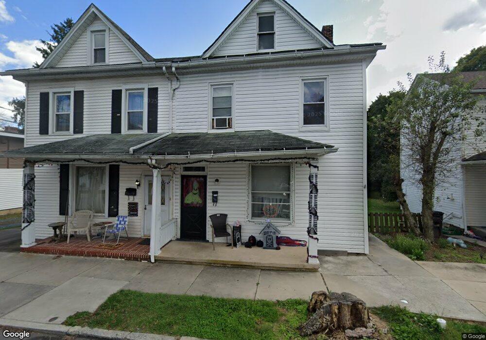
227 Mulberry St Newport, PA 17074
Estimated Value: $126,000 - $156,000
--
Bed
--
Bath
1,366
Sq Ft
$103/Sq Ft
Est. Value
About This Home
This home is located at 227 Mulberry St, Newport, PA 17074 and is currently estimated at $140,533, approximately $102 per square foot. 227 Mulberry St is a home located in Perry County with nearby schools including Newport Elementary School, Newport Middle School, and Newport High School.
Ownership History
Date
Name
Owned For
Owner Type
Purchase Details
Closed on
Jul 30, 2019
Sold by
Koch Kevin P and Koch Heidi M
Bought by
Crouse Michael S
Current Estimated Value
Home Financials for this Owner
Home Financials are based on the most recent Mortgage that was taken out on this home.
Original Mortgage
$71,677
Outstanding Balance
$64,481
Interest Rate
5.12%
Mortgage Type
FHA
Estimated Equity
$76,052
Create a Home Valuation Report for This Property
The Home Valuation Report is an in-depth analysis detailing your home's value as well as a comparison with similar homes in the area
Home Values in the Area
Average Home Value in this Area
Purchase History
| Date | Buyer | Sale Price | Title Company |
|---|---|---|---|
| Crouse Michael S | $73,000 | Purity Abstract Company |
Source: Public Records
Mortgage History
| Date | Status | Borrower | Loan Amount |
|---|---|---|---|
| Open | Crouse Michael S | $71,677 |
Source: Public Records
Tax History Compared to Growth
Tax History
| Year | Tax Paid | Tax Assessment Tax Assessment Total Assessment is a certain percentage of the fair market value that is determined by local assessors to be the total taxable value of land and additions on the property. | Land | Improvement |
|---|---|---|---|---|
| 2025 | $1,706 | $64,800 | $23,200 | $41,600 |
| 2024 | $1,652 | $64,800 | $23,200 | $41,600 |
| 2023 | $1,621 | $64,800 | $23,200 | $41,600 |
| 2022 | $1,596 | $64,800 | $23,200 | $41,600 |
| 2021 | $1,555 | $64,800 | $23,200 | $41,600 |
| 2020 | $1,474 | $64,800 | $23,200 | $41,600 |
| 2019 | $1,450 | $64,800 | $23,200 | $41,600 |
| 2018 | $1,433 | $64,800 | $23,200 | $41,600 |
| 2017 | $1,415 | $64,800 | $23,200 | $41,600 |
| 2016 | -- | $64,800 | $23,200 | $41,600 |
| 2015 | -- | $64,800 | $23,200 | $41,600 |
| 2014 | $1,372 | $64,800 | $23,200 | $41,600 |
Source: Public Records
Map
Nearby Homes
- 67 S 2nd St
- 323 Market St
- 430 Market St
- 137 N 2nd St
- 153 N Front St
- 440 Gantt St
- 794 S 4th St
- 0 Gravel Hill Rd
- 451 Upper Bailey Rd
- 159 Juniata Pkwy E
- 2291 Middle Ridge Rd
- 1986 Newport Rd
- 2751 Middle Ridge Rd
- 40 Ridge Rd
- 101 Old Ferry Rd
- 0 Mahanoy Valley Rd Unit PAPY2007968
- 110 Watson Ln
- 66 Brookview Dr
- 128 Wildcat Rd
- 0 Wildcat Rd