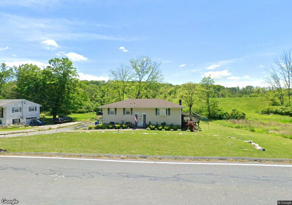
227 Newton Swartswood Rd Newton, NJ 07860
Estimated Value: $363,500 - $487,000
--
Bed
--
Bath
1,860
Sq Ft
$229/Sq Ft
Est. Value
About This Home
This home is located at 227 Newton Swartswood Rd, Newton, NJ 07860 and is currently estimated at $426,375, approximately $229 per square foot. 227 Newton Swartswood Rd is a home located in Sussex County with nearby schools including Fredon Township School, Kittatinny Regional High School, and Northwest Christian School.
Ownership History
Date
Name
Owned For
Owner Type
Purchase Details
Closed on
Aug 27, 1999
Sold by
Stevens Richard E and Stevens Elizabeth C
Bought by
Stevens Richard W
Current Estimated Value
Home Financials for this Owner
Home Financials are based on the most recent Mortgage that was taken out on this home.
Original Mortgage
$80,000
Outstanding Balance
$23,735
Interest Rate
7.83%
Estimated Equity
$402,640
Purchase Details
Closed on
Mar 27, 1990
Bought by
Roth Edw and Mcgrath Linda Ann
Create a Home Valuation Report for This Property
The Home Valuation Report is an in-depth analysis detailing your home's value as well as a comparison with similar homes in the area
Home Values in the Area
Average Home Value in this Area
Purchase History
| Date | Buyer | Sale Price | Title Company |
|---|---|---|---|
| Stevens Richard W | -- | -- | |
| Roth Edw | $127,500 | -- |
Source: Public Records
Mortgage History
| Date | Status | Borrower | Loan Amount |
|---|---|---|---|
| Open | Stevens Richard W | $80,000 |
Source: Public Records
Tax History Compared to Growth
Tax History
| Year | Tax Paid | Tax Assessment Tax Assessment Total Assessment is a certain percentage of the fair market value that is determined by local assessors to be the total taxable value of land and additions on the property. | Land | Improvement |
|---|---|---|---|---|
| 2025 | $6,755 | $216,700 | $94,000 | $122,700 |
| 2024 | $6,469 | $216,700 | $94,000 | $122,700 |
| 2023 | $6,469 | $216,700 | $94,000 | $122,700 |
| 2022 | $6,338 | $216,700 | $94,000 | $122,700 |
| 2021 | $6,482 | $216,700 | $94,000 | $122,700 |
| 2020 | $6,447 | $216,700 | $94,000 | $122,700 |
| 2019 | $6,367 | $216,700 | $94,000 | $122,700 |
| 2018 | $6,258 | $216,700 | $94,000 | $122,700 |
| 2017 | $6,284 | $216,700 | $94,000 | $122,700 |
| 2016 | $6,228 | $216,700 | $94,000 | $122,700 |
| 2015 | $6,031 | $216,700 | $94,000 | $122,700 |
| 2014 | $5,929 | $216,700 | $94,000 | $122,700 |
Source: Public Records
Map
Nearby Homes
- 225 Newton Swartswood Rd
- 229 Newton Swartswood Rd
- 224 Newton Swartswood Rd
- 223 Newton Swartswood Rd
- 221 Newton Swartswood Rd
- 218 Newton Swartswood Rd
- 219 Newton Swartswood Rd
- 304 Newton Swartswood Rd
- 217 Swartswood Rd
- 1 Glenn Terrace
- 216 Newton Swartswood Rd
- 215 Newton Swartswood Rd
- 8 Glenn Terrace
- 3 Glenn Terrace
- 306 Newton Swartswood Rd
- 10 Glenn Terrace
- 16 Glenn Terrace
- 14 Glenn Terrace
- 213 Newton Swartswood Rd
- 5 Glenn Terrace