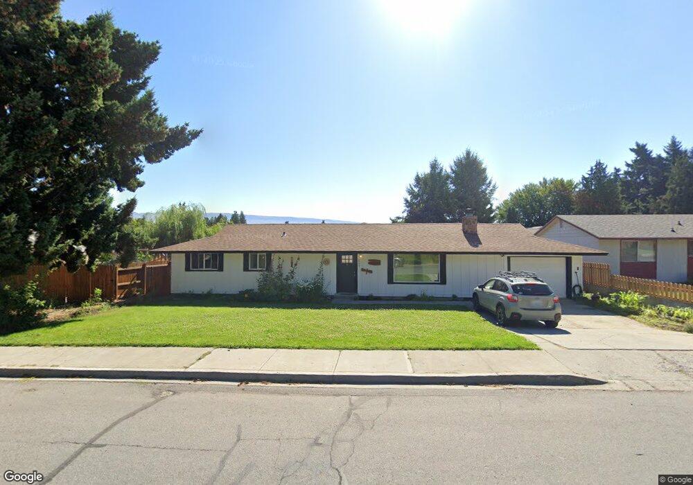
227 Pear Ln Wenatchee, WA 98801
Estimated Value: $442,000 - $509,000
3
Beds
1
Bath
1,352
Sq Ft
$349/Sq Ft
Est. Value
About This Home
This home is located at 227 Pear Ln, Wenatchee, WA 98801 and is currently estimated at $471,812, approximately $348 per square foot. 227 Pear Ln is a home located in Chelan County with nearby schools including Washington Elementary School, Orchard Middle School, and Wenatchee High School.
Ownership History
Date
Name
Owned For
Owner Type
Purchase Details
Closed on
Oct 15, 2019
Sold by
Dent Randy and Dent Linda
Bought by
Vonada Seth
Current Estimated Value
Home Financials for this Owner
Home Financials are based on the most recent Mortgage that was taken out on this home.
Original Mortgage
$235,653
Outstanding Balance
$205,374
Interest Rate
3.25%
Mortgage Type
FHA
Estimated Equity
$266,438
Purchase Details
Closed on
Dec 2, 2014
Sold by
Lucas Catherine D
Bought by
Dent Randy and Dent Linda
Create a Home Valuation Report for This Property
The Home Valuation Report is an in-depth analysis detailing your home's value as well as a comparison with similar homes in the area
Purchase History
| Date | Buyer | Sale Price | Title Company |
|---|---|---|---|
| Vonada Seth | $240,000 | Pioneer Title Company | |
| Dent Randy | $184,000 | Pioneer Title Co |
Source: Public Records
Mortgage History
| Date | Status | Borrower | Loan Amount |
|---|---|---|---|
| Open | Vonada Seth | $235,653 |
Source: Public Records
Tax History
| Year | Tax Paid | Tax Assessment Tax Assessment Total Assessment is a certain percentage of the fair market value that is determined by local assessors to be the total taxable value of land and additions on the property. | Land | Improvement |
|---|---|---|---|---|
| 2025 | $3,222 | $381,408 | $128,000 | $253,408 |
| 2024 | $3,550 | $379,191 | $121,000 | $258,191 |
| 2023 | $3,550 | $421,557 | $77,400 | $344,157 |
| 2022 | $2,853 | $357,916 | $77,400 | $280,516 |
| 2021 | $2,524 | $290,758 | $45,000 | $245,758 |
| 2020 | $2,654 | $240,036 | $45,000 | $195,036 |
| 2019 | $2,274 | $256,533 | $45,000 | $211,533 |
| 2018 | $2,832 | $232,129 | $45,000 | $187,129 |
| 2017 | $2,202 | $236,878 | $52,965 | $183,913 |
| 2016 | $361 | $200,043 | $49,500 | $150,543 |
| 2015 | $361 | $185,422 | $45,000 | $140,422 |
| 2013 | $361 | $152,135 | $45,000 | $107,135 |
Source: Public Records
Map
Nearby Homes
- 409 N Mills Ave
- 9 Elliott Ave N
- 32 Furney St
- 33 Furney St
- 936 Vassar Ave
- 117 N Franklin Ave
- 1310 Castlerock Ave Unit 9
- 1003 Amherst Ave
- 246 N Delaware Ave
- 1013 Amherst Ave
- 110 N Delaware Ave Unit A/B
- 22 S Emerson Ave
- 300 S Elliott Ave Unit 29
- 124 S Franklin Ave
- 1625 Pleasant Ave
- 941 Idaho St
- 20 S Delaware Ave Unit 11
- 913 Meadow Ridge Dr
- 1628 Pleasant Ave
- 104 N Buchanan Ave
Your Personal Tour Guide
Ask me questions while you tour the home.