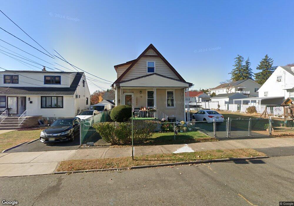
227 Sherwood Ave Unit 231 Paterson, NJ 07502
Hillcrest NeighborhoodEstimated Value: $511,923 - $583,000
--
Bed
--
Bath
1,518
Sq Ft
$361/Sq Ft
Est. Value
About This Home
This home is located at 227 Sherwood Ave Unit 231, Paterson, NJ 07502 and is currently estimated at $547,481, approximately $360 per square foot. 227 Sherwood Ave Unit 231 is a home located in Passaic County with nearby schools including Edward W. Kilpatrick School of Discovery, Dale Avenue Elementary School, and Paterson Public School No. 5.
Ownership History
Date
Name
Owned For
Owner Type
Purchase Details
Closed on
Apr 15, 2022
Sold by
Matos and Janet
Bought by
Matos Luis and Matos Janet
Current Estimated Value
Purchase Details
Closed on
Jul 12, 2001
Sold by
Ristik Maria
Bought by
Matos Luis and Guerra Robert
Home Financials for this Owner
Home Financials are based on the most recent Mortgage that was taken out on this home.
Original Mortgage
$158,650
Interest Rate
7.06%
Create a Home Valuation Report for This Property
The Home Valuation Report is an in-depth analysis detailing your home's value as well as a comparison with similar homes in the area
Home Values in the Area
Average Home Value in this Area
Purchase History
| Date | Buyer | Sale Price | Title Company |
|---|---|---|---|
| Matos Luis | -- | None Listed On Document | |
| Matos Luis | $167,000 | -- | |
| Matos Luis | $167,000 | -- |
Source: Public Records
Mortgage History
| Date | Status | Borrower | Loan Amount |
|---|---|---|---|
| Previous Owner | Matos Luis | $158,650 |
Source: Public Records
Tax History Compared to Growth
Tax History
| Year | Tax Paid | Tax Assessment Tax Assessment Total Assessment is a certain percentage of the fair market value that is determined by local assessors to be the total taxable value of land and additions on the property. | Land | Improvement |
|---|---|---|---|---|
| 2025 | $9,844 | $193,200 | $95,600 | $97,600 |
| 2024 | $9,473 | $193,200 | $95,600 | $97,600 |
| 2022 | $8,968 | $193,200 | $95,600 | $97,600 |
| 2021 | $8,648 | $193,200 | $95,600 | $97,600 |
| 2020 | $8,066 | $193,200 | $95,600 | $97,600 |
| 2019 | $7,822 | $189,200 | $93,900 | $95,300 |
| 2018 | $8,085 | $186,900 | $93,100 | $93,800 |
| 2017 | $7,725 | $185,700 | $92,600 | $93,100 |
| 2016 | $8,500 | $195,900 | $97,500 | $98,400 |
| 2015 | $8,048 | $195,900 | $97,500 | $98,400 |
| 2014 | $10,281 | $354,500 | $213,000 | $141,500 |
Source: Public Records
Map
Nearby Homes
- 237 Sherwood Ave Unit 239
- 295-297 Linwood Ave
- 262-280 Chamberlain Ave Unit 4
- 231 Lenox Ave Unit 233
- 231-233 Lenox Ave
- 239 Lexington Ave Unit 241
- 512 Preakness Ave
- 120 Sherwood Ave Unit 102
- 481 Preakness Ave
- 249 Edmund Ave
- 91 Chatham Ave
- 89-91 Chatham Ave
- 153 Arlington Ave Unit 155
- 153 155arlington Ave
- 207 Burlington Ave
- 203-207 Burlington Ave
- 704 Skyline Dr
- 410 Heights Dr
- 410 Heights Dr Unit 8
- 41 Stirling Terrace
- 223 Sherwood Ave Unit 225
- 282 Linwood Ave Unit 284
- 282-284 Linwood Ave
- 286 Linwood Ave Unit 288
- 280 Linwood Ave
- 230 Sherwood Ave Unit 232
- 294 Linwood Ave Unit 296
- 224 Sherwood Ave Unit 228
- 234-236 Sherwood Ave
- 234 Sherwood Ave Unit 236
- 298 Linwood Ave Unit 300
- 298-300 Linwood Ave
- 209 Chamberlain Ave Unit 215
- 205 Chamberlain Ave Unit 207
- 220 Sherwood Ave Unit 222
- 238 Sherwood Ave Unit 240
- 201 Chamberlain Ave Unit 203
- 302 Linwood Ave Unit 304
- 216 Sherwood Ave Unit 218
- 242 Sherwood Ave Unit 244