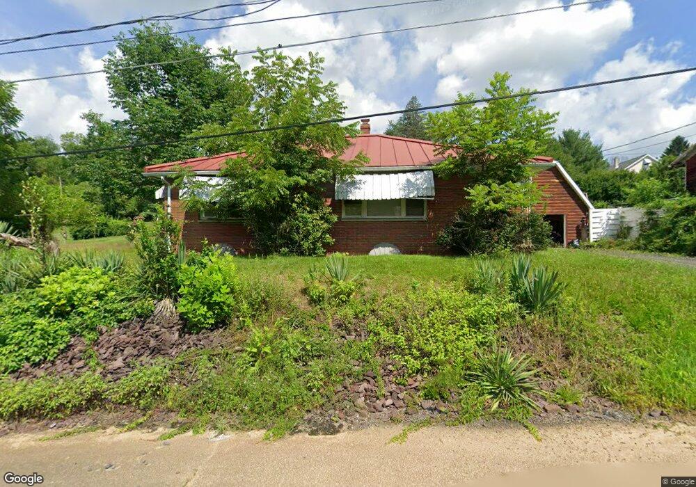
227 Spring Garden Ave Bloomsburg, PA 17815
Estimated Value: $226,000 - $268,000
--
Bed
--
Bath
1,470
Sq Ft
$168/Sq Ft
Est. Value
About This Home
This home is located at 227 Spring Garden Ave, Bloomsburg, PA 17815 and is currently estimated at $247,612, approximately $168 per square foot. 227 Spring Garden Ave is a home located in Columbia County with nearby schools including W.W. Evans Memorial Elementary School, Bloomsburg Area Middle School, and Bloomsburg Area High School.
Ownership History
Date
Name
Owned For
Owner Type
Purchase Details
Closed on
Jul 29, 2017
Sold by
Kipp Gary L and Kipp Patricia A
Bought by
Reed William J
Current Estimated Value
Home Financials for this Owner
Home Financials are based on the most recent Mortgage that was taken out on this home.
Original Mortgage
$135,800
Outstanding Balance
$113,131
Interest Rate
3.9%
Mortgage Type
New Conventional
Estimated Equity
$134,481
Purchase Details
Closed on
Jul 24, 2013
Sold by
Kipp Gary L and Kipp Neil R
Bought by
Kipp Gary L and Kipp Neil R
Create a Home Valuation Report for This Property
The Home Valuation Report is an in-depth analysis detailing your home's value as well as a comparison with similar homes in the area
Home Values in the Area
Average Home Value in this Area
Purchase History
| Date | Buyer | Sale Price | Title Company |
|---|---|---|---|
| Reed William J | $140,000 | Attorney | |
| Kipp Gary L | -- | None Available |
Source: Public Records
Mortgage History
| Date | Status | Borrower | Loan Amount |
|---|---|---|---|
| Open | Reed William J | $135,800 |
Source: Public Records
Tax History Compared to Growth
Tax History
| Year | Tax Paid | Tax Assessment Tax Assessment Total Assessment is a certain percentage of the fair market value that is determined by local assessors to be the total taxable value of land and additions on the property. | Land | Improvement |
|---|---|---|---|---|
| 2025 | $2,899 | $34,906 | $0 | $0 |
| 2024 | $2,847 | $34,906 | $2,500 | $32,406 |
| 2023 | $2,585 | $34,906 | $2,500 | $32,406 |
| 2022 | $2,516 | $34,906 | $2,500 | $32,406 |
| 2021 | $2,437 | $34,906 | $2,500 | $32,406 |
| 2020 | $2,410 | $34,906 | $2,500 | $32,406 |
| 2019 | $2,358 | $34,906 | $2,500 | $32,406 |
| 2018 | $2,313 | $34,906 | $2,500 | $32,406 |
| 2017 | $2,237 | $34,906 | $2,500 | $32,406 |
| 2016 | -- | $34,906 | $2,500 | $32,406 |
| 2015 | -- | $34,906 | $2,500 | $32,406 |
| 2014 | -- | $34,906 | $2,500 | $32,406 |
Source: Public Records
Map
Nearby Homes
- 479 Drinker St
- 115 West St
- 179181 Railroad St
- 421 W Main St
- 518 W Main St
- 123 William St
- 405 W 3rd St
- 579 W 3rd St
- 402 Millville Rd
- 261 West St
- 225 W 3rd St
- 24 Millville Rd
- 606 W 3rd St
- LOT 1 Kressler Ave
- 527 Clover Ave
- Sweet Birch Plan at Oak Lane
- Black Cherry Plan at Oak Lane
- Blue Ridge Plan at Oak Lane
- Beacon Pointe Plan at Oak Lane
- White Oak Plan at Oak Lane
- 217 Springarden Ave
- 207 Springarden Ave
- 247 Spring Garden Ave
- 226 Springarden Ave
- 226 Springarden Ave
- 216 Spring Garden Ave
- 216 Springarden Ave
- 206 Springarden Ave
- 391 Ferncliff Rd
- 197 Springarden Ave
- 187 Springarden Ave
- 196 Springarden Ave
- 251 Ferncliff Rd
- 187 Spring Garden Ave
- 229 Apple Ave
- 259 Apple Ave
- 0 Spring Garden Ave
- 256 Ferncliff Rd
- 400 Ferncliff Rd
- 167 Springarden Ave