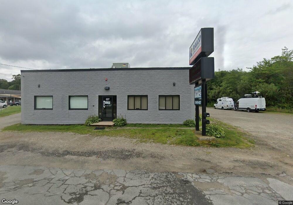
227 State Rd Westport, MA 02790
North Westport NeighborhoodEstimated Value: $1,109,197
--
Bed
--
Bath
4,888
Sq Ft
$227/Sq Ft
Est. Value
About This Home
This home is located at 227 State Rd, Westport, MA 02790 and is currently estimated at $1,109,197, approximately $226 per square foot. 227 State Rd is a home located in Bristol County with nearby schools including Alice A. Macomber Primary School, Westport Elementary School, and Westport Middle-High School.
Ownership History
Date
Name
Owned For
Owner Type
Purchase Details
Closed on
Sep 21, 2016
Sold by
Hutchins & Sons Ent Inc
Bought by
Tara-Ryan 101 Llc
Current Estimated Value
Home Financials for this Owner
Home Financials are based on the most recent Mortgage that was taken out on this home.
Original Mortgage
$461,600
Outstanding Balance
$367,946
Interest Rate
3.45%
Mortgage Type
Commercial
Estimated Equity
$741,251
Purchase Details
Closed on
Dec 12, 2001
Sold by
Hutchins & Sons Ent
Bought by
Rice James R
Home Financials for this Owner
Home Financials are based on the most recent Mortgage that was taken out on this home.
Original Mortgage
$268,110
Interest Rate
6.6%
Mortgage Type
Commercial
Create a Home Valuation Report for This Property
The Home Valuation Report is an in-depth analysis detailing your home's value as well as a comparison with similar homes in the area
Home Values in the Area
Average Home Value in this Area
Purchase History
| Date | Buyer | Sale Price | Title Company |
|---|---|---|---|
| Tara-Ryan 101 Llc | $577,000 | -- | |
| Rice James R | $297,900 | -- | |
| Rice James R | $297,900 | -- |
Source: Public Records
Mortgage History
| Date | Status | Borrower | Loan Amount |
|---|---|---|---|
| Open | Tara-Ryan 101 Llc | $461,600 | |
| Closed | Rice James R | $461,600 | |
| Previous Owner | Rice James R | $268,110 | |
| Previous Owner | Rice James R | $200,000 |
Source: Public Records
Tax History Compared to Growth
Tax History
| Year | Tax Paid | Tax Assessment Tax Assessment Total Assessment is a certain percentage of the fair market value that is determined by local assessors to be the total taxable value of land and additions on the property. | Land | Improvement |
|---|---|---|---|---|
| 2025 | $4,586 | $615,600 | $230,900 | $384,700 |
| 2024 | $4,593 | $594,200 | $209,500 | $384,700 |
| 2023 | $4,694 | $575,300 | $196,100 | $379,200 |
| 2022 | $4,694 | $553,500 | $196,100 | $357,400 |
| 2021 | $4,619 | $535,800 | $178,400 | $357,400 |
| 2020 | $4,517 | $535,800 | $178,400 | $357,400 |
| 2019 | $4,460 | $539,300 | $178,400 | $360,900 |
| 2018 | $4,254 | $520,700 | $171,300 | $349,400 |
| 2017 | $4,185 | $525,100 | $171,300 | $353,800 |
| 2016 | $4,154 | $525,100 | $171,300 | $353,800 |
| 2015 | $4,173 | $526,200 | $171,300 | $354,900 |
Source: Public Records
Map
Nearby Homes
- 33 William St
- 6 Beaulieu St
- 25 Beaulieu St
- 128 Old Bedford Rd
- 9 Register Ave
- 3 Diane Way
- 92 Benoit St
- 34 Alsop St
- 125 Angell St
- 100 D Dr
- 37 Eaton St
- 219 Earle St Unit 3
- 217 Earle St Unit 2
- 215 Earle St Unit 1
- 1792 Pleasant St Unit 1808
- 85 Reney St
- 172 Earle St
- 20 Faulkner St
- 89 Lafayette St
- 951 Dickinson St
- 237C Sate Rd Unit C
- 237 State Rd Unit B
- 237 State Rd Unit A
- 237 State Rd
- 237C State Rd Unit C
- 237 State Rd Unit A&B
- 237C State Rd
- 231 State Rd Unit 235
- 231 State Rd
- 231 State Rd Unit A
- 231 State Rd Unit B
- 231 State Rd Unit 1
- 245 State Rd
- 245 State Rd Unit C
- 248 State Rd
- 248 State Rd Unit 1
- 108 Sanford Rd
- 124 Sanford Rd
- 112 Sanford Rd
- 82 Sanford Rd